Winter Storm Warning In Place As Super Bowl Sunday Snowstorm Could Dump Several Inches Across Delaware Valley
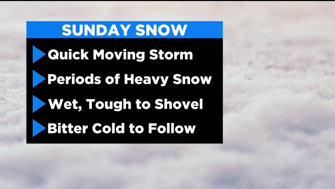
PHILADELPHIA (CBS) -- Another bout of snow is gearing up to smack the region just as many residents throughout are getting done cleaning up from the first significant snowfall in five years in Philadelphia. Unlike the recent winter storm that produced four consecutive days of measurable snowfall in the region, this Super Bowl Sunday snowstorm will be a quick hitter.
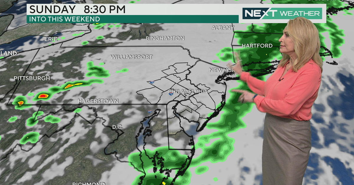
Precipitation began to move into the area late Saturday as snow northwest of Philly, a rain/snow mix southeast, and snow with some mixing along I-95 after 4 a.m.
While a brief period of rain or mix could be seen in Philly at the very start of the event, snow will quickly take over as the primary form of precipitation type.
Snow will continue to spread north and should overtake the entire area by 8 a.m. The heaviest snow will fall from about 9 a.m. to 2 p.m. Sunday and the system should exit the region by 6 p.m. or slightly sooner.
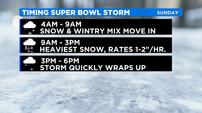
We expect 4 to 6 inches of snow across a wide swath of the urban corridor with some localized spots possibly receiving up to 8 inches by Sunday evening.
Across upper Bucks and Montgomery Counties, the Lehigh Valley, and Poconos, we will be the 2-to-4-inch range, same goes for much of the coastal plain of New Jersey. The Shore towns could receive a quick coating -- 2 inches due to the rain/mixing potential, however, some models indicate that even locations along the immediate coast could see a few periods of heavy snow, which could push totals above 3 inches locally.
Skies will clear very quickly after the system departs Sunday evening and bitter cold will blast in with temperatures dropping into the teens overnight Sunday into Monday morning.
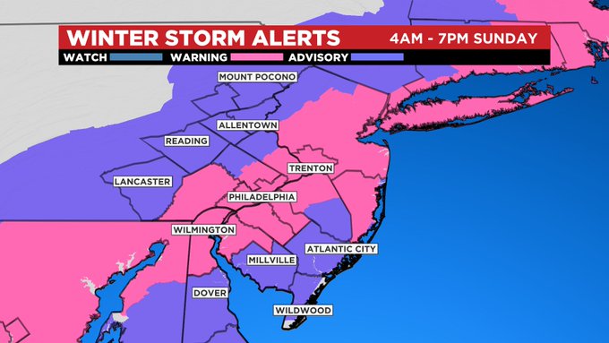
Due to the travel impacts, as well as the potential for another pretty significant snowfall, the National Weather Service has issued a Winter Storm Warning for the I-95 corridor, including the City of Philadelphia.
A Winter Weather Advisory is also in place for areas where snow will be lighter, like the Lehigh Valley and interior South Jersey. These winter weather alerts will go into effect at 4 a.m. Sunday lasting until 7 p.m. Sunday.
It is advised for folks to shovel soon after the snow ends late-day Sunday because, by Monday morning, the snow will take on an icy hard crust-like consistency that will be difficult to remove.
Minimal melting will occur on Monday with sub-freezing highs. Two more systems next week may bring a light wintry mix on Tuesday and potentially a stronger storm with a snow/rain mix threat is possible Thursday and Friday.
CBS3's Matt Peterson and Lauren Casey contributed to this report.
Stay with the Eyewitness Weather Team over the course of the weekend as we get ready for another round of possibly heavy snow across the area.
MORE ON CBSPHILLY.COM
Pennsylvania SPCA Rescues 17 Puppies From Lancaster Property Over Welfare Concerns