Philadelphia Weather: Bitter Cold, Another Powerful Storm On Horizon For Weekend After Brief Reprieve
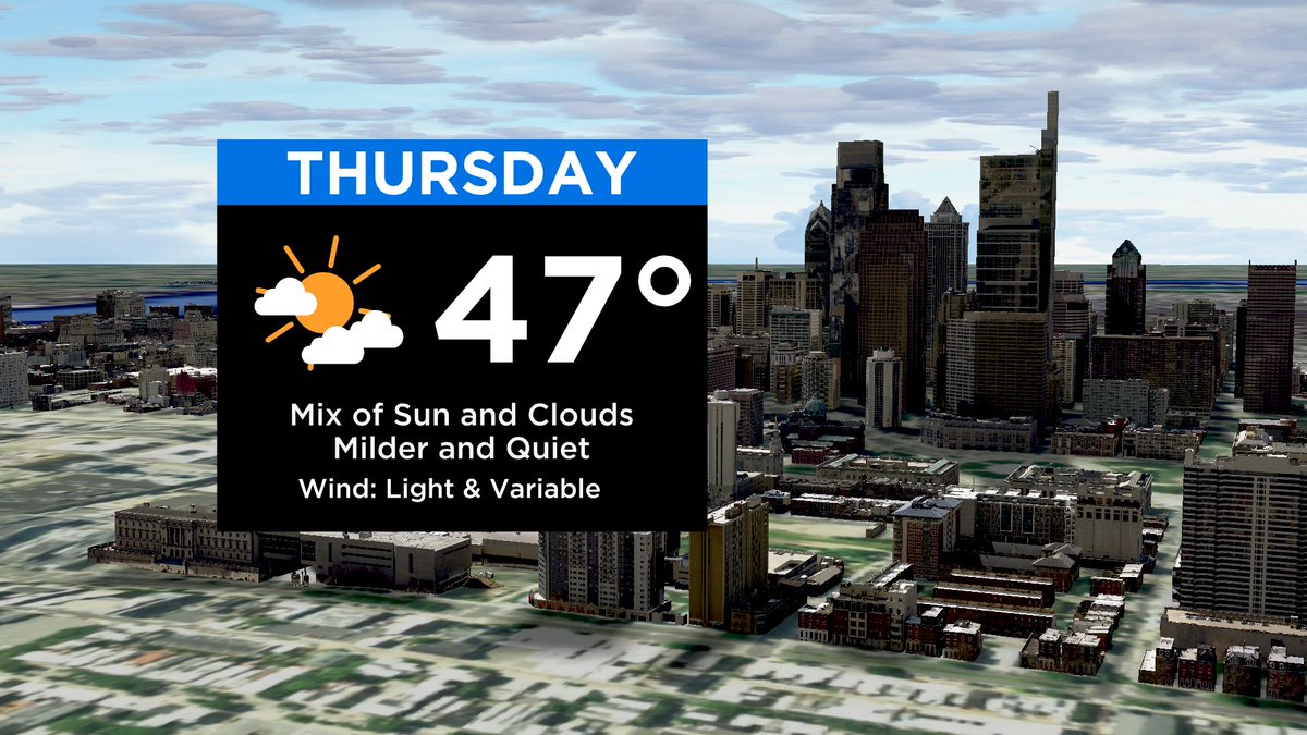
PHILADELPHIA (CBS) -- Highs will top out slightly above average Thursday, and conditions will stay mostly calm before bitter cold returns and a powerful storm arrives this weekend. Day time highs in and around the city will be around 47 degrees with scattered clouds.
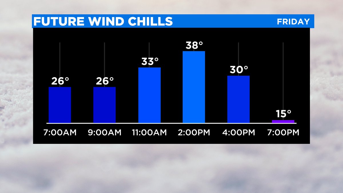
An arctic cold front is set to drop in Friday afternoon leading to gusty winds and plummeting temperatures. Temperatures are scheduled to drop some 30 degrees and wind chills will fall into the teens by Friday evening.
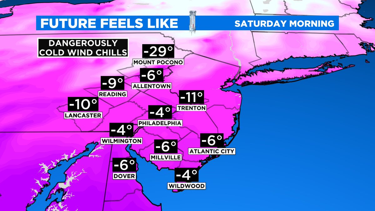
Expect a frigid start to the weekend with sub-zero wind chills, likely region-wide. Dangerous cold will develop in the Poconos with winds chills as cold as -30 degrees late Friday night and into early Saturday.
In these conditions, frostbite and hypothermia are possible within minutes without proper clothing. Wind chills stay sub-zero Saturday afternoon in the mountains and in the low teens and single digits across the Delaware Valley.
Our attention then turns to a large, powerful and dynamic storm system. Currently the storm looks to impact the region Sunday evening into Martin Luther King Day on Monday. Current data is pointing to a measurable-snow-changing-to-rain event for the city and nearby suburbs, all snow far north and west, and mainly all rain at the Jersey Shore.
Intense wind gusts appear likely Sunday night, and with snow potentially falling in conjunction, power outages could be possible or potentially widespread. Our impacts and the type of precipitation we'll see strongly depends on the systems track. An inland track will bring Rain, Sleet and Snow into the region, while a coastal track fairs mostly snow across the area. Stay tuned of the evolving forecast.