Philadelphia Weather: Tracking Henri's Effects
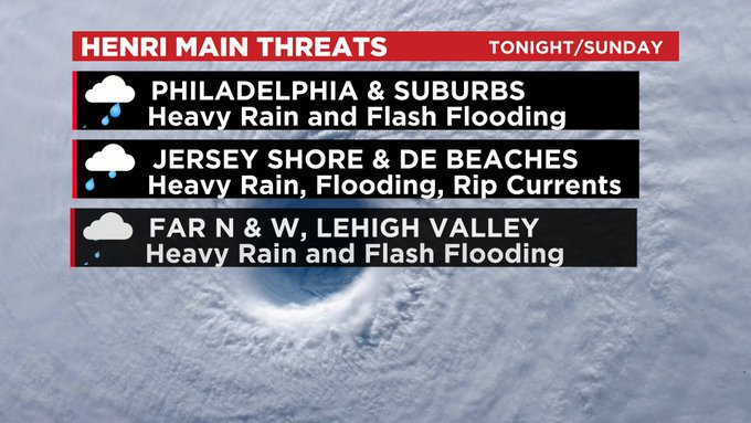
PHILADELPHIA (CBS) -- The main threat Henri will bring to the Philadelphia region is heavy rainfall and the potential for flooding and flash flooding. Rounds of rain, some heavy to torrential, and thunderstorms will impact the area, particularly the Shore, and the Philly metro overnight.
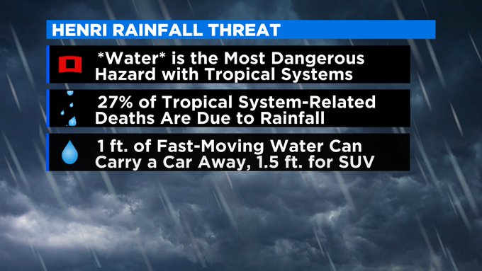
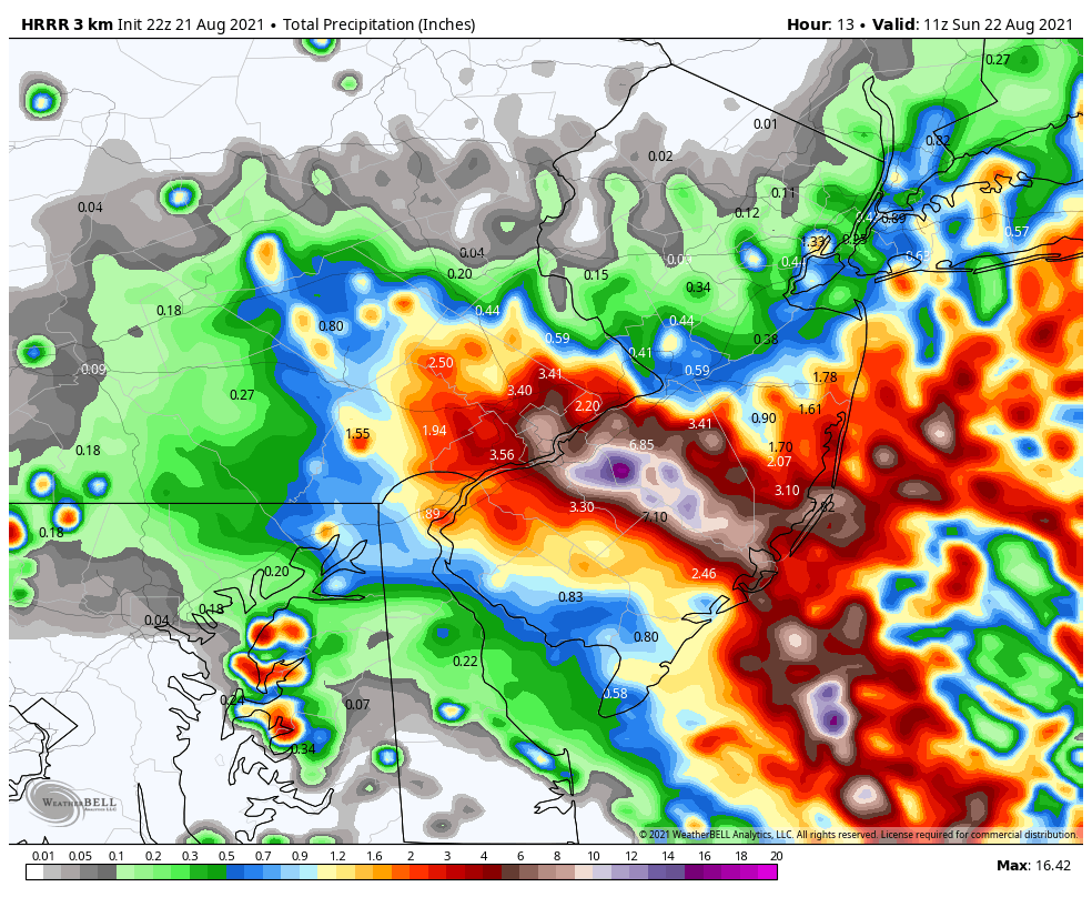
Flash flooding is a big concern. The entire Philadelphia area is under a flood watch until 8 a.m. on Monday. The latest HRRR shows a swath of heavy rainfall from Philly and nearby Pennsylvania suburbs into Burlington, Atlantic and Ocean Counties in New Jersey with rainfall totals of seven-plus inches by early Sunday morning as excessive moisture from Henri flows in. The possibility of water rescues is a concern.
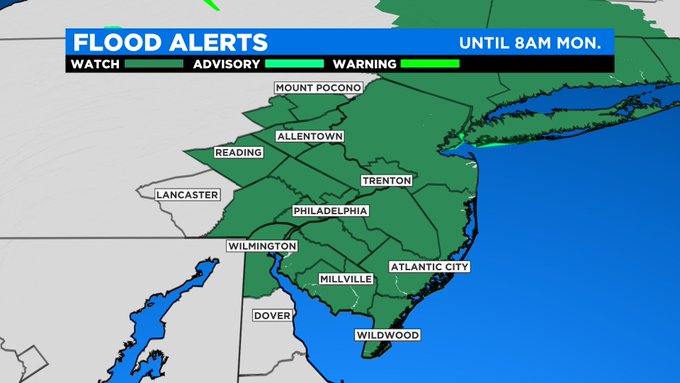
There will also be a high risk for dangerous rip currents along the coast and a coastal flood advisory until 1 a.m. Sunday.
Rounds of rain and thunderstorms will continue Sunday and spread far north and west. We could see some sporadic gusty winds to 40 mph otherwise winds are not a primary concern.
Though as the ground becomes supersaturated, wind gusts may be capable of pulling down trees and thus powerlines. So, we could see a few localized outages. Neither are tornadoes as we will be on the western, typically tornado-free side of the storm.
Scattered rain and storms continue to sweep in Sunday night and into Monday before late day clearing is expected.
Any residual moisture should exit the region by Monday night at the latest. Tuesday looks dry for the time being as we get ready for another dose of high heat and humidity next week as highs will rocket back into the 90s and remain there through week's end.