Philadelphia Weather: Tornado Watch For Region In Effect As Potential Severe Weather Returns
PHILADELPHIA (CBS) -- A tornado watch has been issued for the Philadelphia region until 9 p.m. Thursday as the potential for more severe weather returns to the area.
Southeastern Pennsylvania, all of South Jersey and Delaware are under an enhanced risk for severe weather on Thursday. Lehigh, Carbon and Monroe counties are under a slight risk.
Earlier in the day, Andrew Shearer caught video and a photo of a funnel cloud near Long Neck. The area was under a tornado warning before 4 p.m.
It will be cloudy and humid with a few showers and isolated thundershowers expected to develop later this morning. Showers and storms will likely develop ahead of a strong cold front that will work its way through the region from west to east.
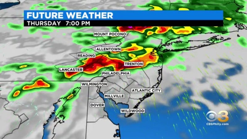
The cold front is expected to move in during the late afternoon and evening leading to the threat of damaging straight-line winds, hail, and even an isolated tornado.
Skies clear tonight and much drier air on the backside of the front will cause humidity values to plummet.
This will make for beautiful weather Friday and Saturday. Both days will feature sunny skies, atypically low humidity, and highs in the low to mid 80's.
Rain chances return Sunday for the start of August. The first week of August, temperatures are trending cooler with highs in the low 80's and several chances of rain.
CBS3's Llarisa Abreu contributed to this report.