Philadelphia Weather: Tracking Threat For Severe Thunderstorms, Damaging Winds And Isolated Tornadoes This Evening
PHILADELPHIA (CBS) - A steamy day is in store across the Delaware and Lehigh Valleys. We will also watch for another severe weather threat developing late in the day into the nighttime hours.
Highs in the upper 80's to near 90° in combination with high humidity will push heat index values into the mid to upper 90's. We anticipate a mix of sun and clouds for much of the day, then thunderstorms will develop this evening and continue through tonight, as a strong cold front nears.
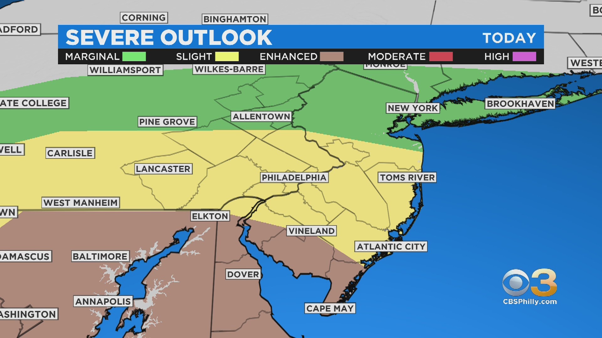
The threat is more elevated and the storms may be more widespread in coverage. There is now an Enhanced Risk of severe weather for southern portions of the area and a Slight Risk for much of the remaining area, including Philadelphia.
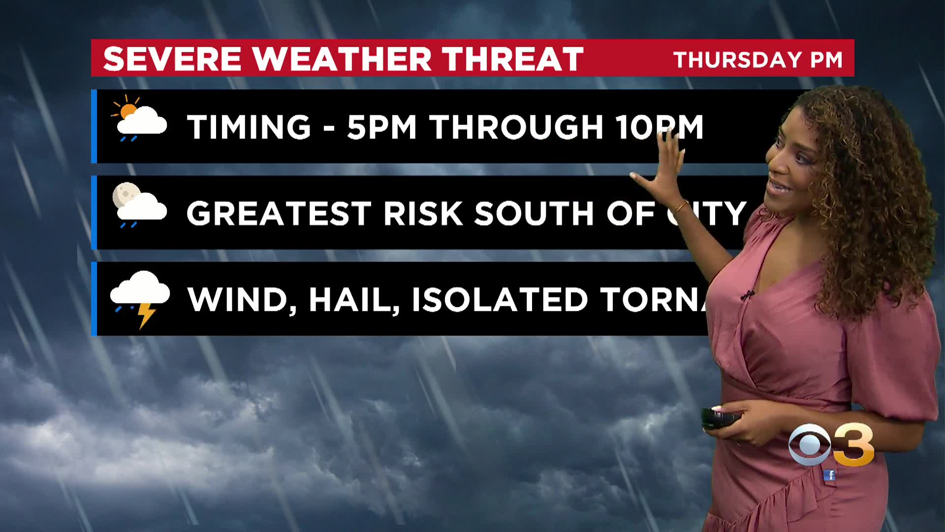
Damaging winds, hail and isolated tornadoes are potential threats, as well as localized flash flooding. Most of the activity looks to develop after 5 p.m. with the best chance of severe weather in the city around 7 p.m.
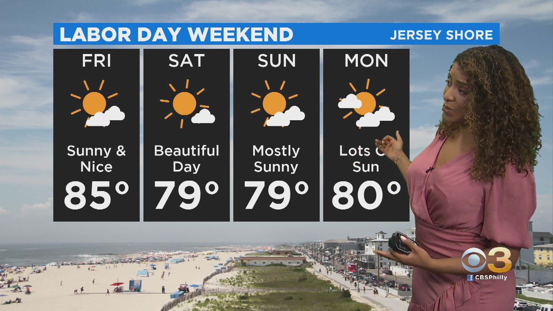
Friday will be mostly sunny on with a humid start but significantly drier air will be spilling in across the region throughout the day. It should feel awesome by Friday evening. A gorgeous day to start the holiday weekend on Saturday with sunshine and low humidity. Sunday and Labor Day look great as well.