Severe Thunderstorms This Afternoon To Potentially Produce Damaging Winds, Isolated Tornado
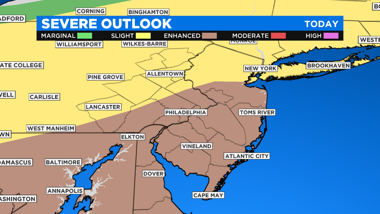
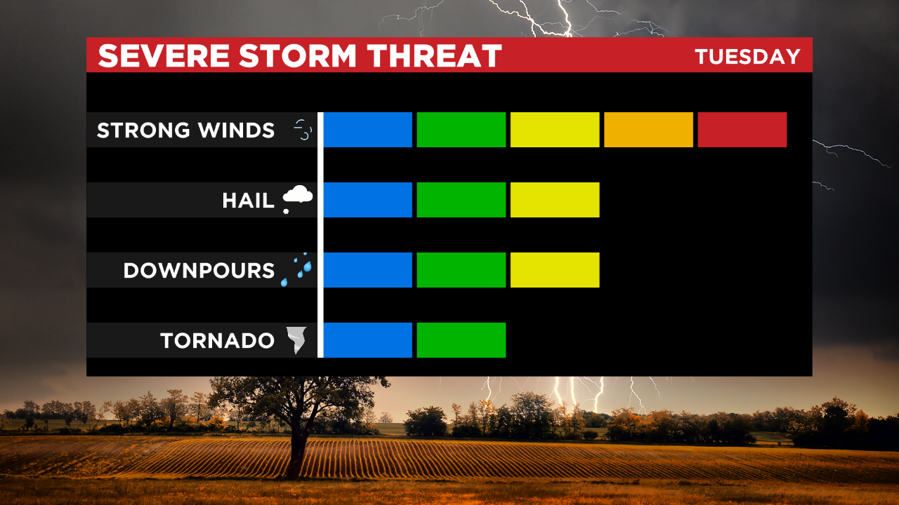
PHILADELPHIA (CBS) - The Delaware Valley is under an Enhanced Risk (3 of 5) for severe weather on Tuesday. It doesn't get much higher than "Enhanced" in our part of the country.
The Lehigh Valley, Berks County and the Poconos are under a Slight Risk (2 out of 5). Not everyone may see a storm but the storms that form have the potential to be quite nasty.
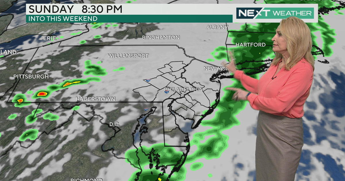
Storm clusters and bowing segments (or mini-lines), capable of producing damaging winds, will develop and may try to congeal into a more expansive squall line, particularly south of Philly. Wind gusts up to 70 mph are possible. A brief tornado is possible. Storms will be fast-moving.
Arrival time looks to be between 3 p.m. and 5 p.m. in the Poconos, 5 p.m. and 7 p.m. in Philadelphia, and 7 p.m. and 9 p.m. at the coast. The threat then ends. Downed trees and power outages are likely in storm impacted locations. The approach of a cold front will be the trigger mechanism for these storms.
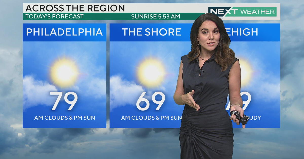
Drier air will rush in behind frontal passage tonight to make for a beautiful Wednesday.
Be sure to have a severe storm plan for your outdoor and commuting plans. Be sure to have a way to receive severe weather warnings. If a warning is issued for your area, take action immediately. Storms today will be very fast-moving.