Philadelphia Weather: Severe Storms Expected To Bring Torrential Rain, Damaging Winds To Delaware Valley
PHILADELPHIA (CBS) -- After a quiet weekend and start to the workweek, we'll soon contend with yet another severe thunderstorm threat. The Delaware Valley is in an enhanced risk, the third-highest on a five-tier risk scale, of severe weather on Tuesday. We are not often in this category as determined by the Storm Prediction Center.
The morning hours could feature a few showers and rumbles but the severe threat will materialize in the afternoon and persist through the evening. Storms are likely to arrive in rounds during this time frame as opposed to one discrete line.
Damaging winds are likely. Anticipate downed branches, trees and wires with localized power outages probable. Large hail is also possible in some storms.
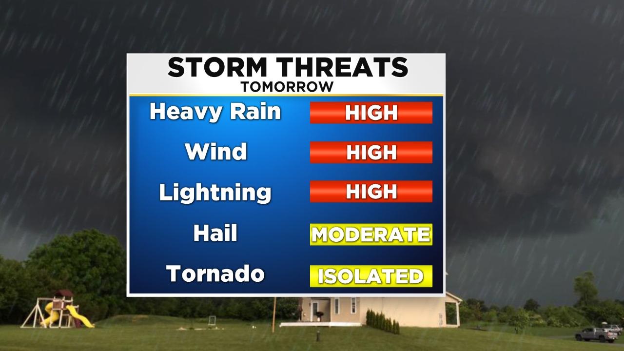
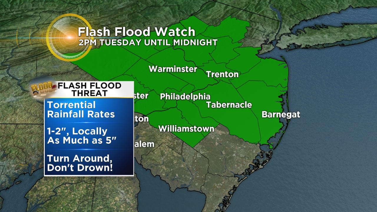
Torrential rain is likely. A flash flood watch is in effect for Philadelphia and surrounding counties, Berks and the Lehigh Valley on Tuesday from 2 p.m. until midnight.
Storms may "train" over the same locations due to the slow-moving nature of an approaching cold front and further enhance the flood threat. Road closures are possible. If you encounter a flooded road, always turn around, don't drown.
Wind shear, a key component in the formation of rotating or "supercell" thunderstorms, will be atypically high for the area on Tuesday. The development of an isolated tornado is probable. If a tornado warning is issued for your county, seek shelter immediately on the lowest level of your home or office, and away from all windows.
This severe weather season has and continues to be extremely active across the Delaware Valley. Of the 122 National Weather Service Weather Forecast Offices across the country, The Philadelphia/Mt. Holly office is currently sixth for severe thunderstorm warnings issued this year at 350 warnings.
Most of the action will be happening on Tuesday and will be followed by a stretch of temperatures in the mid-80s.
TONIGHT -- Partly Cloudy and Humid. Low 72.
TOMORROW -- Severe Thunderstorms Likely. (Afternoon/Evening). High 86.
WEDNESDAY -- Mix of Sun and Clouds, Hit or Miss T-Storms. High 84.
THURSDAY -- Partly Cloudy with a Spotty T-Shower. High 84.
FRIDAY -- Mostly Sunny with an Isolated Shower East. High 83.
SATURDAY -- Mostly Sunny and Seasonable. High 85.