Philadelphia Weather: What Types Of Precipitation To Expect During Winter Storm Sunday
Follow CBSPHILLY Facebook | Twitter
PHILADELPHIA (CBS) – We've enjoyed a gorgeous sunrise to start out this Sunday morning, making it hard to believe that winter weather is only a few hours away. Breaks in the cloud deck will quickly fill in this morning as clouds increase and thicken.
A winter storm warning goes into effect for Philadelphia and the surrounding suburbs starting at 3 p.m. this afternoon through 7 a.m. Monday.
A winter weather advisory goes into effect for Cumberland and Atlantic Counties in South Jersey at 3 p.m. through 7 a.m. Monday.
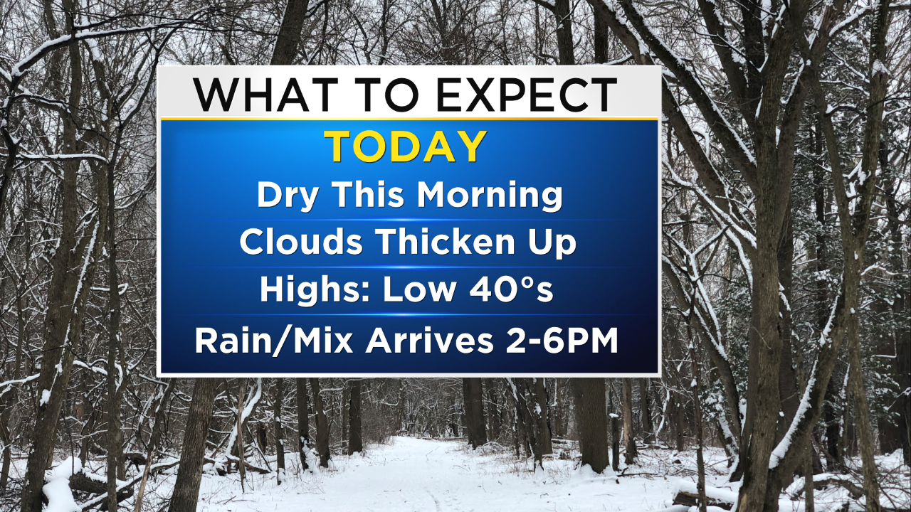
Precipitation is expected to arrive between 2 p.m. and 6 p.m. this afternoon and evening. With highs in the low 40s, we will likely start out with rain from I-95 to areas south and east.
With the center of low pressure traveling to our south, cold air will quickly get pulled in and we will see a transition to a wintry mix and snow.
Between 6 p.m. Sunday and 2 a.m. Monday morning, we expect to see snow – some heavy – for areas north and west, rain – some heavy – for areas south and east of I-95, and snow – some heavy – mixing with pockets of sleet along and within the I-95 corridor.
We will taper to snow showers on the back end of this system between 2 a.m. and 6 a.m. on Monday before the system exits and skies begin to clear.
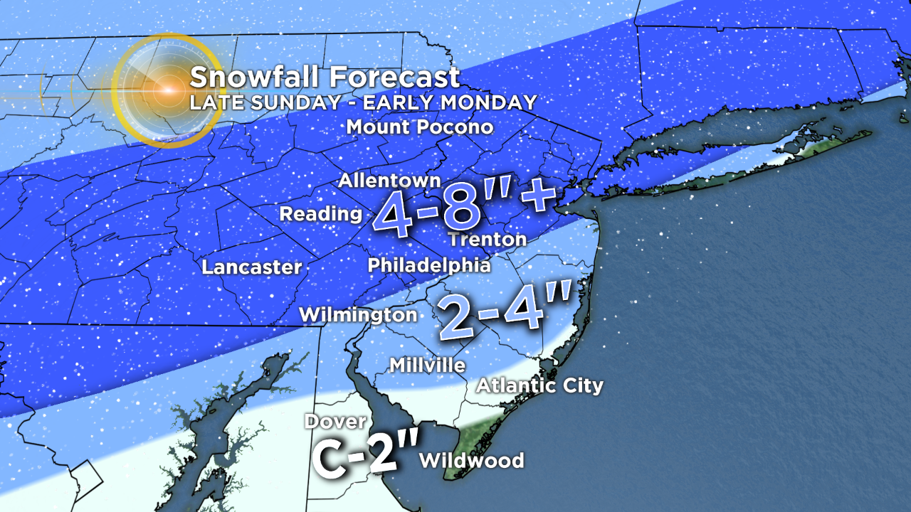
Here is a look at the latest snowfall forecast. Find your neighborhood on the map to see how much snow you can expect based on where you live.