WEATHER BLOG: Tornado Watch In Effect For Parts Of Area Until 1 A.M.
Follow CBSPHILLY Facebook | Twitter
PHILADELPHIA (CBS) -- The National Weather Service has issued a tornado watch for parts of Pennsylvania, New Jersey and Delaware.
The Pennsylvania counties include Philadelphia, Berks, Bucks, Chester, Delaware, and Montgomery. The eight New Jersey counties are Atlantic, Burlington, Camden, Cape May, Cumberland, Gloucester, Ocean, and Salem. The three Delaware counties are Kent, New Castle, and Sussex.
The tornado watch is in effect until 1 a.m. Sunday morning.
The National Weather Service is warning residents of potential wind gusts of 75 mph and hail the size of ping pong balls.
An area of low pressure will ride along this front bringing us the potential for numerous strong to severe thunderstorms as we head into the late afternoon and evening hours.
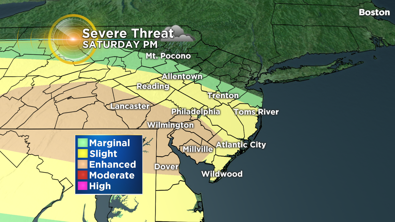
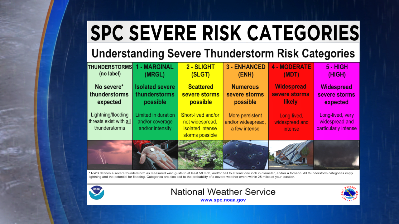
The Storm Prediction Center has highlighted portions of the Delaware Valley under an "Enhanced Risk" for severe weather as we head into the late afternoon and evening.
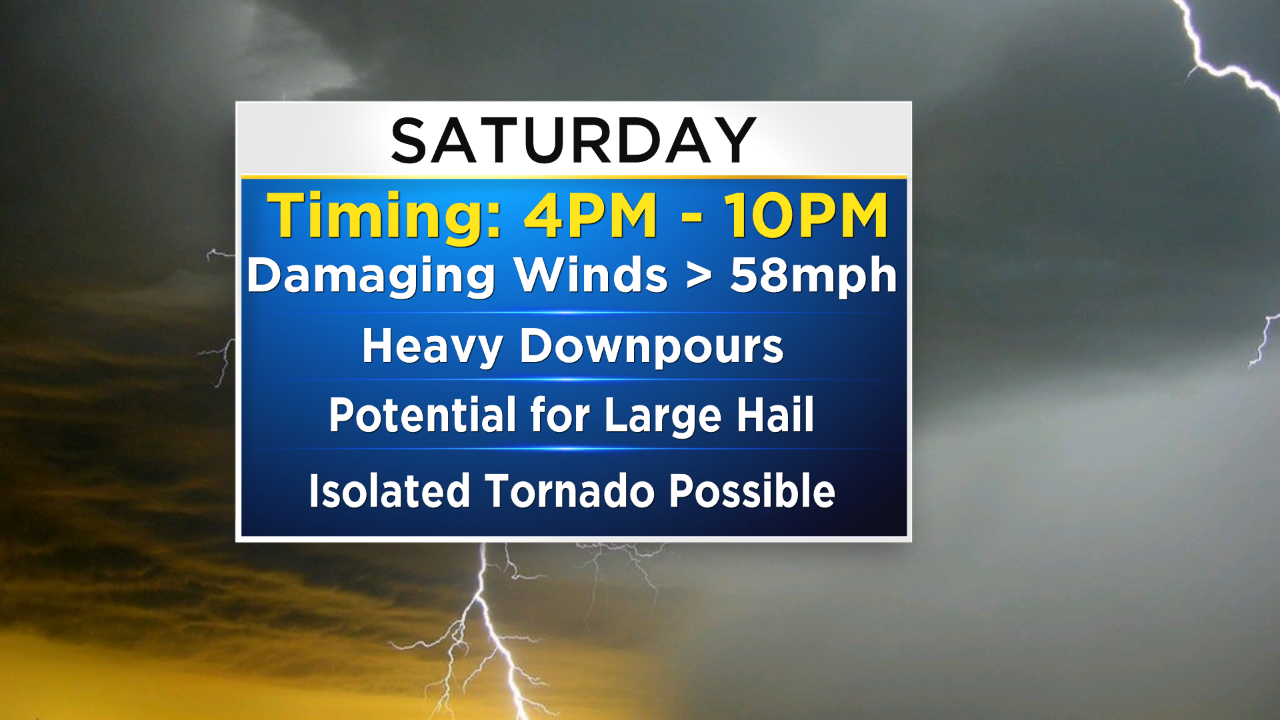
You can expect storms to arrive between 4pm to 10pm.
During this time frame strong/damaging winds, heavy downpours, lightning, and large hail will be possible. Even an isolated tornado can't be ruled out as this system moves through.
Keep an eye to the sky this afternoon and evening.
Most importantly, remember, when thunder roars -- go indoors!
TONIGHT - Strong to Severe Thunderstorms Early then Cloudy. Low 56.
SUNDAY - Cloudy and Cool with Periods of Rain and Drizzle. High 60.
MONDAY - Mostly Cloudy and Warmer. High 78.
A Shower or T-Storm at Night.
TUESDAY - A Mix of Sun and Clouds. Very Warm with Late Day Thunderstorms. High 86.
WEDNESDAY - Mostly Cloudy and Humid with Showers and a T-storm Likely. High 84.
THURSDAY - Partly Sunny with a Chance of Showers and a T-Storm. High 78.
JERSEY SHORE:
TORNADO WATCH IN EFFECT UNTIL 1AM TONIGHT
TONIGHT - Strong to Severe Thunderstorms Early then Cloudy with Fog. Low 54.
SUNDAY - Cloudy and Cool with Periods of Rain and Drizzle. High 60.
MONDAY - Mostly Cloudy and Mainly Dry. High 70.
OCEAN TEMP: 58°
POCONOS:
TONIGHT - Showers and a Strong Thunderstorm Early then Cloudy with Fog. Low 49.
SUNDAY - Cloudy and Damp with Periods of Rain and Drizzle. High 57.
MONDAY - Mostly Cloudy and Milder. High 71.