Arctic Air Rushes In, On The Back Of A Strong Winter Wind
PHILADELPHIA (CBS) — Some wintry precipitation came rolling across northern parts of the region Christmas morning, as a powerful arctic cold front sweeps through the area Monday afternoon and evening.
Some folks in the Lehigh Valley and the Poconos woke up to a quick dusting of snow on the grassy surfaces, with reports of freezing rain and slick roads in areas as well.
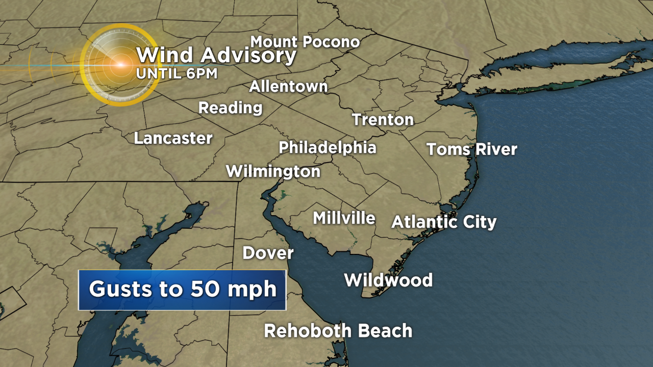
Now that the front is on the way through, the precipitation has ended but the colder air is slowly filtering in and the winds are already racing through with gusts that could push as high as 40, or even 50 MPH at times Monday afternoon. Since the Philadelphia-area will be dealing with the very strong winds, a Wind Advisory is in effect until 6 p.m.
If you are driving in open areas, make sure to use extra caution. And if you have outdoor Christmas decorations, make sure to tie them down or bring them inside, since there is a possibility that they could blow away in the strong winds.
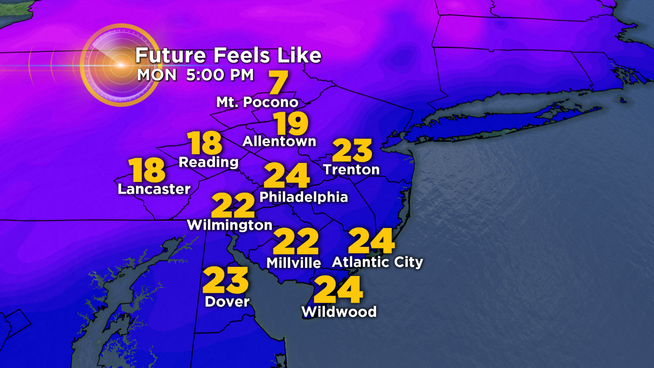
Temperatures throughout the afternoon are likely to remain in the middle to upper 30s for Philadelphia, which means that wind chill values, while they are not going to be frigid, will still be very low, likely in the 20s as the wind chills drop into the teens later into the evening.
If you are planning on going to the Eagles game, make sure to dress appropriately with heavy jackets and hats and gloves.
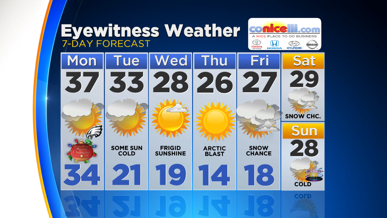
Temperatures will then stay well below normal all week long, with highs only in the 20s at times later in the week, before a new system comes through that could give the area another shot at some snow showers by Friday or Saturday.