Severe Weather Chances On Monday Evening and Monday Night
PHILADELPHIA (CBS) -- We kicked off the work week on Monday morning with areas of fog across the region, and visibility throughout the area was as low as a mile or less for most of the morning.
While the fog will remain a concern throughout the morning, the bigger threat and bigger weather marker will come rolling through later this evening and tonight in the form of cold front that could spark thunderstorms, some of which could be strong to severe in nature.
There is a Slight and Enhanced Risk for Severe Weather across all of Pennsylvania for today, with the timing of the storms later this afternoon into the evening and also some of the overnight hours as well. We are going to break down the threats and the exact timing for the Delaware and Lehigh Valleys as well as South Jersey.
The cold front that is going to roll across Southeast Pennsylvania Southern New Jersey is all part of much larger system that is spiraling out in the Mid-West and has sparked severe weather through parts of Texas, Arkansas and much of the Deep South. As of this morning the front itself is still well off to our West, advancing through Western Ohio, with rain and thunderstorms out in front of the actual surface front extending all the way into Western Pennsylvania.
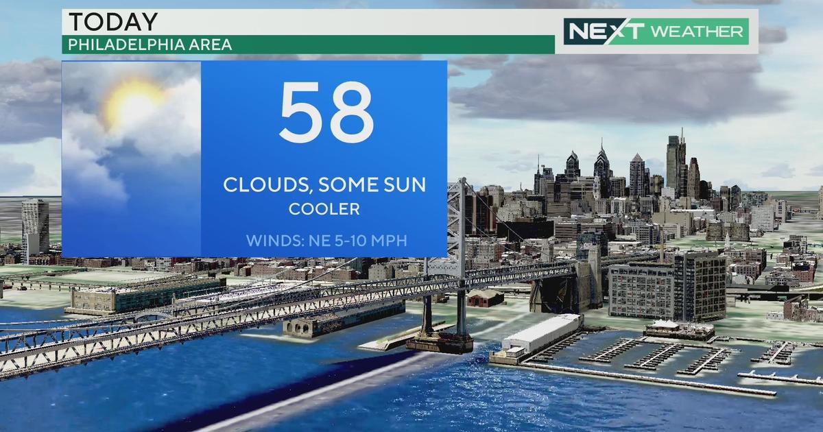
We should expect the front to continue to track East for the rest of the morning and into the afternoon and it is likely the physical, surface cold front reaches Western Pennsylvania by around 4PM. While the actual front will not reach Western Pennsylvania until around 4PM, there will be still be showers and thunderstorms that fire up in front of the actual boundary, during much of the early and mid-afternoon hours, that will likely affect Central PA while the Eastern half of the state will be dry and we could even see some sunshine at times this afternoon in Southeast PA. Due to the fact that we will be dry for the afternoon and we should see some sunshine at times, expect temperatures today across the region to climb well into the upper 70s and likely even the lower to middle 80s in areas as well. We are going to get an influx of moisture into the region throughout the day so humidity will be higher on Monday afternoon, with dew points in the Philly area that could reach into the low 60s. What this all means for the region, is that there will be ingredients in place for the formation of strong to possibly severe thunderstorms as the cold front gets closer to the area in the evening and early nighttime hours.
The biggest threats with this system will be come in a couple different forms. First off as with any thunderstorm we will be have to be on the lookout for heavy rain as well as dangerous lightning. It does not look as though flooding will be much of a threat with this line of thunderstorms but localized heavy rain is also a possibility when we are dealing with strong to possibly severe thunderstorms, so everyone should be prepared for that.
As for actual severe weather, there is the potential for all three modes (strong wind, large hail, tornadoes), the good news about this cold front and system is that the severe weather chances are in general pretty low. The biggest threat with this front as it rolls across the state and across the region later tonight is going to be strong winds. The Storm Prediction Center has placed us under a 30% chance for winds as high as 60MPH. This means that if you have any kind of outside furniture or anything that is not fully secured outside in your yard, you are going to want to secure those items, or a better idea would be just to bring them inside your house or put them in a shed or garage for the night.
There is also a low chance for there to be a possible tornado with this line of thunderstorms. At this point though it really looks as though the best chance for a tornado to form will be in Central PA out in front of the actual cold front rather than here across the Eastern and Southeastern sections of the state. However the Storm Prediction Center has still placed Philadelphia and much of the surrounding suburbs, on the Pennsylvania side in a 5% chance for tornado while the suburbs in New Jersey are in a 2% chance for a tornado to form.
Right now hail is the lowest threat for the whole region, with the only areas within any kind of threat for large hail are in the far North and Western Areas, like Reading, Allentown, or Lancaster where the Storm Prediction Center has placed a 5% chance for hail 1" or more in diameter to form. While these threats are out there later this evening and potentially tonight, there are a couple of things working for and against this system though in terms of atmospheric dynamics and ingredients needed for the formation of severe storms. First, we can talk about why these storms could form. There is going to be plenty of moisture in the lower atmosphere during the daytime today. A strong low level flow from the South should pump in warm and humid air which is a big factor in the formation of severe weather. We also are going to look for some afternoon sunshine as the fog burns off. When this happens the low levels of the atmosphere near the ground heat faster than the upper levels and that allows for rising air and rising air is what causes clouds and precipitation to develop as well.
Last we have the "triggering" mechanism of the cold front to help push the warm and moisture air from the surface upward even faster than it would normally, allowing for thunderstorms to develop along that front. There are a couple of things working against this system though as well. One, there is not much upper level help that the thunderstorms are going to get. This means that after the thunderstorms form there is a small chance that they are able to become self sustaining, and thus become severe. Also we are looking at timing that brings the storms and cold front in after the sun has already set. This means that while there is going to be some destabilization of the atmosphere early in tht day thanks to some sunshine, it should cool off enough after the sun sets that energy from the afternoon will be gone and the storms will be relying solely on the cold front to help give them lift and energy. Overall this means that while there is the threat for severe weather, at this time it looks as though the threat is on the lower end.
Let's talk about timing of the front for those of us here in the eastern half of the state. As we talked about earlier in this post, the physical cold front is likely to move into Western PA around 4PM and should reach the Central parts of the state by 8-9PM tonight. What that means for those of here in Eastern PA is that this is likely going to be an overnight event for all involved. The model runs from the first part of Monday have been fairly consistent with this system and the line of thunderstorms as they move out of Central PA and into the Eastern half of the state. We are likely to see thunderstorm activity get into areas like to the Poconos and Lehigh Valley, as well as the far Western suburbs around 11PM. The first areas that are likely to see the rain and thunderstorms in the Poconos and Lehigh Valley will be the Western and Northern Sections of Schuylkill, Columbia, and Luzerne Counties. Areas in the far West to see the thunderstorm activity first will be Western Lancaster County and also Lebanon County. The cold front is likely to start to fizzle out as it exits the far Western and Northern counties and move into areas like Chester, Bucks and Montgomery Counties. We should see thunderstorm activity in areas like, Quarkertown, Pottstown, or Coatesville around 1-2AM. Philadelphia as well as Lower Bucks, Montgomery and Delaware Counties should get in on the action by around 3AM. By the time the line of thunderstorms moves into South Jersey between 4-6AM is should be much weaker than it was even as it entered Southeast PA. Still look for some locally heavy rain and possibly gusty winds but in general we should be done with the severe weather threats by that time. The front and the thunderstorms should clear off the coast of New Jersey by 7AM.
While it does not look as though we are going to be dealing much if any severe weather across the region through the night tonight, everyone needs to remain Weather Aware as this cold front pulls through.
Have a great day!


