WEATHER BLOG: Powerful Nor'easter To Bring Heavy Snow To Northeast
PHILADELPHIA (CBS)--A powerful nor'easter is set to impact the Delaware Valley tonight through much of the day Tuesday.
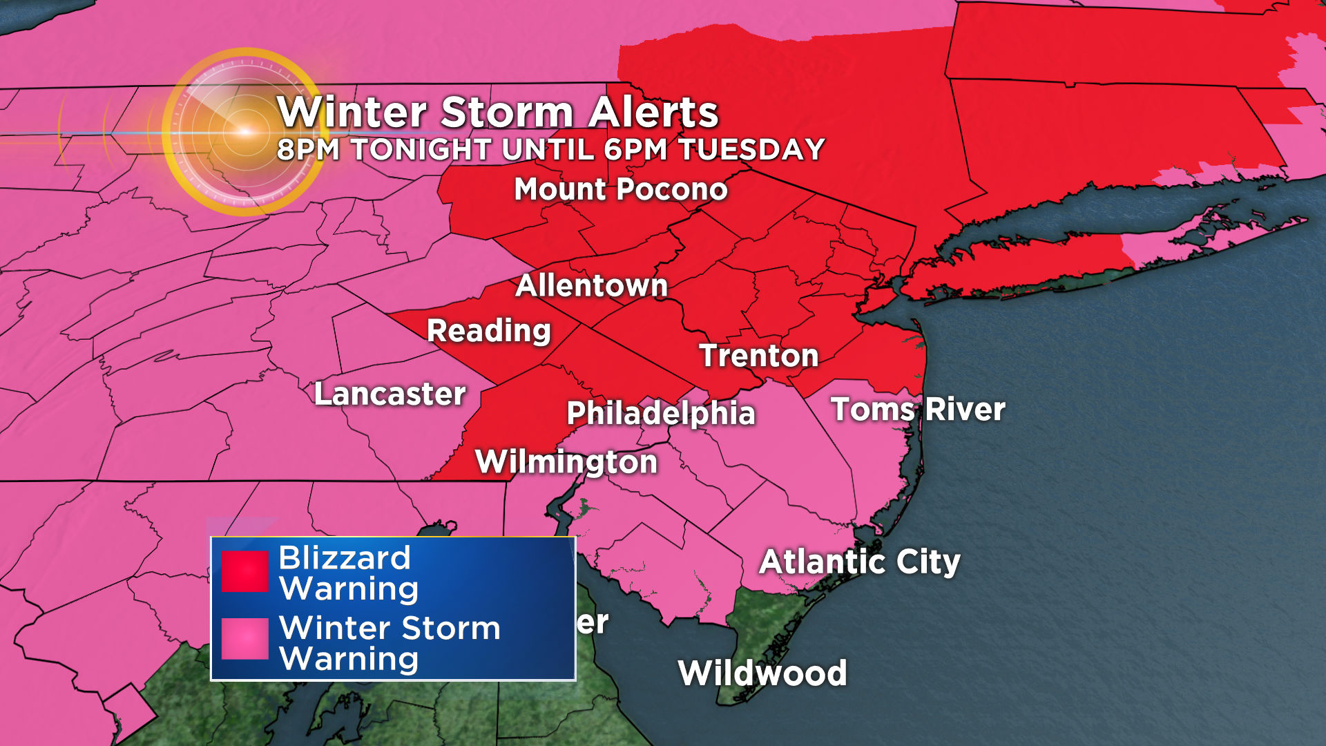
A Blizzard Warning is in effect for a large portion of the area until 6 p.m. Tuesday including Chester, Montgomery, Bucks, and Berks counties, the Lehigh Valley and the Poconos.
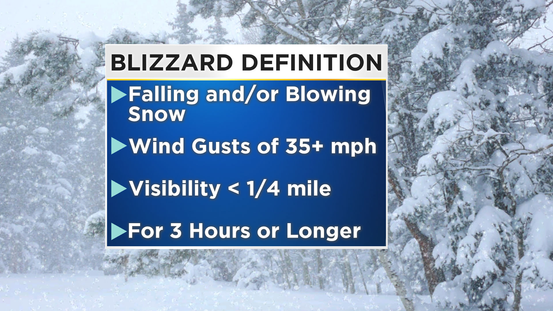
A 'blizzard' is defined by falling and/or blowing snow with visibility of 1/4 mile or less and sustained or frequent wind gusts of 35 mph or greater occurring for a period of 3 hours or longer.
A Winter Storm Warning remains in effect for the remainder of the area, including Center City, with the exception of Cape May County where a Winter Weather Advisory is in effect.
Coastal Flood and High Wind Warnings are in effect along the coast through the day Tuesday. Widespread moderate flooding and wind gusts to 60 mph are likely especially Tuesday morning.
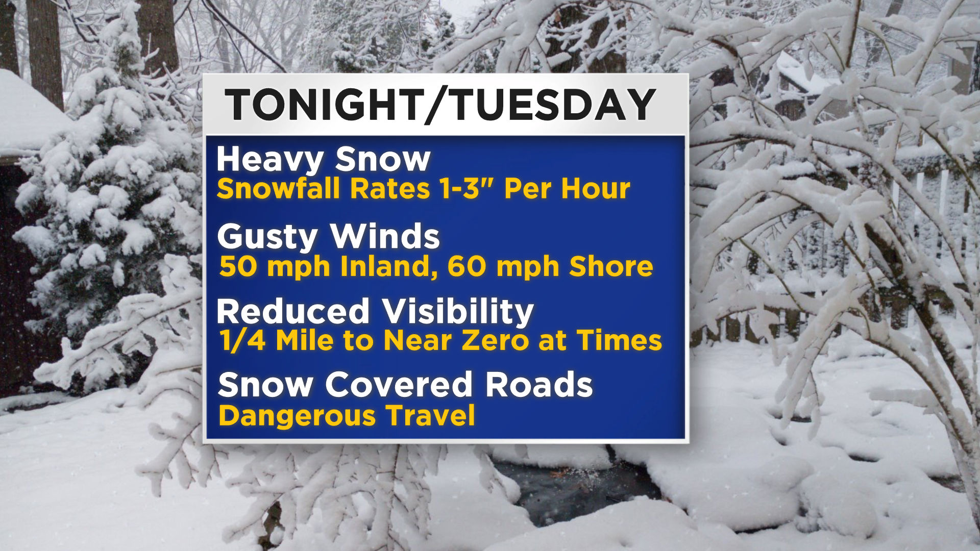
Abundant moisture and intense lift within the deepening storm system will yield heavy intensity precipitation area-wide. Expect all snow north and west of the city, snow with a period of heavy sleet is expected along and east of I-95 into South Jersey, with mainly rain at the shore.
TIMING
Snowfall will begin to overspread the area from southwest to northeast by late this evening. Steady snow with times of heavy snow, at rates of 1-3" of snow per hour, will impact Philadelphia, the immediate Jersey suburbs and all PA suburbs from 2 a.m. Tuesday until 10 a.m. Thunder is possible.
The most likely time frame for sleet along I-95 will be between 6 a.m. and 9 a.m. Tuesday. The event will briefly start as snow along the coast then change to rain with snow again possible at the end of the event near early afternoon.
HOW MUCH SNOW?
Widespread snowfall will begin to taper off by 2 p.m. with scattered snow showers thereafter. Forecast snowfall amounts are significant for much of the area with 18-24" of snow possible for Berks county, the Lehigh Valley and Poconos.
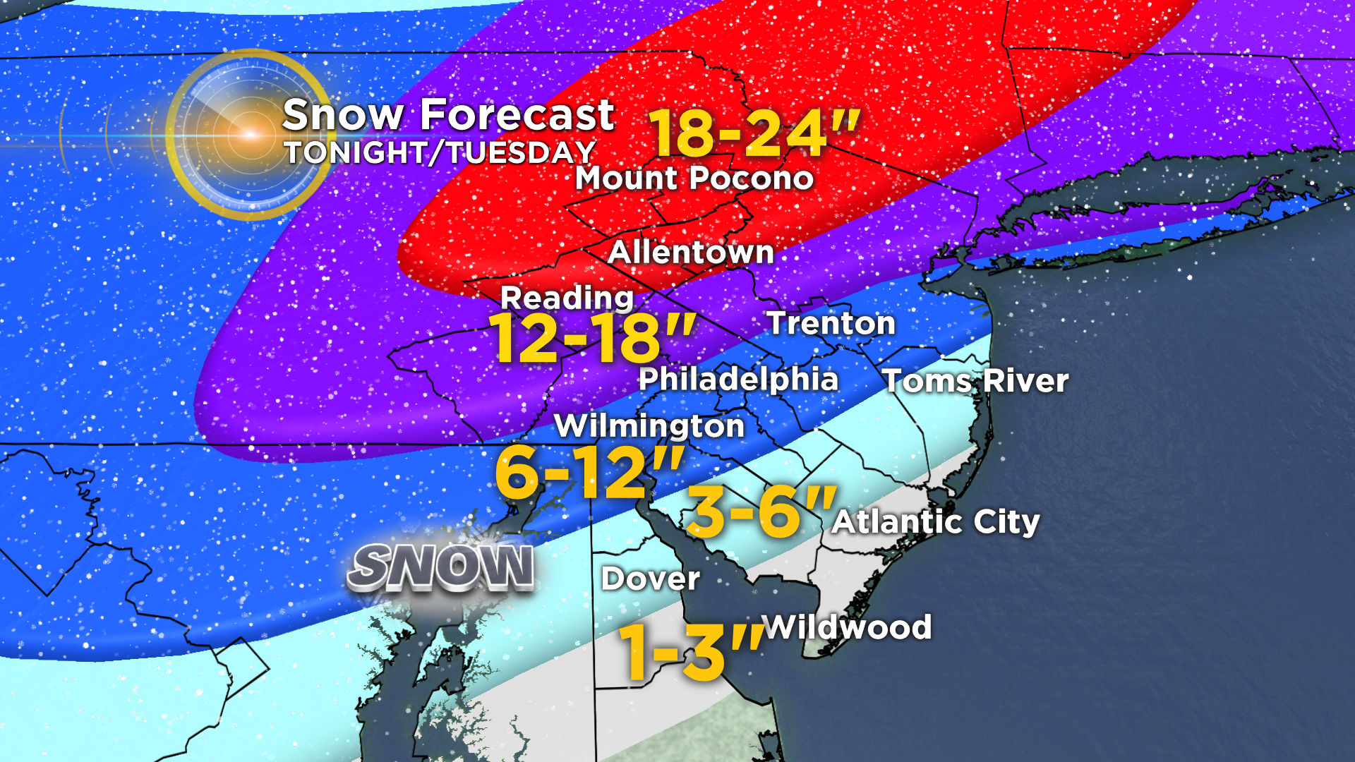
Expect 12-18" in Philly's northern and western suburbs, 6-12" in Center City and immediate suburbs with a sharp gradient from there to the south and east. For example, northern Burlington county is likely to see up to 12" of snow whereas far southeastern Burlington county may see only a dusting.
It's important to not focus too intently on the snowfall forecast numbers but concentrate on the severity of the impacts the snow will yield such as dangerous travel conditions, the potential for stranding, and the possibility of power outages and prolonged outages.