Damp Start To October, All Eyes On Joaquin
By Geoff Bansen
PHILADELPHIA (CBS) -- It's beginning to feel a lot like...October?
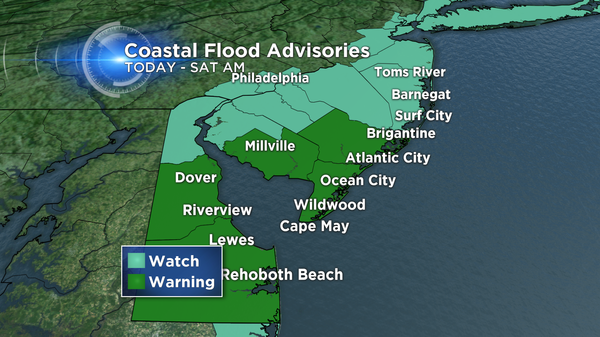
It's a damp, dreary start to Thursday, worthy of a jacket for most folks. Temperatures are only in the low 60s, which is significantly cooler than they have been. They'll be stuck there for the remainder of the day, helped by clouds and a persistent onshore flow. There is some light rain around which is beginning to taper off. Thursday will feature a bit of a break in the action, but expect more rain to develop overnight and put quite a damper on Friday. Winds are starting to pick up as well, as high pressure from the north and another area of low pressure begin to move closer to one another. Coastal flood watches and warning have been posted for the region, but they are not associated with any tropical activity.
Speaking of which, October is also still very much in hurricane season. Joaquin continues to churn down in the Bahamas as a powerful category 3 storm. It will strengthen a little bit more before eventually turning and beginning it's northward trek. There have been some positive trends with the models this morning, with the US perhaps avoiding a landfall as Joaquin skirts along the coast. The slow movement of the storm could prove to be the main catalyst, as it would allow blocking high pressure to move away and provide Joaquin with a clearer path, which could help it veer out to sea. The time frame as of now for any immediate local impacts is late Monday into Tuesday. The next 24 hours will be very tell-tale about what this storm decides to do.