WEATHER: It's SNOW Time!
By Geoff Bansen
PHILADELPHIA (CBS) -- Lights, Camera, Action.
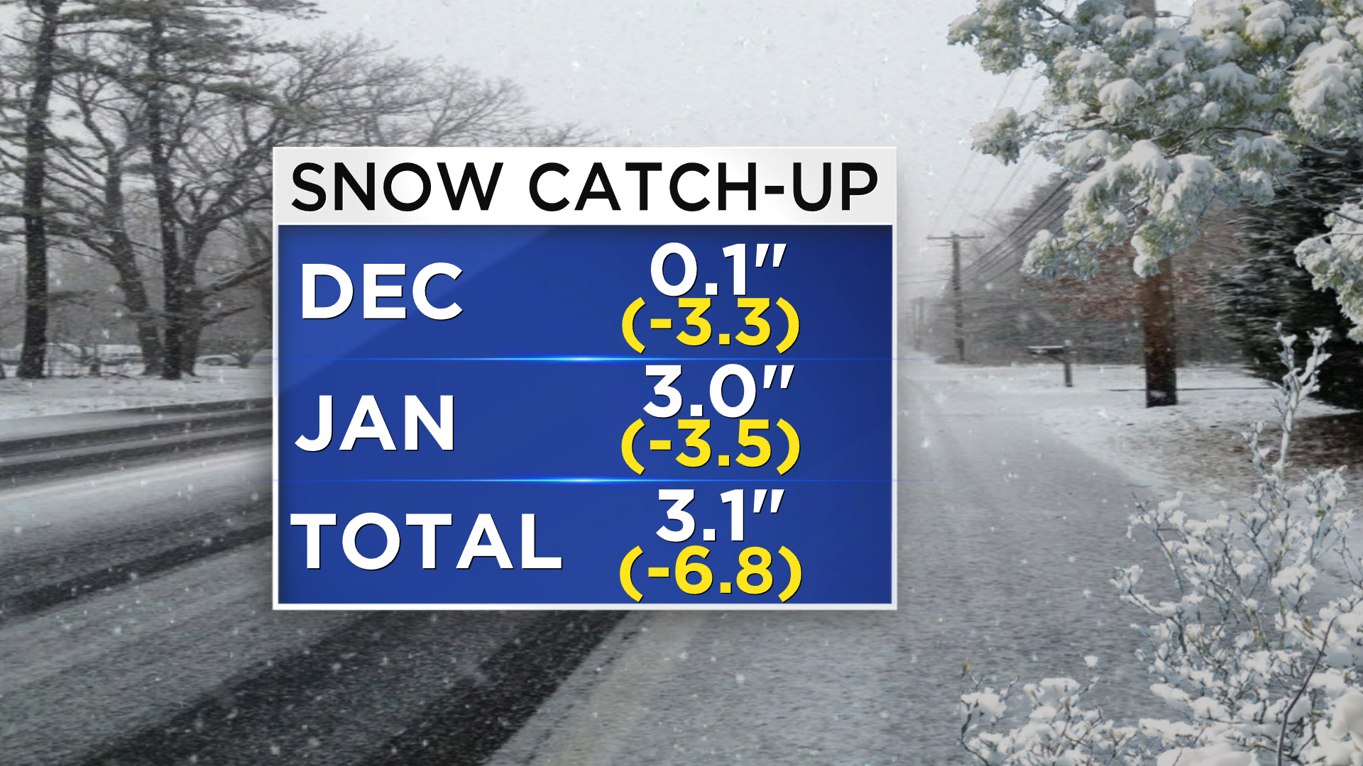
So far, the 2014-2015 Winter Season hasn't provided much to get excited about ... if you like snow, that is. Otherwise, it's been pretty darn good! But all of that is going to change. What started off looking like light snow last week has become a whopper of a storm, and we will be playing a quick game of snow catch-up starting late Monday into Tuesday.
Right not, there are just a few light snow showers across the area. Precipitation will be more on the scattered side for the first half of Monday. This afternoon, snow showers will begin to become a bit more steady. At the shore, you can expect primarily rain today, before it eventually changes over to snow Monday night. The wind is going to be picking up later Monday as well, and will create white out conditions as the storm intensifies overnight.
Once the snow intensifies later tonight, it will drop heavy amounts of snow, at rates from 1-2" per hour. Winds will wreak havoc on those who need to travel. If you don't need to travel, we'd strongly advise against it. The snow may be so bad, you may not even have a choice!
The national weather advisories map looks like a Christmas Tree this morning:
- A BLIZZARD WARNING is in effect for East Central NJ, beginning at noon.
- A WINTER STORM WARNING is in effect for West Central and Southern NJ, Philadelphia Co, Montgomery Co, Bucks Co, Delaware Co, Carbon Co, and Monroe Co, beginning at noon.
- A WINTER WEATHER ADVISORY is in effect for all of Delaware, Chester Co, Lancaster Co, Berks Co, and Schuylkill Co, beginning at noon.
- A COASTAL FLOOD WARNING is in effect for coastal NJ and Delaware beginning late tonight.
Whew!
Despite all of the craziness surrounding this large storm, the Delaware Valley will not be seeing the worst of this! Check out our newly updated exclusive CBS3 snowfall map:
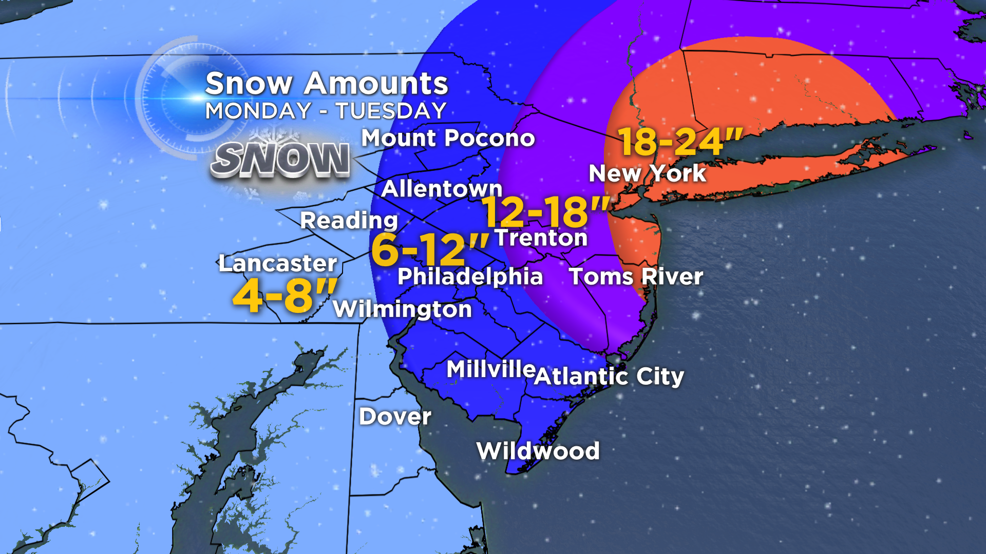
New York City, Long Island, and Coastal New England could see 2 feet of snow, and even locally higher amounts! This system will really "blow up" once it hits the ocean and churn in tons of moisture. Thankfully, the timing and placement will limit the effects as you go further inland. Additionally, inland locations also won't have wind gusts as high as the coast will.
We will continue to track the evolution of this system and keep you updated throughout the day.
If you can't get to a TV or radio, CBS3 and KYW Newsradio are always online! Stay up to the minute on our Facebook page and follow us on Twitter. #CBS3SNOW

