Ice Jam Causes Flooding Along The Delaware, Snow For Mid-Week Too
PHILADELPHIA (CBS) - The temperature fluctuations from the end of last week and through the weekend have caused issues along the Delaware River as was expected due to the melting and refreezing we have seen.
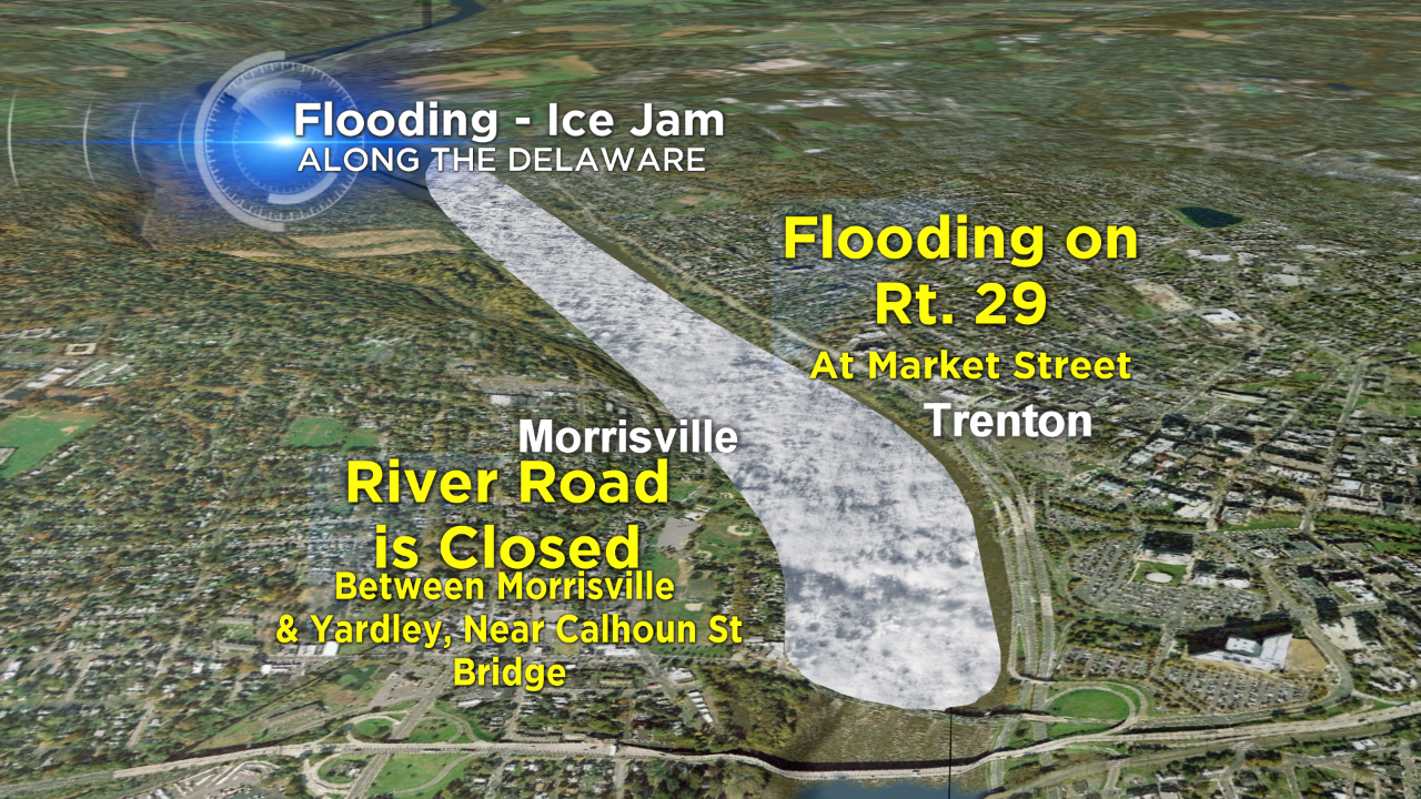
This morning, flooding in Lower Bucks and Mercer Counties forced the closure of roads and a flood warning remains in effect until 5:30 tonight, thanks to an ice jam near the Trenton area. Ice jams occur when frozen water starts to melt and breaks away from the ice sheet and flows down river, eventually getting caught up along a bridge or in a turn of the river or stream.
This morning, the ice jam was caught up near the I-95 or Scudders Falls Bridge. It forced Route 29 in Trenton to be closed most of the morning and it should remain closed until the flood waters are able to recede. On the Pennsylvania side, there are issues in the Morrisville and Yardley areas where River Road will be closed until further notice. These types of issues usually occur in the spring time as the ice pack melts, but with the warmer weather at the end of last week, we are experiencing some of the spring problems in the middle of the winter season.
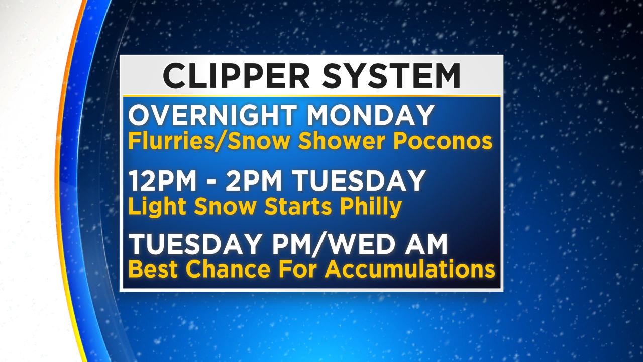
Ice jams and flooding aren't the only issues in the forecast this week either. A fast moving clipper system is going to sweep through on Tuesday and into Wednesday and should leave in its wake some light accumulations of snow for most of the area. The system will bring flurries to the Poconos as early as tonight even with snow showers picking up for areas well north of Philly on Tuesday morning.
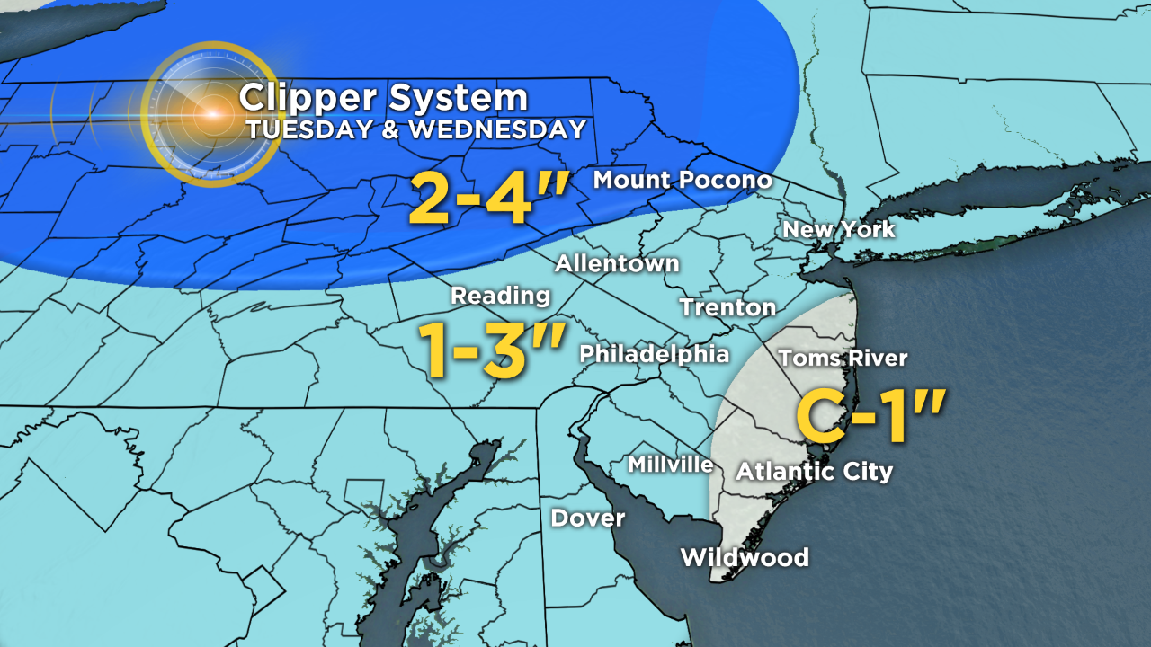
We should start to see a few snow flakes fly in the afternoon in Philly with the best chance for accumulating snow to develop on Tuesday night into Wednesday morning. Right now, as stated, amounts should remain on the lower side of things, especially for the I-95 corridor and down toward the shore points too. The break down for snow at this time looks like this: The Poconos, 2-4 inches; Philly and immediate suburbs, 1-2 inches; Lehigh Valley 1-3 inches; coastal New Jersey, coating-1 inch. We will get a reinforcing shot of cold air on the back side of the system for Wednesday and Thursday, before we look to return to more seasonable temperatures heading into Friday and the weekend where we could even have a chance to hit the 50s by Sunday with a couple rain showers in the mix.
Bundle up and don't put the shovels away just yet!