Friday Afternoon Snow Ushers In The Weekend
PHILADELPHIA (CBS)- It has been the week of the "Alberta Clipper" in the Delaware Valley for most of the work week. As we get ready to close out another work week and move closer to the Christmas holiday, we are going to deal with one more shot of cold air and another chance for snow on Friday afternoon. This time however, it will not be one of those Clipper systems like earlier in the week but a quick moving coastal system that will kick-off some snow showers across the region and leave us with some limited accumulations when it all is said and done by tonight.
The low which will travel up the coastline this morning will start to kick off the snow in the area after lunchtime. By the time we hit the 1-3PM time frame we should be looking for snow showers overtaking most of if not all of the I-95 corridor and areas to the south and east of 95 as well. The heaviest snow today is likely going to fall at the most inopportune time, that is around the time many of us are going to be driving home from work in the mid-hours of the afternoon and early evening. As stated this is going to be a fast moving system though and we are likely finished up with the snow in the Philly metro around 8PM and it will likely clear even the coastal areas of New Jersey by 10-11 at night.
While this low will have a bit more moisture to work with thanks to the fact that it will riding up the coast and can feed off some of the moisture from the Atlantic Ocean, the fact that it will be moving very quick keeps our snow amounts on the lower end of the scale this time around.
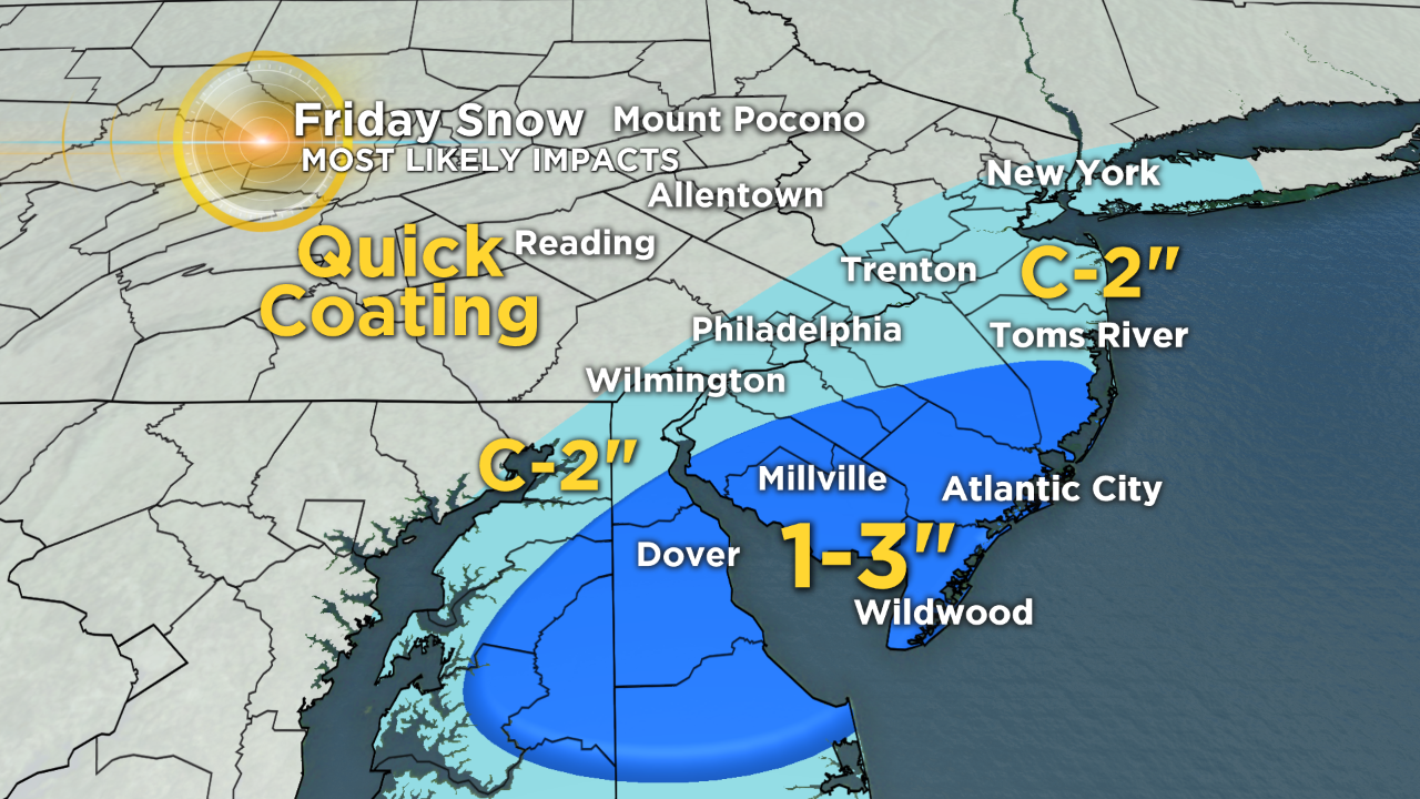
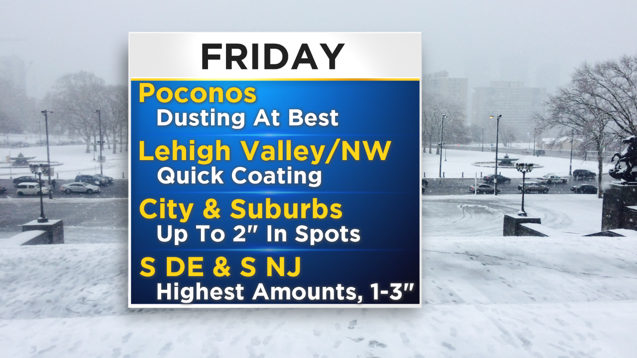
The highest snow totals are likely to fall in the South Jersey area and into parts of Delaware. In those areas we could be looking for 1-3" of snow with a small chance that a few local spots could potentially see up to maybe 4" if a more moderate band of snowfall sets up.
For the 95 corridor, especially Philly and the immediate suburbs, we are in the range of about a coating of snow to as high as 2" in spots. Again this will be subjective as to where the potentially more moderate bands of snow set up, but we should look for just about 1" right around Philly.
Snow amounts then rapidly fall off as you head farther north from the city. In the Lehigh Valley and into the Poconos we will be lucky to see a dusting of snow with the way this system will set up. Roads could potentially still be slick if any snow does fall but do not look for any real accumulations north of Philadelphia.
With the timing of the snow in the afternoon and the potential for limited visibility as well as slick roads there will be a Winter Weather Advisory this afternoon from 1PM to 9PM, for the time of peak snowfall in the area. The Advisory will be for the counties most likely to be affected by the snow and is South Jersey and Delaware, but also included are Philadelphia and Delaware Counties.