Quiet Weather For The 2nd Anniversary Of Sandy
By Geoff Bansen
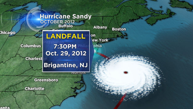
PHILADELPHIA (CBS) -- Two years ago today, much of the region was bracing for the impact of powerful Superstorm Sandy.
Thankfully, no such case for today.
Temperatures aren't as warm as yesterday, but they are certainly still mild for this time of year. Highs will top out in the mid 60s today, as some sun will mix in with clouds. A cold front draped NE to SW will slowly approach this afternoon, and a few showers will be possible later in the day.
Tonight, skies clear out, but it will certainly be much cooler, a trend that sticks with us through the end of the week. Thursday and Friday will both feature sunshine. Clouds will begin to increase Friday evening, but conditions look dry for trick-or-treaters. A sweatshirt underneath the costume would be recommended!
We will continue to track a potential coastal storm for the first half of the weekend. It looks as though the heaviest rain may remain offshore as of know. The timing of two pieces of the storm will ultimately decide its fate. Regardless, it's going to be a wet, chilly, and windy. Many locations to the far north and west and up into the Poconos shouldn't be surprised to see some wet snowflakes on the back edge of this system as it departs. That being said, this is NOT a snow event. Sunshine will return on Sunday, remaining chilly. Highs both days will struggle to escape the 40s.
Today's Highs:
Philly - 66
Shore - 68
Poconos – 60
On this date in weather history...
1885 - The barometric pressure at PHL fell to 29.10", the lowest pressure ever recorded in October.
2012 - Hurricane Sandy pummeled the east coast, coming ashore in southern NJ and causing billions of dollars in damage.