Getaway Guide To Chesapeake Bay 'Gunkholing'
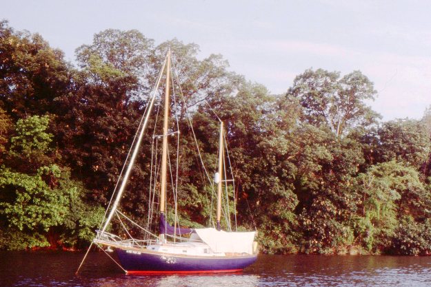
"Gunkholing" is simply the practice of guiding a boat into a secluded, scenic cove, find just the right spot with a breeze on a warm day, water deep enough for anchoring and swimming, just far enough away from shore to cut the land bond, and then just drop the hook to anchor and relax in silence. If you don't own a boat, sail with a friend who does or charter one for a day, a weekend or week. The perfect backdrop is the nearby Chesapeake Bay with its 6,000 miles of shoreline, including rivers, creeks, their tributaries and coves. Assuming your charts or GPS navigation programs are up to date, here's a sampling on the upper bay that are easy to reach and offer decent protection from a sudden storm. -- Jay Lloyd.
WORTON CREEK
GPS: Latitude: 39.17.373N/Longitude: 76.11.209W
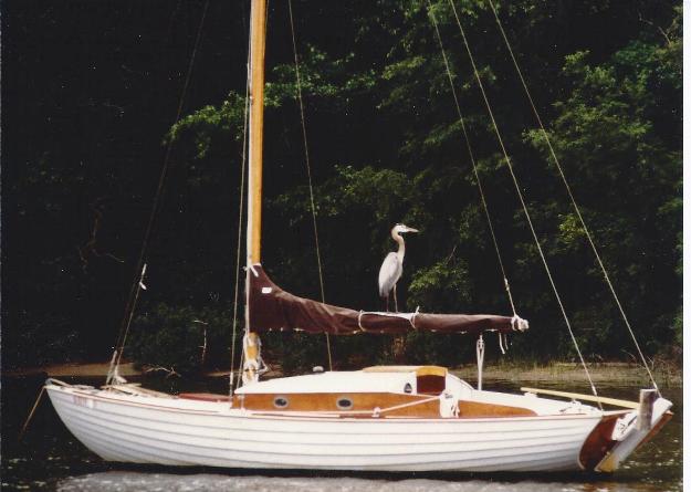
A wooded setting that draws Great Blue Herons to fish at sunset also provides a pristine backdrop for the cruising boater who anchors off the shoreline. In snug Worton Creek just 1-1/2 miles off the bay you can drop a crab trap or fishing line and catch a fresh dinner. If you prefer to sleep at anchor but dine ashore, it's a short dinghy ride to the Harbor House restaurant with bay fare and a friendly boater buzz bar. If you have the dinghy launched, take it further south to Mill creek for a little exploration or bird watching.
SWAN CREEK
GPS: Latitude 39.08.708N/Longitude 76.15.733W
Swan Creek is one of the more popular anchorages on the eastern shore. It's scenic, away from marinas and traffic, yet close enough to the restaurants, bars and shops of Rock Hall, Maryland for a dinghy ride to the closest shore and then a rental bike or walk into town. Follow a well marked channel from the bay and hang a left after passing the mooring field at the Swan Creek Marina. There's plenty of deep water in the anchorage, but keep an eye on the depth sounder as you close with the shoreline. Because of its prime location, Swan Creek does get crowded on weekends, but weekdays find few boats and a lot of solitude.
TILGHMAN CREEK
GPS: Latitude 38.50.671N/Longitude 76.15.802W
As many times as I've sailed into one of the most idyllic of upper bay anchorages, it still takes several passes and 3 sets of eyeballs to spot the entrance against a background of dense woodland. Tilghman Creek on the northern end of Tilghman Island is marked by a lighted buoy and a pair of day marks. Once you spot them, stay in the center of the channel till you find the perfect hole in the water to spend the night. There are no shore attractions to distract you from nature here. It's just you, your crew and whatever you're putting on the grill or pouring in the glass.
SHAW BAY
GPS: Latitude 38.50.811N/Longitude 76.12.062W
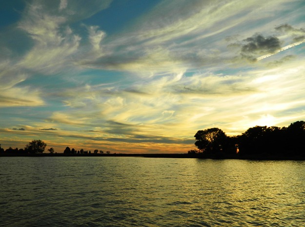
Almost directly across the Eastern Bay from Tilghman Creek you'll find the storied Wye River. It's photogenic banks and deep water invite exploration. But just around a protective hook at the Wye entrance, you'll find Shaw Bay, a wide expansive cove. If you're meeting up with other boats, there's plenty of room here for rafting. The sunsets are spectacular and like Tilghman Creek there are no shoreside distractions. it's all about swimming, maybe some crabbing and an easy night at anchor. The last time I was here, we were chased in by a storm. The bay was boiling, the anchorage, calm. But while here take time to explore the Wye.
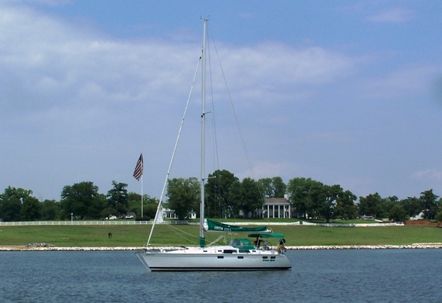
MAGOTHY RIVER
GPS: Latitude 39.03.312N/Longitude 76.25.997W
The Magothy River has been a longtime favorite spot to drop the hook, either for lunch or overnight. The mouth of the river is easily spotted just west of the Baltimore Light. The entrance is a narrow channel that opens into a wide river with good anchorages in coves that dimple the banks. We have two favorite spots. One is right behind Dobbins Island in a patch of water called, Sillery Bay. Just don't try to sail around the island. The northwestern side carries only a foot of water. Expect weekend crowding. A more isolated anchorage is to the east of Sillery between Holland and Purdy Points. A large flag, horses and a manicured estate on the north shore provide the photogenic backdrop for a well protected night at anchor.
These are just a few of the thousands of anchorages, found on the bay. They were chosen because of their proximity to home port marinas by most Philadelphia area boaters and charter sailors who sail and power on the Chesapeake. The most comprehensive guide to the popular gunkholes as well as the most isolated is the annual "Guide to Cruising Chesapeake Bay" published by Chesapeake Bay Magazine.
The GPS coordinates used in this article represent buoys and day markers closest to the designated waterway entrances.
Enjoy!