Philadelphia Weather: Dangerous Heat Wave Continues With A Shot At A Record
PHILADELPHIA (CBS) -- Thursday was day four of our current heat wave, which appears as though it will last eight days in total. Thursday was the worst of the heat so far.
The temperature reached a high of 96 in Philadelphia with a heat index of 104. The heat index briefly touched 110 in Wildwood!
We get a small measure of relief Friday, not in the temperature but in the humidity. A weak cold front moved through the region Thursday afternoon and behind it, some drier air is working in overnight. This will drop the dewpoints a bit Friday, meaning we won't be feeling the insufferable heat indices we felt Thursday.
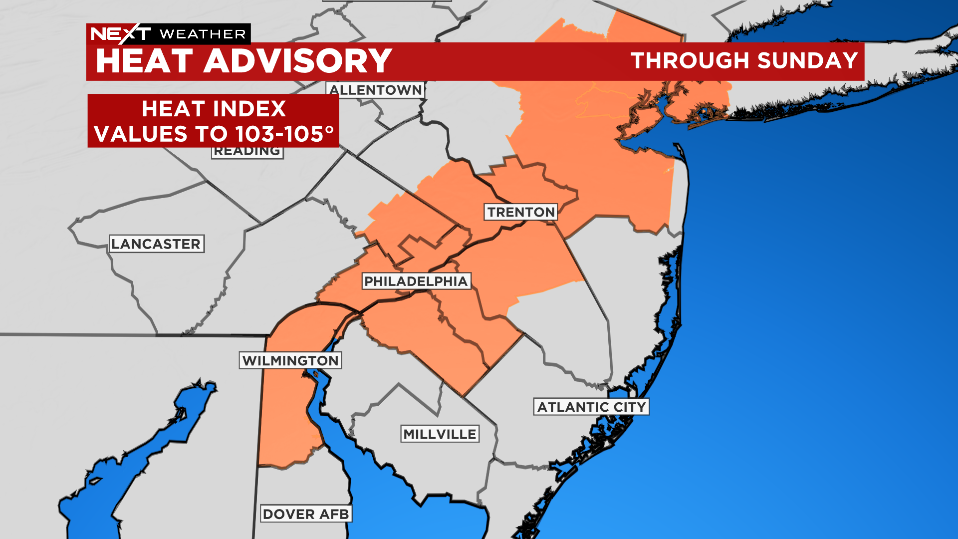
Basically, 95 will feel like 95 -- still very hot, but a tiny bit better. Because of this, the heat advisory has been scaled down to include just the city and nearby suburbs on both sides of I-95. I expect it will be expanded again over the weekend.
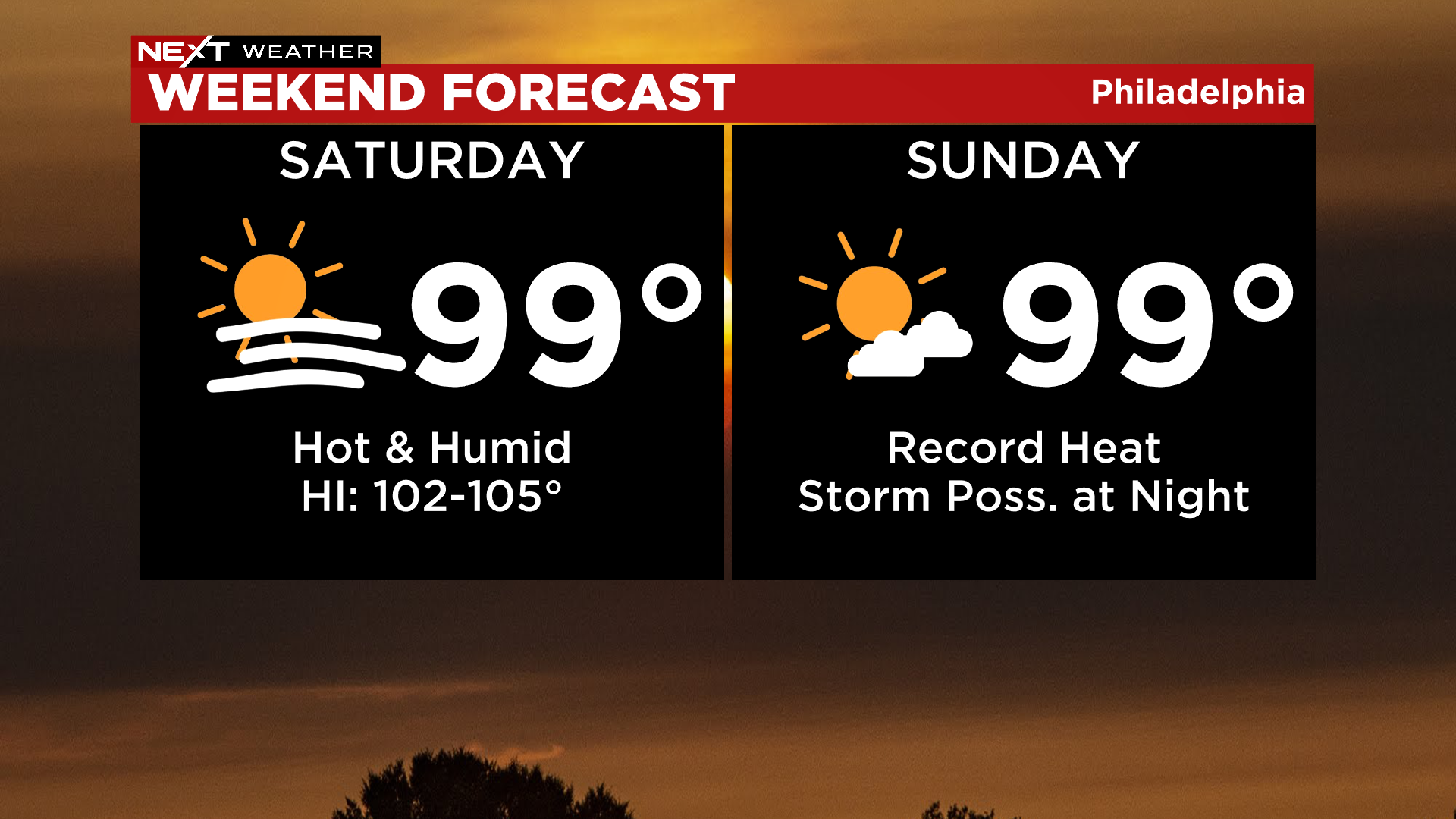
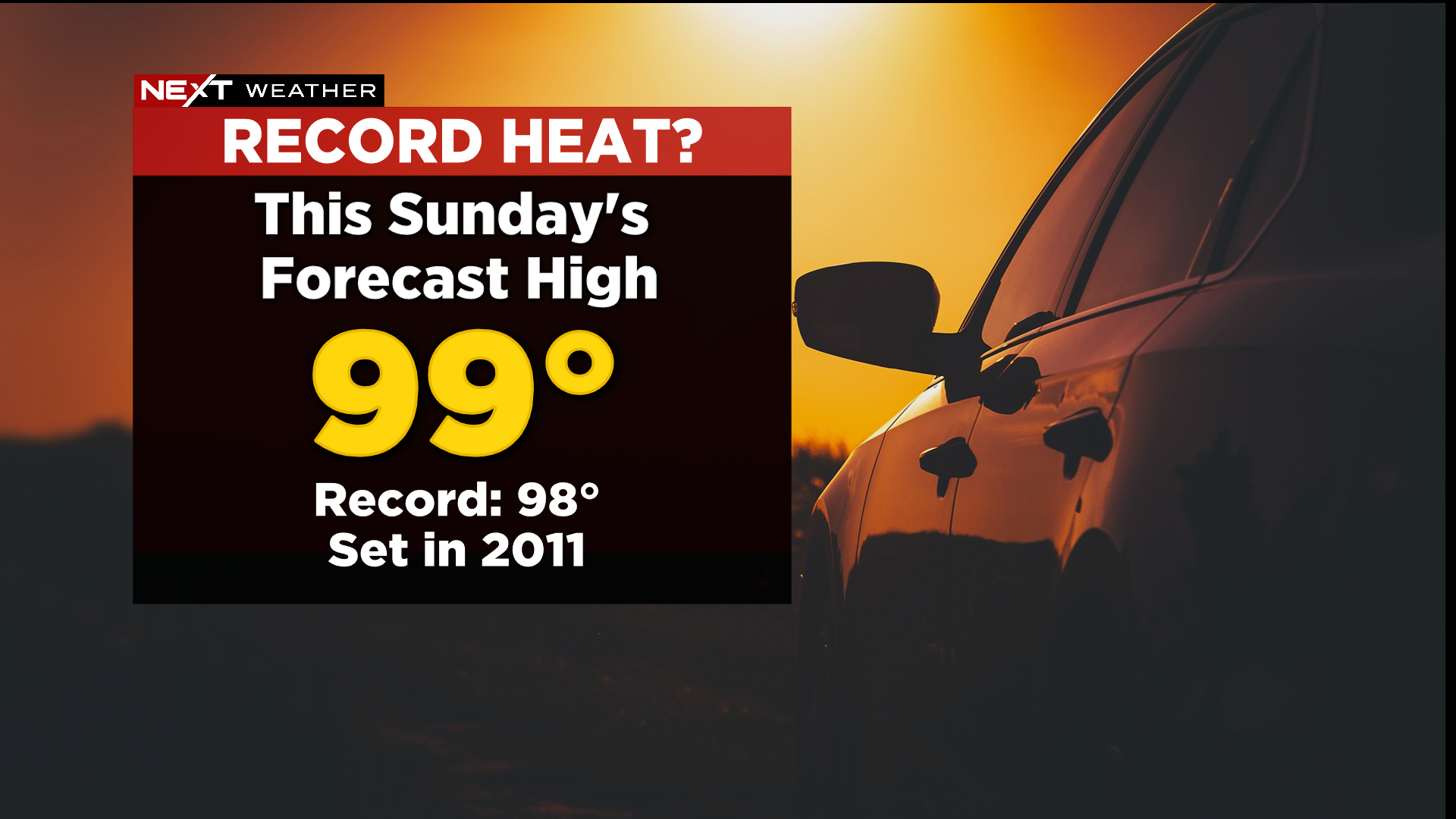
Any shred of relief Friday disappears over the weekend. Temperatures will peak this weekend in the upper 90's, likely 99 both days, which would set a new record on Sunday. The current record for July 24 is 98, set in 2011.
There is even a chance we make a run for 100 degrees, which hasn't happened in Philadelphia since 2012 -- a full decade ago.
The pattern begins to break down early next week as a series of fronts bring shower and thunderstorm chances. This should finally break the worst of the heat, though it doesn't appear that we'll drop much below the 90 mark.