Philadelphia Weather: Heat Advisory Continues As Thunderstorms Are Likely
PHILADELPHIA (CBS) — Our heat advisory continues Tuesday as excessive humidity combined with seasonably hot temperatures will yield heat index values near 100 degrees this afternoon. Fog has cleared out along the coast but will linger in the city and suburbs before eroding by midday to reveal some steamy sunshine.
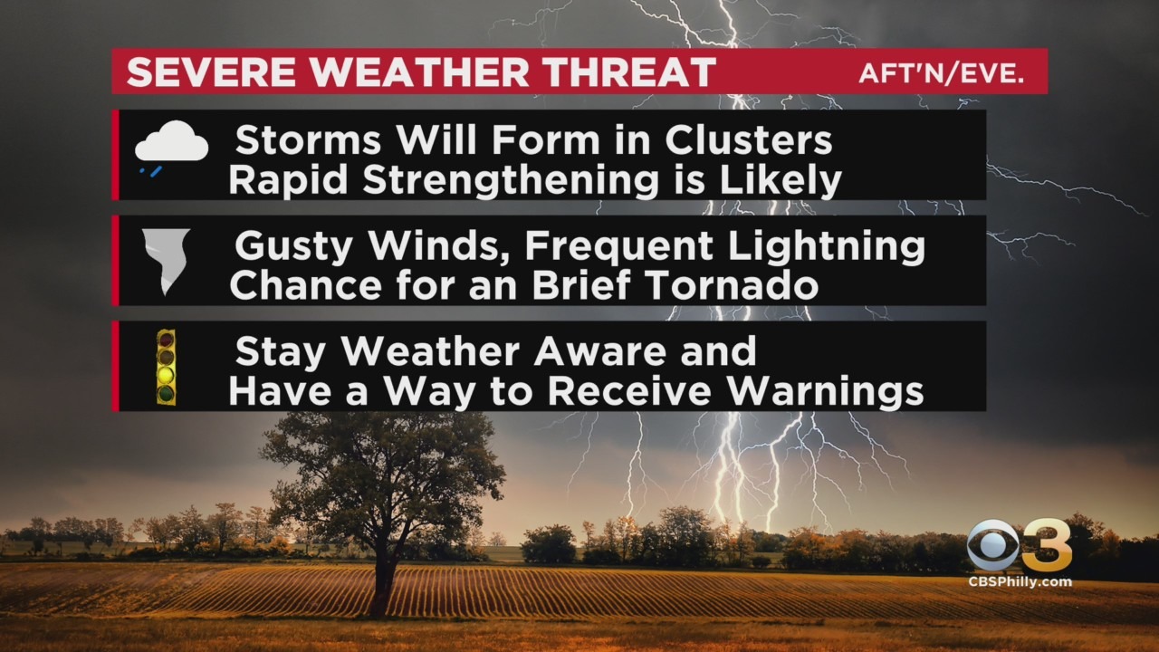
Late-day thunderstorms are again likely today yet the coverage looks to be less than yesterday. Rain could be heavy but with slightly lower atmospheric moisture content, the threat for flash flooding should only be localized.
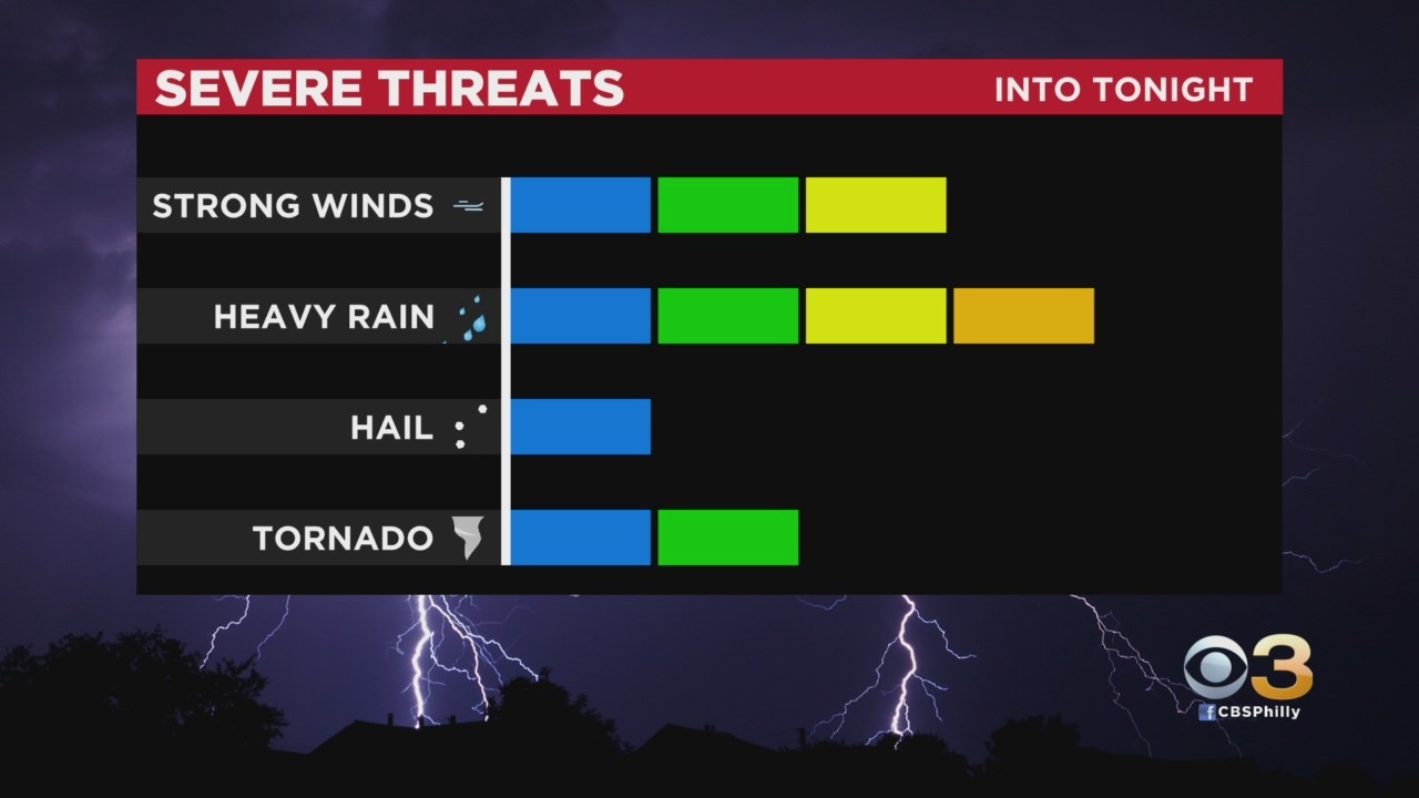
Additionally, storm motion should be more progressive today but still can't rule out a few slow-movers. Along with the severe weather potential will come the chance of a brief isolated tornado particularly in the Slight Risk area far north and west.
Wednesday will still be hot and a touch less humid with another round of scattered afternoon downpours and thunderstorms.
Thursday will be the only legitimate dry day with sunny skies. Humidity values quickly return to intolerable levels on Friday, and with highs in the mid 90's, heat index values will likely soar into the low 100's to end the workweek.
The weekend is looking not quite as hot but very unsettled as a slow-moving cold front moves through.