Philadelphia Weather: Severe Thunderstorm Watch Issued Throughout Region Until 8 p.m. Thursday
PHILADELPHIA (CBS) -- Strong to severe thunderstorms are sweeping through the area Thursday afternoon as a potent cold front passes through the Philadelphia region. Several tornado warnings were issued for parts of New Jersey and Delaware, but have since expired.
CBS3 meteorologist Matt Peterson says a National Weather Service spotter reported a possible tornado near Milford, Delaware, around 5 p.m. Whether a tornado touched down or not will be confirmed by the NWS in the coming days.
Thunderstorms are already developing in areas north and west of Philadelphia, like Berks County and portions of the Lehigh Valley and Poconos.
A Severe Thunderstorm Watch has been issued for southeastern Pennsylvania, New Jersey and Delaware until 8 p.m. Thursday.
Thunderstorms will likely fire closer to the city around 3 p.m.
The threat of severe weather will develop at this time as well. The strongest of the storms will then continue throughout the afternoon before slowly subsiding in the evening.
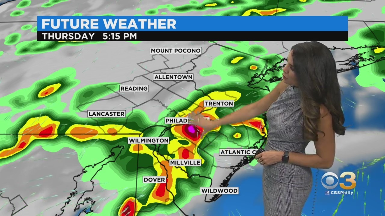
The threat for the strongest storms will likely die down around 8 p.m.
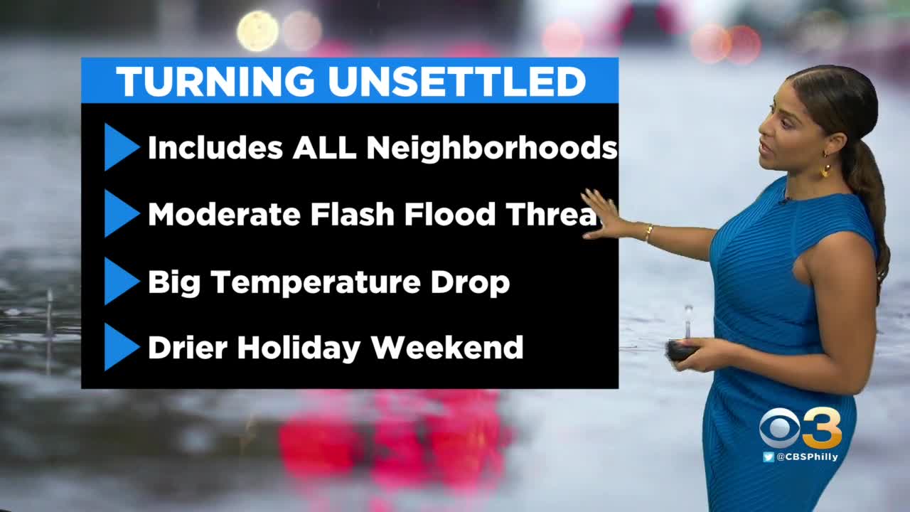
During the worst of the storms, the region can expect strong, gusty winds and locally heavy rain. Wind damage will be possible and flash flooding will be likely.
Rainfall rates could reach as much as 2 inches per hour and widespread across the whole region amounts of 1 to 3 inches of rain are possible.
While the tornado and hail threat Thursday is limited, it is not completely out of the question, so the CBS3 Weather Team will monitor those threats as well.
While the heaviest of the rain and storms will be in the afternoon and early evening, there will continue to be chances for showers and thunderstorms through the overnight hours.
Lows Thursday night with rain still remain fairly mild and conditions will be muggy too, as we dip into the upper 60s.
The long holiday weekend starts for many on Friday, but it will not be the best day.
With mostly cloudy skies and scattered showers and thunderstorms, it will remain fairly dreary.
Highs will be cooler though, even if the humidity remains high, as we top out in the low 80s.
The bulk of the holiday weekend will be pretty nice.
Partly to mostly sunny skies are likely, with low humidity and highs in the mid-70s to low 80s.
While a few spotty showers cannot be fully ruled out, it should remain dry for a majority of Saturday and Sunday.
By Monday we are back into the upper 80s with the humidity starting to creep higher as well.
Expect the 90s to return to the forecast as many head back to work on Tuesday, with 90s lingering into Wednesday too.
A renewed chance for showers and thunderstorms will develop for the middle and end of next week.
Stay with the Eyewitness News Weather Team for the latest forecast.