Philadelphia Weather: Severe Thunderstorm, Gusty Wind Threat Wednesday Followed By Rapid Temperature Drop Into Mid 40's
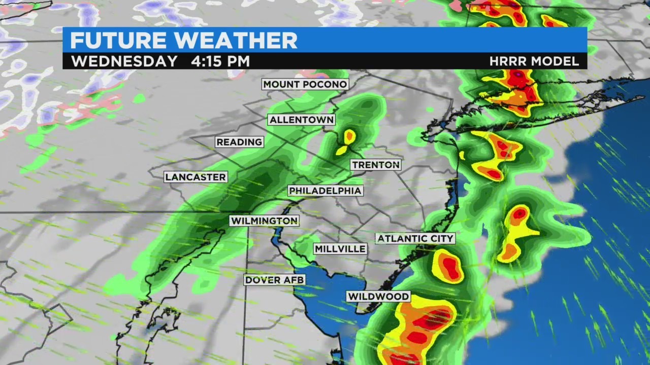
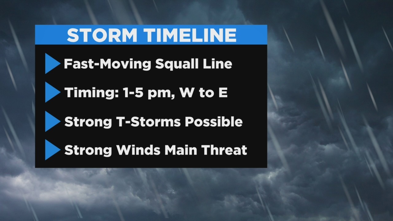
PHILADELPHIA (CBS) - The main event sweeps through the region later this afternoon. While this doesn't look like a major severe weather threat, localized severe wind gusts are possible with any storm as well as brief heavy rainfall and frequent lightning.
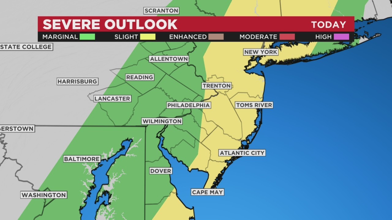
Timing looks to be from 1 p.m. to 5 p.m. from west to east. Center City timing looks to be 2-3 p.m. The storms should be moving offshore by 5 p.m., prior to the height of the evening rush.
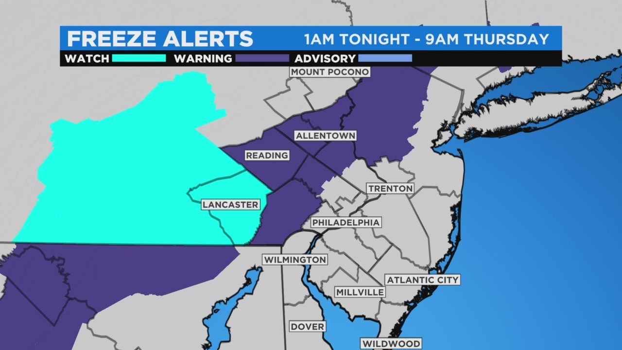
Behind the frontal boundary, temperatures will immediately and rapidly plummet this afternoon. Many locations will fall from near 70° to mid 40's in 1-2 hours! Gusty winds will also kick up to yield wind chills in the 30's across much of PA by 8 p.m. this evening.
Lows will fall into the 30's region-wide tonight and the combination of blustery conditions will prompt wind chills in the 20's across the area by Thursday morning, and wind chills in the teens are likely in the Poconos and Lehigh Valley. A freeze warning will go into effect overnight through 9 a.m. Thursday. High temperature struggle to low 50's Thursday afternoon, and with wind gusts to 40 mph, it will feel like 30's and low 40's almost all day long.
We quickly return more spring-appropriate temperatures by Friday afternoon with highs in the mid 60's. Saturday looks great before conditions take a turn Sunday.