Philadelphia Weather: 3 Winter Storms Likely To Hound Region Beginning With Nasty Mix This Weekend
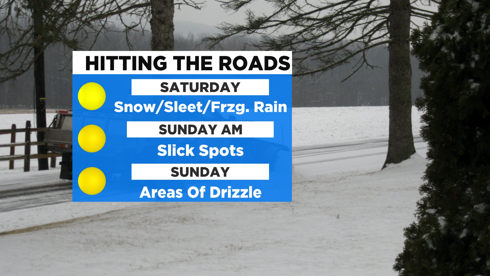
PHILADELPHIA (CBS) -- Saturday begins our stretch of stormy days as the first of what is likely three winter storms get ready to hound the Delaware Valley. A nasty wintry mix will track north throughout the morning and likely overtake Philly and much of the urban corridor around 12 p.m.
The initial precipitation in Philly and much of the immediate suburbs will be snow, sleet and likely some freezing rain as well. As the messy mix is moving into Philly, we will start to see a changeover to more plain rain at the coast, while areas of light snow could develop across the northern tier of counties.
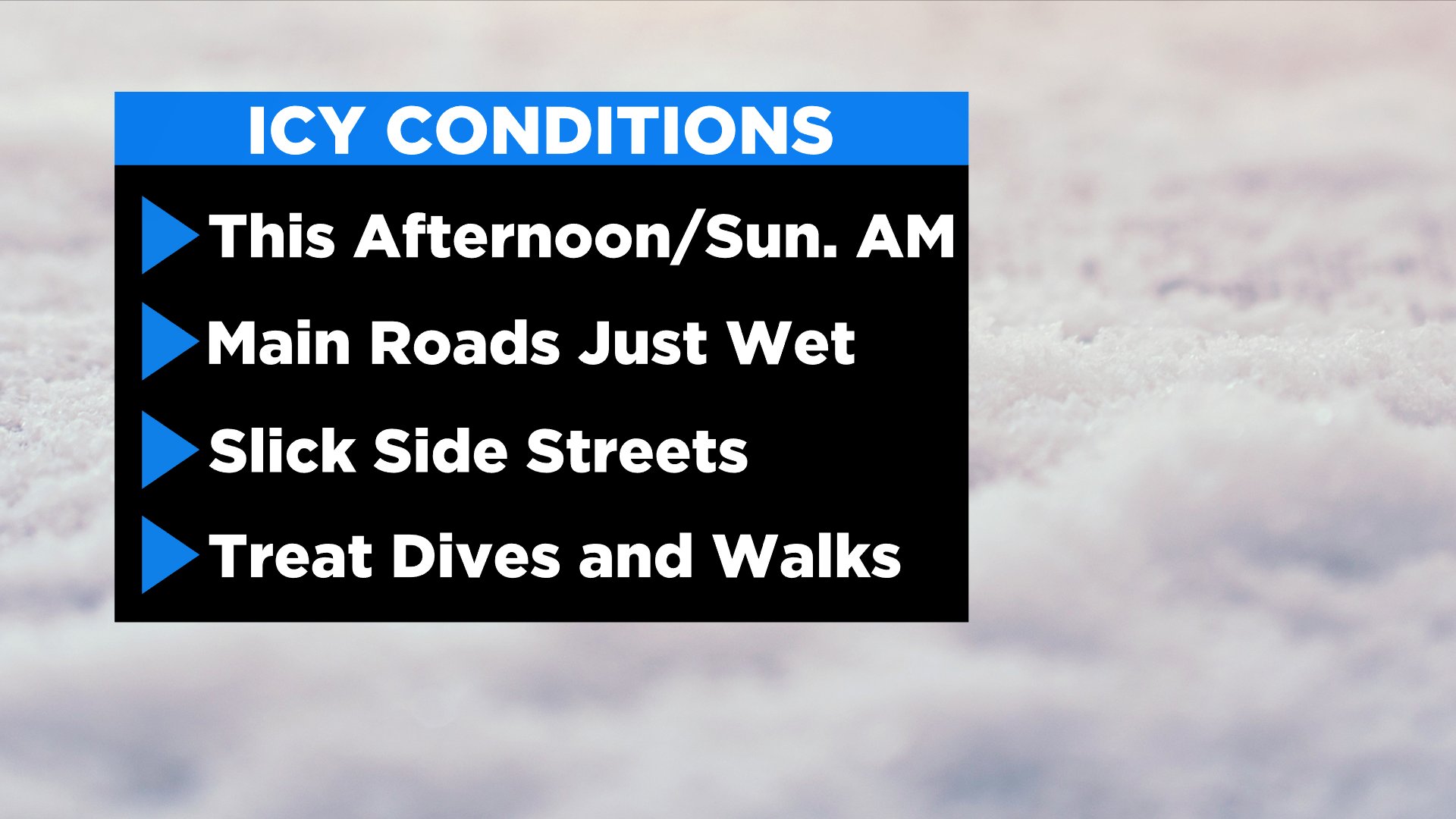
The mix in Philly and across the I-95 corridor will persist through the rest of the afternoon and evening before becoming slightly lighter during the night.
Warm air will continue to intrude to the north and throughout the afternoon as well, and we likely transition from snow/sleet to more freezing rain/drizzle in the urban corridor during this time.
A change over from wintry mix to plain rain will be possible at the Shore, while northern areas will stay with a light, wet snow.
The highest risk of icing will occur during Saturday evening and night, possibly pushing into early Sunday morning too. The reason for the high risk of freezing rain is due to temperatures at the surface on Saturday will stay below freezing, while temperatures aloft in the low/mid-levels of the atmosphere will rise to above freezing.
Highs on Saturday will be near 30 degrees.
The threat of wintry mix, including freezing rain will continue Sunday morning. The bulk of the precipitation will end in the morning hours on Sunday, but a few light and lingering areas of mix or plain rain will still be possible during the afternoon. Sunday's highs will push into the mid to upper 30s.
When our weekend system is all said and done, we look to have a glaze to up to a tenth of an inch of ice accretion across a vast majority of the region.
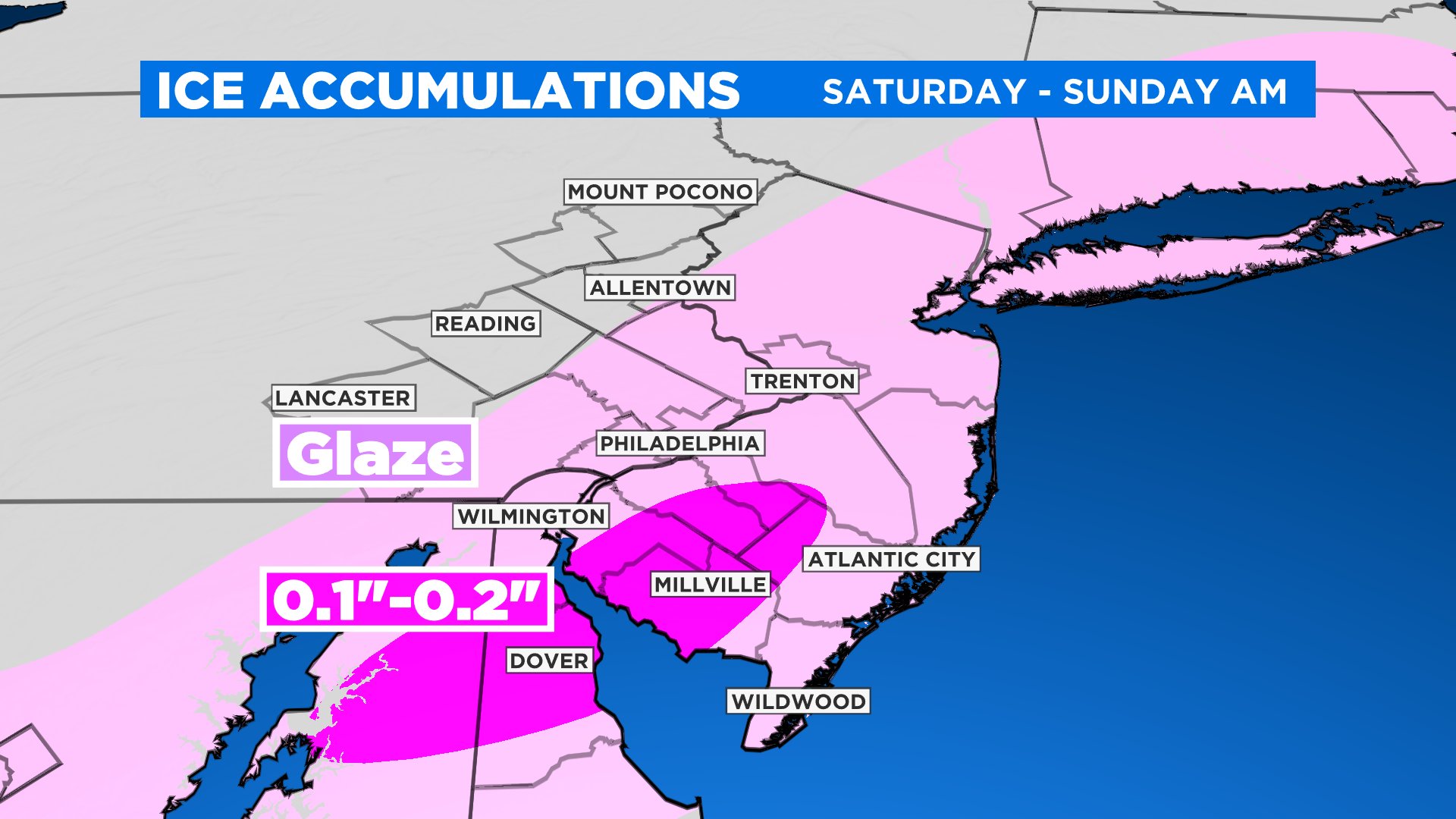
However, there is a chance of a ribbon of higher ice accumulation across interior South Jersey, where up to 0.25 inches of ice could be possible.
Right now, we are not calling for a widespread ice storm, but power outages and very difficult travel are possible from Saturday afternoon through at least Sunday morning.
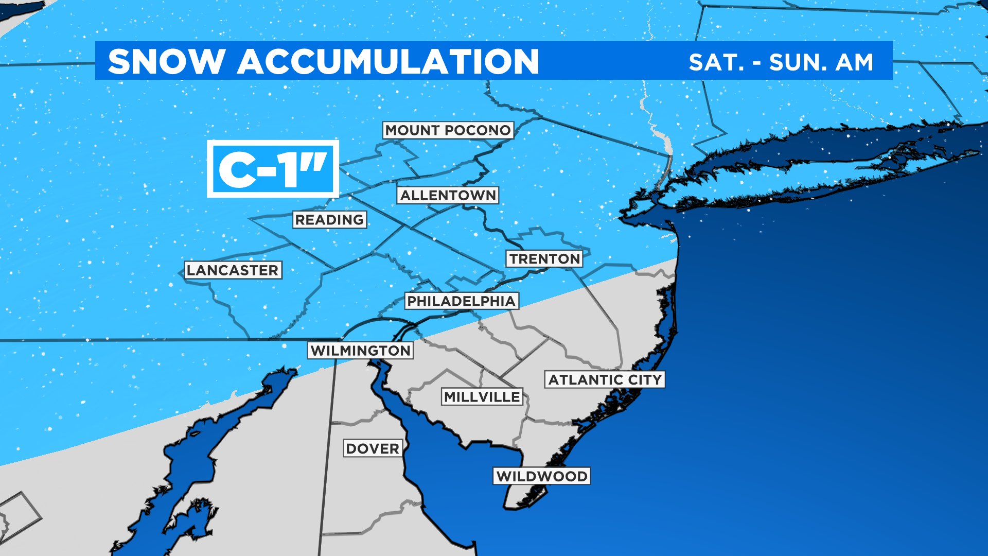
Snow amounts will be extremely light with this system. If anything sticks it would only amount to about a coating-1 inch at most for places.
Monday offers a slight reprieve from the winter weather for at least a few hours as we wait for storm number two to show up. Monday as a whole will be mostly cloudy with possible periods of wintry mix during the day.
Those who see any wintry weather Monday will note that it should be light and quick moving. The better chance for more robust wintry mix comes Monday night. At this time our Monday night-Tuesday storm is trending slightly warmer.
What this means for us is a better chance to see rain, sleet and freezing rain, with a lower chance to see snow, especially in Philly.
The second round of winter weather ends by Tuesday evening, leaving a chance to clear out pretty nicely on Tuesday night and into Wednesday.
This will also allow for arctic high pressure to take control for at least a brief time on Wednesday afternoon. Wednesday looks to be mostly sunny but very cold with highs only in the low 30s.
The sunny skies are short-lived as storm number of the week rolls in on Thursday. Thursday's storm right now looks as though it should begin as snow/mix for most of the region before a transition to mix/rain then all rain for most.
As the system progresses into Friday a transition to snow or a rain/snow will be possible. An early look at next weekend shows we may finally have a couple of quiet days after the rocky road that is on the way.