Philadelphia Weather: Parade Of Winter Storms Set To Move Through Delaware Valley
PHILADELPHIA (CBS) -- Many woke up on Thursday morning to a fresh coating of snow on the ground. While it wasn't overly heavy in Philadelphia and many of the immediate suburbs, parts of South Jersey saw up to 5 to 7 inches of snow.
Hopefully, you cleaned the snow from today quickly because another winter storm is nipping at this one's heels and will only be the start of what should be a very active week for the region.
Tonight, only expect a few flurries across southern parts of the area, with no accumulations likely. For the most part, it will just be a cold and quiet night, with lows in the city near 20 degrees, but likely in the teens in the surrounding communities.
The arctic high, which drives our temperatures down tonight, will work to keep us bitterly cold again tomorrow, too. Thanks to limited sunshine and just a cold air mass in place, highs on Friday will only top out near 30 during the afternoon.
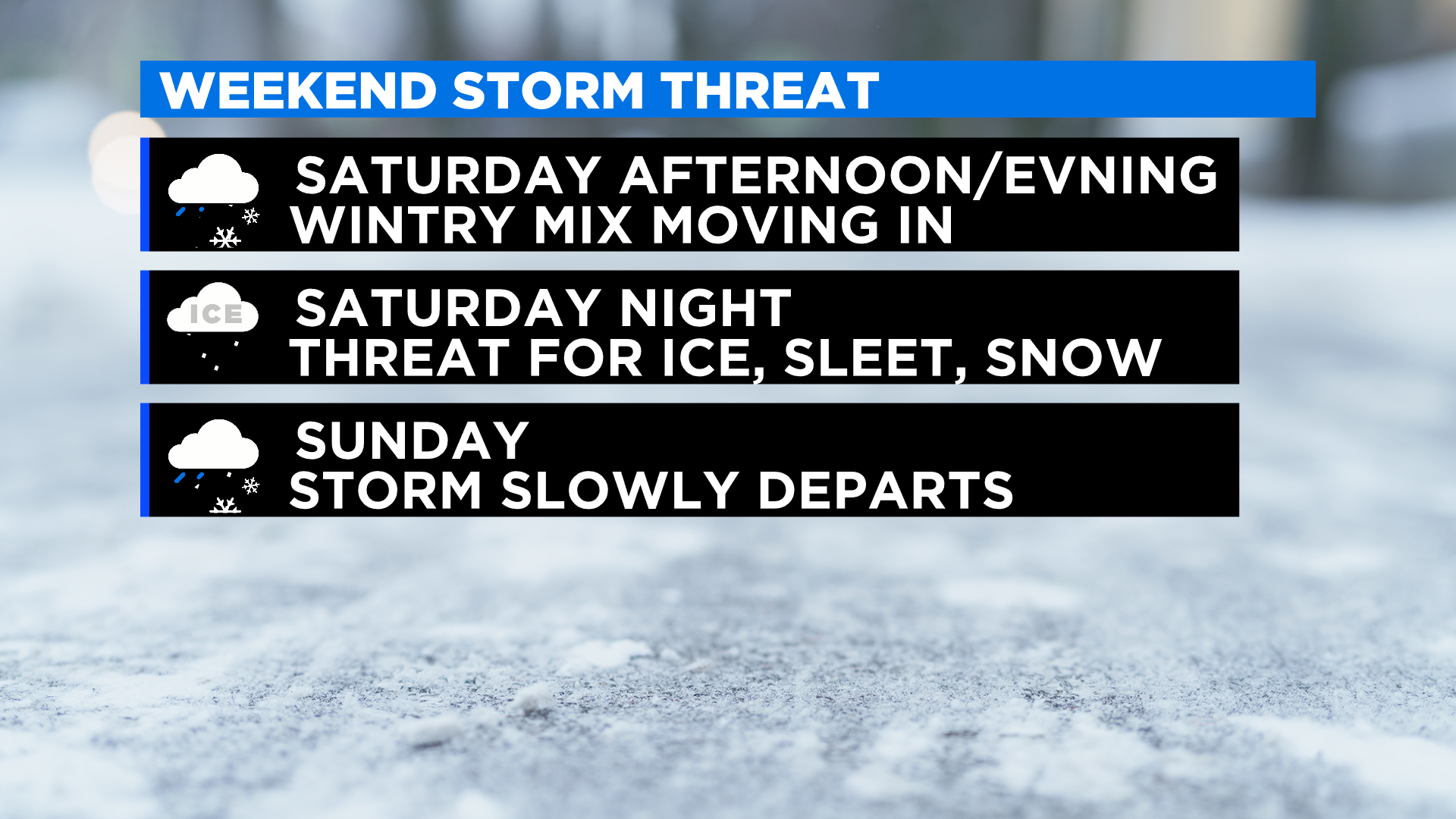
Heading into the weekend, our pattern really starts to flip as our stormy set up takes hold of the region. Thanks to the strong arctic high, temperatures will be plenty cold at the surface and conditions should be dry for at least the first half of the day Saturday.
Then, as the precipitation moves in later on Saturday afternoon and evening, we actually could start out with a quick period of all snow across the area. However, as the evening and then as the nighttime hours progress, warm air will slide in the mid and upper levels of the atmosphere and most, if not all, of the precipitation in the urban corridor should transition to a nasty wintry mix of sleet and freezing.
Rain will be more likely over South Jersey, while temperatures could remain cold enough for at least some light snow in the northern Lehigh Valley and the Poconos.
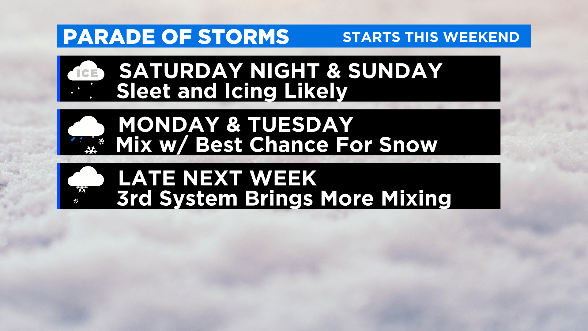
While ice accretion amounts are not forecast to be overly high, we need to remember that only a small amount of ice on the roads can cause huge issues. Travel will not be advised on Saturday night or Sunday morning.
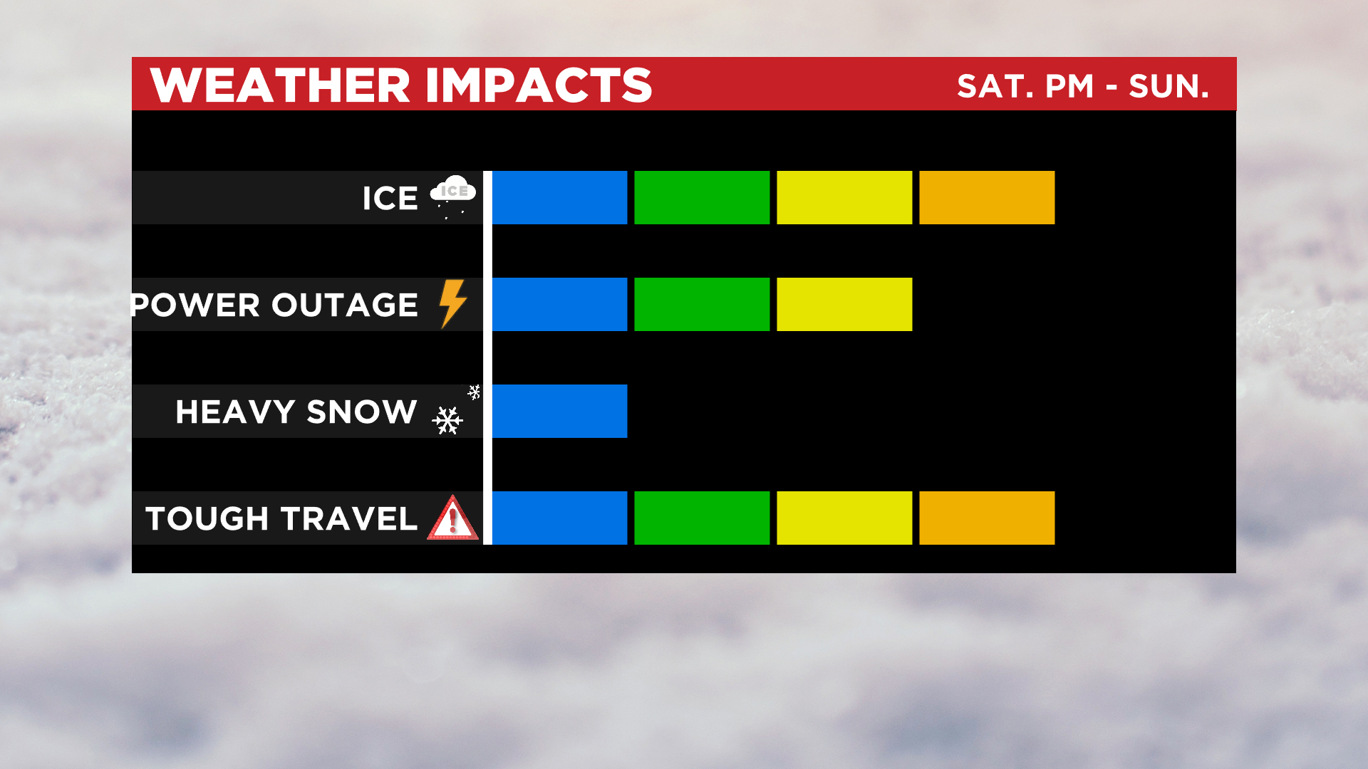
Our weekend system should exit through the morning hours on Sunday and be gone by around midday.
Our parade of storms, though, is only just heating up with the weekend. Another storm system is going to work into the region again, this time later on Monday, lasting through Tuesday. The Monday/Tuesday storm will likely be the best chance to see snow across the area over the next week. The early-week winter storm will still have a threat for a wintry mix, even if temperatures are colder overall.
Finally, after a break in the action on Wednesday, a third storm system is looking like it takes aim at the region, this time on Thursday into Friday. The system late next week at this time looks to be the warmest, with a chance for a wintry mix early before a change to rain.