Philadelphia Weather: Light Snow, Wintry Mix Expected Tuesday As More Snow Possible This Week
PHILADELPHIA (CBS) - A fast-moving, weaker storm is still on track to bring areas of light snow or a light wintry mix in the city and suburbs through Tuesday morning. As temperatures warm up, precip along the 95 will change over to rain.
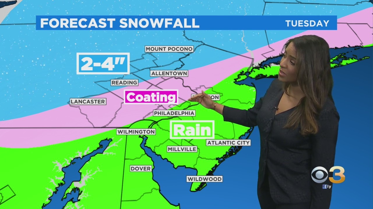
In the Lehigh Valley, Berks, and the Poconos, snow will be the dominant precipitation type where 2-4" of snowfall is likely by late afternoon when the system departs. Philly and our PA suburbs may pick up a coating of snow/slush prior to the transition to all rain.
Quiet during the day on Wednesday, before the next chance of snow develops Wednesday evening. A series of disturbances may yield an extended period with rounds of snow from Wednesday night into Friday. There is a chance we may see a lull Thursday night, but regardless measurable snowfall will occur during this timeframe across much of the region. (Some mixing will occur along the coast). A few more model runs will be needed to hone in on totals but as it stands now, snowfall of 6+" appears possible in some locations by late-day Friday.
Sunday we may have a shot at another coastal storm. The forecast is evolving.
STATS: We are at 16.6" of snow so far this season in Philadelphia. Last season we had only 0.3" of snow.
Allentown has received 44.7" of snow this season! 26.2" of it this month. Allentown's seasonal average is 31.6" of snow.