Philadelphia Weather: Freezing Rain, Snow Will Lead To Hazardous, Icy Commute Thursday
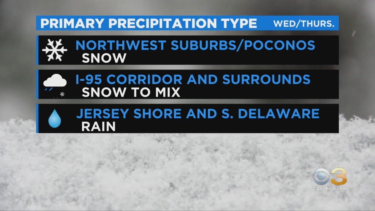
PHILADELPHIA (CBS) -- We are entering the final phase of our nor'easter overnight as snow begins to fill back in after a dry slot caused a lull in precipitation rates across much of the area. An additional couple of inches will likely fall in the Lehigh Valley with potentially over 4 inches more in the Poconos.
Parts of the region are also dealing with freezing rain, and this will lead to hazardous icy travel near the city through the early morning hours.
After about 7 a.m., any lingering snow will taper off to flurries.
Thursday will be windy and frigid with highs only in the 30s, and the cold will settle in for Friday and Saturday, with highs in the 30s and lows in the teens and 20s.
Wind chills Saturday morning may be near zero. A dry stretch though lies in our future, with some sun each day and temperatures returning to the 40s by Sunday. Winter officially begins on Monday with highs in the mid 40s and some sun.
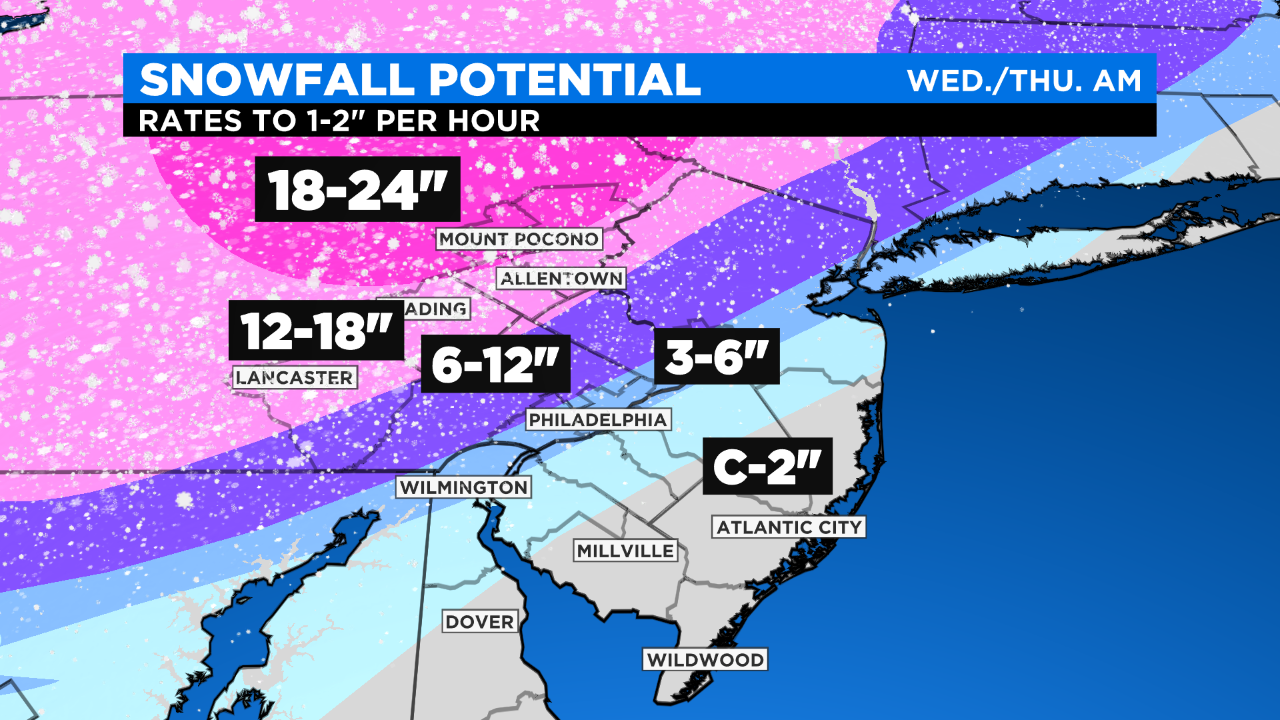
Parts of the Lehigh Valley, Poconos and Berks County could see up to 2 feet of snow.
This strong winter storm will yield multiple hazards across the region in addition to heavy snow, including heavy sleet, ice, strong winds and coastal flooding.
A winter weather advisory has been issued for our New Jersey and Delaware suburbs.
Precipitation is likely to commence for most by mid-afternoon, become heavy in the evening and continue tonight into early Thursday morning.
Recent model runs are indicating some warmer mid-level air could lift in as far as Philly and eastern Delaware County on Wednesday night, which could yield a period of heavy sleet vs. snow. That could reduce totals for these areas a bit.
Still, Philadelphia looks likely to end up near or just shy of the 6-inch mark.
Area Under Winter Storm Warning (Southeastern Pennsylvania):
- Winter Storm Warning lasts from 12 p.m. Wednesday to 10 a.m. Thursday
- Heavy Snow with rates up to 1 to 2 inches per hour
- Thundersnow possible
- Wind gusts of 35-45 mph
- Times of mix and/or heavy sleet near I-95
- Very difficult to impossible travel
Area Under Winter Weather Advisory (New Jersey & Delaware Suburbs):
- Winter Weather Advisory lasts from 12 p.m. Wednesday to 10 a.m. Thursday
- Snow and sleet, heavy at times
- Periods of rain/snow mix or all rain
- Wind gusts of 35-45 mph
- Sharp drop off in snow totals from NW to SE
- Very difficult travel
The Shore and Delaware Beaches:
- Coastal flood warning in effect from 7 p.m. Wednesday until 3 p.m. Thursday
- High Wind Warning in effect from 4 p.m. Wednesday until 2 a.m. Thursday
- Heavy rain and strong wind
- Some mix at the onset, some snow at the tail end
- Wind gusts as high as 55 mph
- Very difficult travel
- Impassable roads due to tidal flooding
Heavy snow, the accumulation of sleet and/or ice, strong gusty winds and various combinations of these elements will pose the threat for power outages across the entire region.
Additionally, bitter cold will prevail following the storm's exit. Highs near and sub-freezing on Thursday and Friday will not yield much melting. This means snow-covered and icy roads may persist for up to several days following this event.
Be safe and avoid travel if possible.
CBS3's Llarisa Abreu and Kate Bilo contributed to this report.
MORE ON CBSPHILLY.COM
Nor'easter Could Dump Up To 2 Feet Of Snow In Some Parts, Thundersnow Possible
Pennsylvania Gov. Wolf Signs Proclamation Of Disaster Emergency Ahead Of Snowstorm
Local School Districts Differ On Whether To Use Snow Days Amid Virtual Learning


