Hurricane Isaias Expected To Bring Heavy Rain, Flooding & Strong Winds To Region
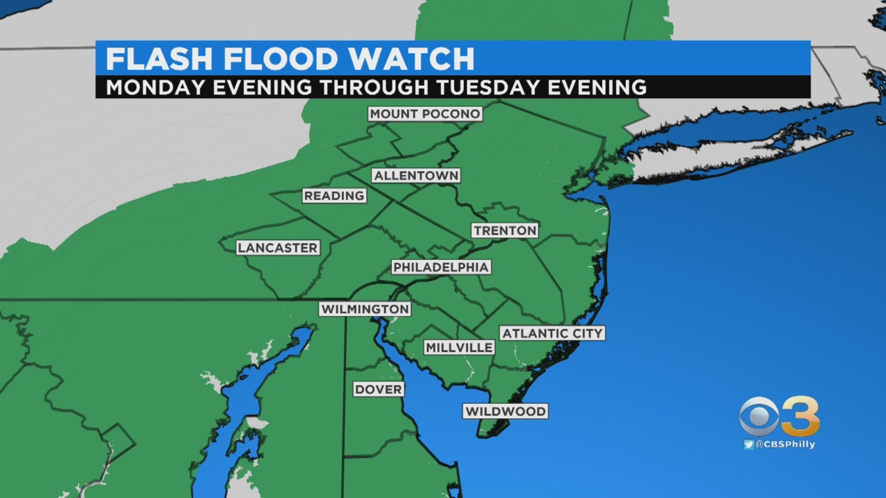
PHILADELPHIA (CBS) -- Weather officials say Isaias regained hurricane strength and is expected to make landfall in the Carolinas Monday night. In our area, multiple alerts are in effect for Monday night and Tuesday, including a Tropical Storm Watch and a Flash Flood Watch.
The system may turn post-tropical by arrival in our region. However, this will not alter the impacts we're expecting.
By tonight, our rain chances increase dramatically as we begin to tap into some tropical moisture from Isaias. Widespread rain is likely to develop Monday night, some heavy at times. The main impacts from Isaias will come on Tuesday. This is when the center of the storm will pass directly over the region.
The primary threat will be heavy rain and the potential for flash flooding. Rainfall totals of 2-6+" are likely across much of the region from Monday night into Tuesday night. The storm's wind span looks to hold its own due to a couple of key factors. Winds look to gust into the 30-50+ mph range though there continues to be indications that we could experience 60-70+ mph gusts, with the best chance at the Shore. Evening hours on Tuesday look to be the worst of it for our area - timing can still change if the storm doesn't speed up.
Tropical systems also typically present the threat for an isolated tornado. By Tuesday night Isaias should be making its exit to the north. A surface front will be trailing behind the departing system, so a few lingering showers or a pop-up thunderstorm are not completely ruled out on Wednesday but overall it looks like a day of just decreasing cloud cover. Thursday high pressure will build into the area, leaving a mostly sunny day, seasonable highs and lower humidity. A few more thunderstorms are possible Friday, with chances for 90's to return for the weekend.
TROPICS
Isaias brings 70mph sustained winds located just off-shore of east-central Florida. Tropical Storm Warnings extend from coastal Florida, along the Southeast Coast, north to Fenwick Island, DE. A Tropical Storm Watch has been issued for much of our area. A landfall is possible along the Carolina coastline Monday night. After Isaias makes landfall, it will increase in speed and weaken. Isaias is likely to cross our region as a Tropical or Post-Tropical Storm through the day on Tuesday. The highest concerns for us will be heavy rain, flash flooding and strong winds.