Philadelphia Weather: Snow In May? Parts Of Region Could See Snowflakes, Wind Chills Dipping Into 20s Later This Week
PHILADELPHIA (CBS) -- After a brief reprieve tomorrow with sunshine and high temperatures back closer to average -- in the mid-60s -- our next next storm system arrives on Friday, and will bring a chance of May snowflakes to some. A strong cold front will pass through the region Friday night and open the door to an air mass with roots in the Arctic.
Ahead of the front, precipitation will move in and start as rain. This will be a mainly rain event for most of us, but could end as a snow/mix or snow north and west of Philadelphia.
Rain is likely to commence in the late afternoon on Friday and continue into the nighttime hours. Friday evening/night, cold air will be rushing in as the moisture is moving through and exiting. During this overlap is when we could see a snow/mix or snow for areas north and west.
The best chance for snow will be in the Poconos. Some models are indicating there could be some snowfall accumulation in these higher elevations, though the snow will have to overcome ground temperatures near 50 degrees.
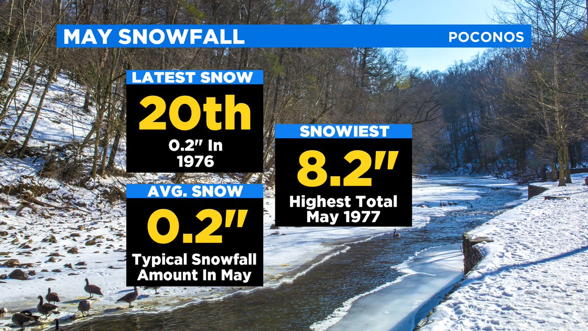
If the snow comes down fast enough, this may be possible. The latest measurable snowfall on record for Mt. Pocono is May 20, which occurred in 1976.
A brief period of snow is possible in the Lehigh Valley and it is not out of the question that rain could mix with snow in our western suburbs closer to the city Friday night, but any accumulation would be difficult.
A second shot at spring snowflakes could materialize on Saturday in the form of scattered snow squalls. Very cold air, certainly by May standards, moves in behind the front late Friday night/early Saturday morning, allowing temperatures to fall into the 30s for most across the region.
We'll be near record territory in Philly on Saturday morning with a forecast low of 37 degrees compared with a record low of 33 degrees set in 1947. Strong northwest winds will kick up on the backside of the system, causing wind chills to plummet into the 20s and even some wind chills in the teens in the Poconos.
This intense northwesterly wind flow will help to generate lake effect snow showers and squalls over the Great Lakes, and these winds could be capable of driving scattered snow squalls far southeast into our region. It is not outside the realm of possibility that a squall could reach as far south as the city or even nearby suburbs in South Jersey.
Remember, snow squalls yield quick and dramatic reductions in visibility, strong winds and the potential for quickly slicked roads.
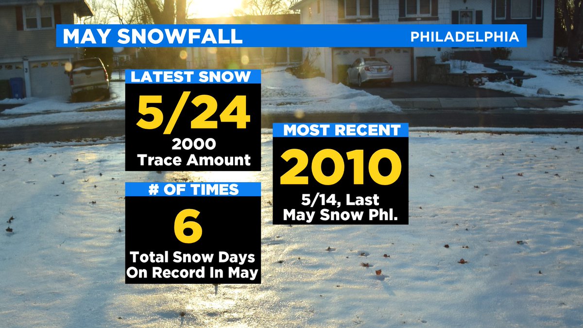
After the second-least snowiest season on record in Philadelphia, this spring snowflake chance is quite the surprise! Philadelphia has only recorded six days with snow in May dating back to 1885 -- all trace amounts.
The most recent of these May trace snowfalls occurred in 2010 and the latest occurred on May 24 in 2000.
Stay tuned to the evolving forecast.