Philadelphia Weather: Rainy Pattern, Flooding Potential To End Week
PHILADELPHIA (CBS) - The dreary and rainy pattern from early in the workweek will continue through Thursday afternoon and at least through the first half of Friday, before a cold front will look to clear out the region. Conditions should improve for at least the first half of the weekend.
Rain will pick up in intensity and as the afternoon progresses, the heaviest of the rain will fall after 2 p.m. Thursday. Pockets of heavy downpours are likely through the evening rush hour and the overnight hours, as well. We are likely to see the heaviest rainfall in areas from the I-95 corridor south in New Jersey and Delaware.
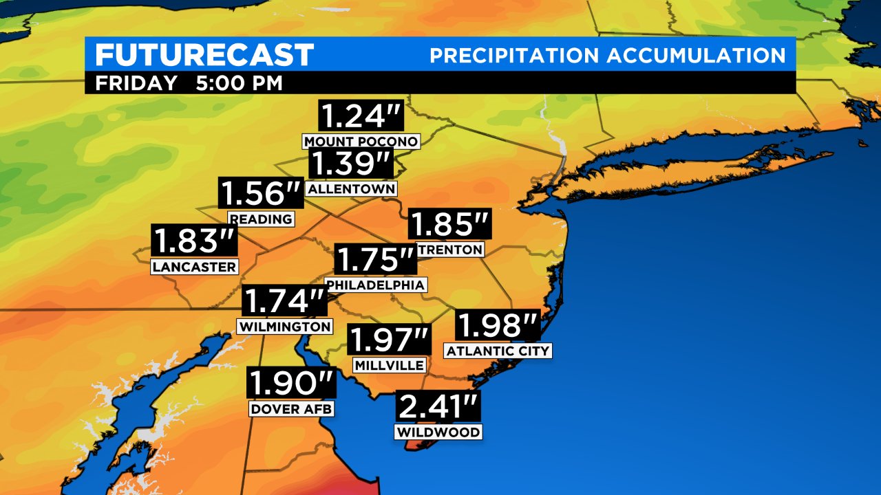
Rain amounts in many areas are expected to be as high as 1-1.5 inches, but in localized spots in South Jersey, we could see as much as 2-plus inches of rain before everything is all said and done.
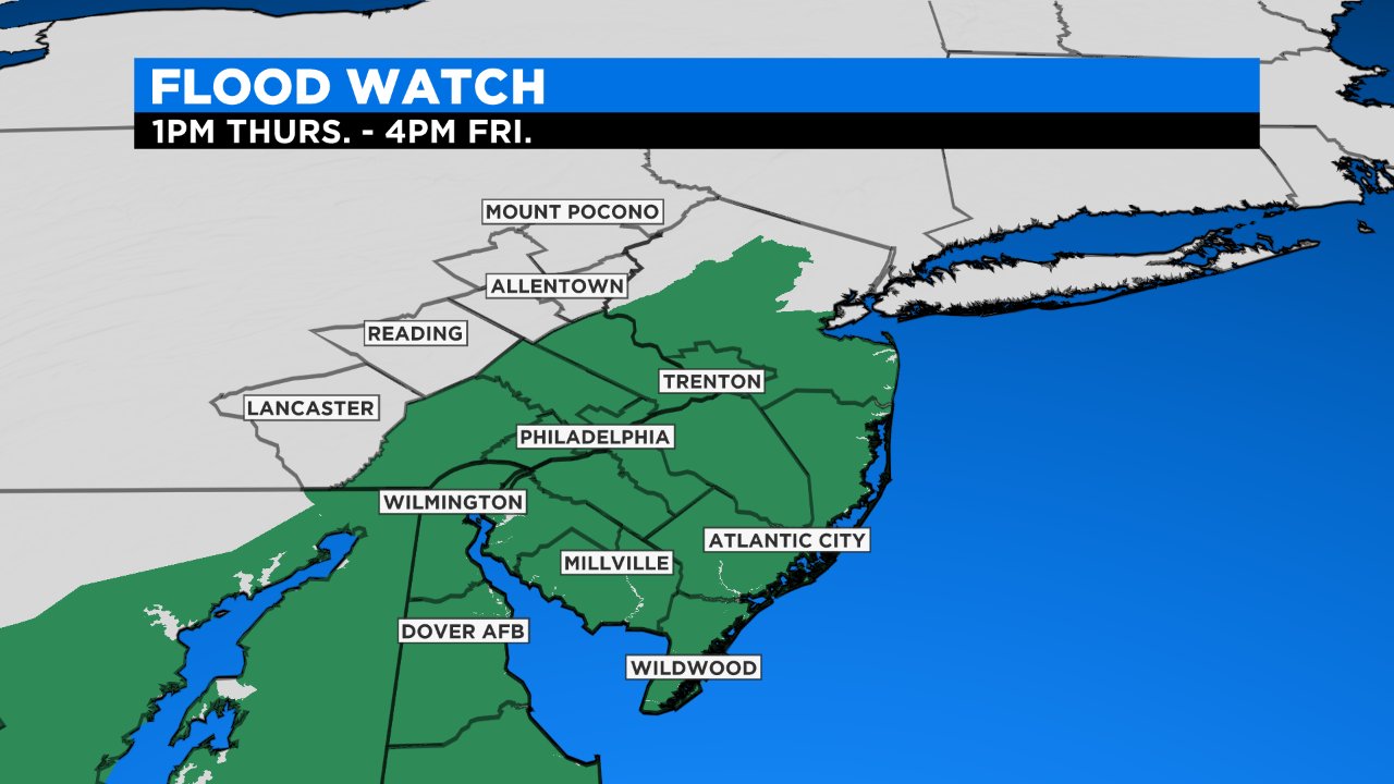
Due to the threat of heavy rain, all Thursday afternoon and into the night, and even Friday, a flood watch has been issued by the National Weather Service for southeastern Pennsylvania, southern New Jersey and Delaware. The flood watch will be in effect from 1 p.m. Thursday until 4 p.m. Friday. Also, remember to never drive through flooded roads, "turn around, don't drown."
As mentioned, a cold front will eventually sweep through the area on Friday and push all the precipitation out to the east. Behind the front expect conditions to turn cold and windy, with wind gusts Friday afternoon as high as 30 mph and even a few wind-driven snow showers or squalls possible in the Pocono Mountains on Friday afternoon.
Conditions look to dry out most of the weekend with even sunshine likely on Saturday. Temperatures will take a big hit, only topping out in the 40s all weekend long.