Philadelphia Weather: First Winter System Of 2020 Comes This Weekend As Parts Of Region Could See Accumulating Snow
PHILADELPHIA (CBS) -- The 2019-2020 winter season has been relatively tame so far. Temperatures for much of the first half of January have been well above normal and besides a trace amount of snow on a few scattered days, most recently on Dec. 8, we have only seen rain in the Delaware Valley. That could be changing though this weekend, as the first real dose of winter weather, both in temperatures and precipitation, rolls into Philly.
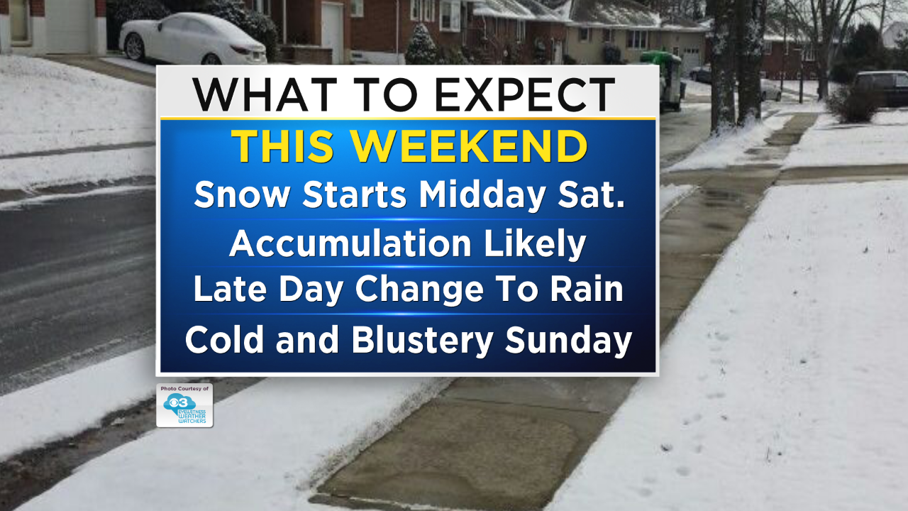
Many details on the exact timing and nature of the storm system are still coming together and will be more precise as the rest of the work week progresses but confidence is fairly high at this point that we are looking at a Saturday-only event, with only a small chance for some morning wintry mix on Sunday before the system fully clears the region.
As of Wednesday morning, this is what we are looking at for this Saturday. A low pressure system will exit the Midwest and collide with the remnants of the arctic high that was sitting on the region on Friday, solidifying the cold air needed for the initial rounds of precipitation to be snow. Eventually, a warm front will press northward and cross the Delaware Valley, leading to enough warm air in place to change the snow to all rain. The change from snow to rain is most likely to happen in the later afternoon and evening hours as it stands right now.
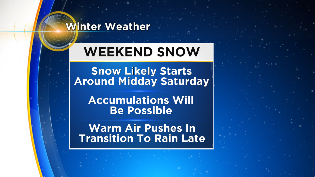
This will be a Saturday-only event it looks like right now. Snow will likely start in the midday hours on Saturday and overtake the whole region fairly quickly after beginning in the western counties. We could have pockets of heavier snow embedded within the overall widespread swath of snow, and the heaviest will also likely be from I-95 and north and west.
That does not mean areas across South Jersey are out of the woods, but those areas are much less likely to see accumulating snowfall than the I-95 corridor and northward. Amounts at this time are a bit too hard to nail down, however, the greatest chance for accumulating snow will be where the cold air is able to hold on the longest, which will be in the northwest suburbs, the Lehigh Valley and the Poconos. Amounts will be easier to pin down in the coming days.
This system will likely allow snow to stick to roads as well as the grass, so difficult travel will be something we need to monitor and winter weather headlines, i.e. advisories and warning, will likely be issued at some point for Saturday afternoon and evening.
Stay tuned to the Eyewitness Weather Team as this situation continues to develop and for all update sin the coming days.