Philadelphia Weather: Wintry Mix, Cold Rain Expected To Create Slippery Road Conditions For Drivers Across Region Sunday
PHILADELPHIA (CBS) -- CBS3 meteorologists are tracking a complex system that could create some miserable conditions for commuters in the Philadelphia region. Most of the region was under a winter weather advisory until 2 p.m. Sunday as travelers head home this holiday weekend.
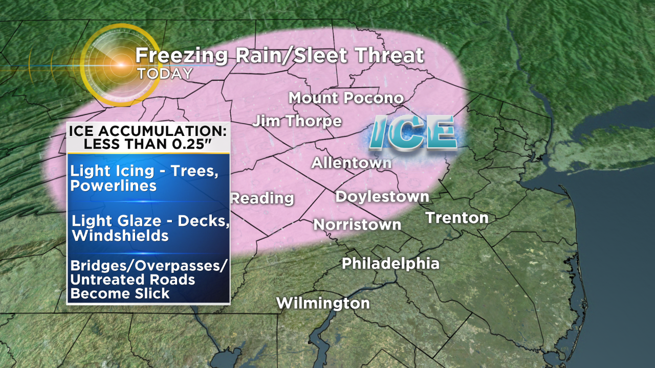
It's expected to be a cold rain for most of the day in Philadelphia, but areas northwest of the city, including Berks County, Upper Montgomery County, Upper Bucks County and the Lehigh Valley into the Poconos could see some ice accumulations and maybe even some snow today.
If we see a wintry mix in the Philadelphia area it will likely end by mid-to-late morning and changeover to cold rain. The wintry mix could continue into the early afternoon across the Lehigh Valley and Upper Bucks, Upper Montgomery, and Berks Counties.
A winter storm warning was expanded into Montgomery, Bucks, Lehigh and Northampton Counties from 6 a.m. Monday until 4 a.m. Tuesday.
There's potential that the wintry mix will change over to all snow in the Lehigh Valley and Poconos.
Sunday's weather is expected to cause a messy commute for drivers heading home from the holiday weekend. Drivers should allow extra travel time and be prepared for slippery road conditions.
PennDOT issued safety tips for drivers traveling through winter weather.
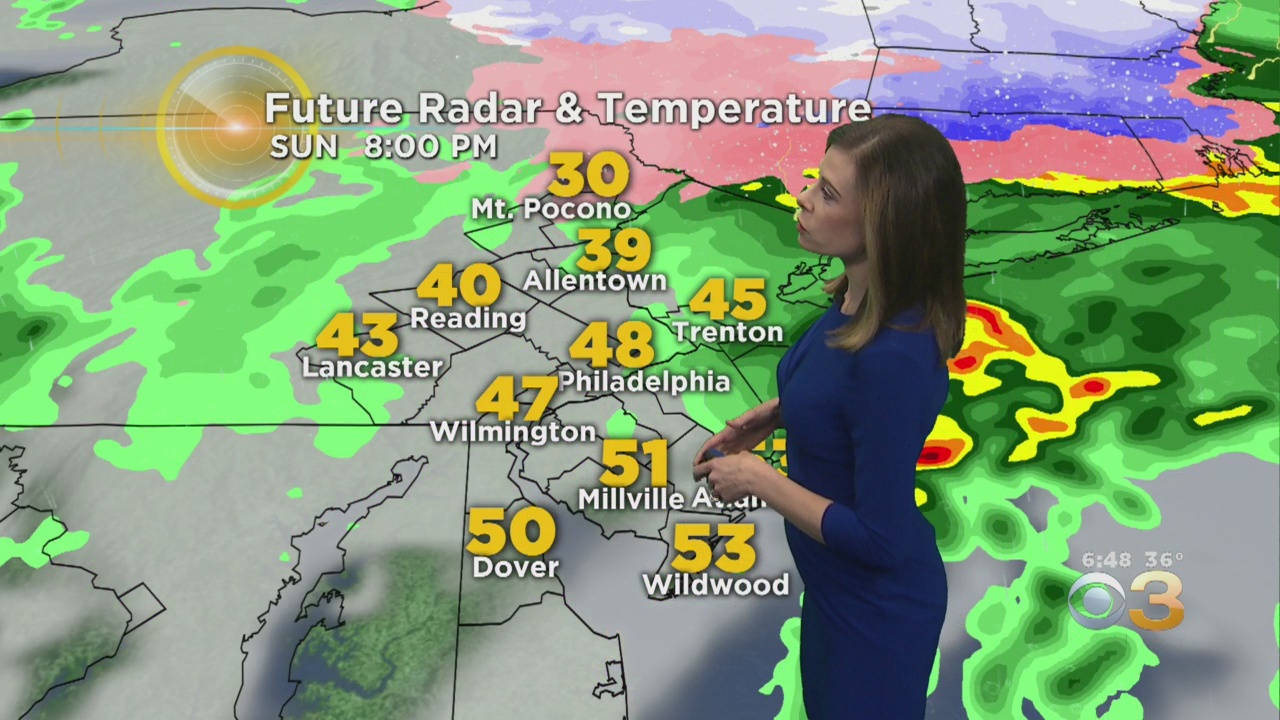
The steady rain is expected to move out Sunday evening, giving much of the region a break before round two rolls in on Monday.
An area of low pressure will develop offshore late Sunday night into early Monday morning and then strengthen.
As this happens, colder air will wrap in on the backside of the system.
This will allow any rain to change over to snow from north to south across the region.
Scattered rain showers will be possible in and around the city for the Monday morning commute.
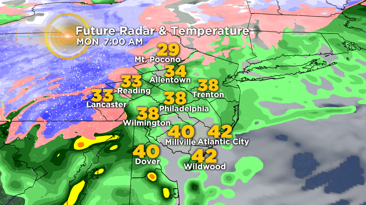
However, at this time, rain may be changing over to snow across the Poconos and our far northern and western suburbs.
The rain/snow line will continue to move farther south throughout the day on Monday, probably reaching Philadelphia during the afternoon and impacting the evening commute.
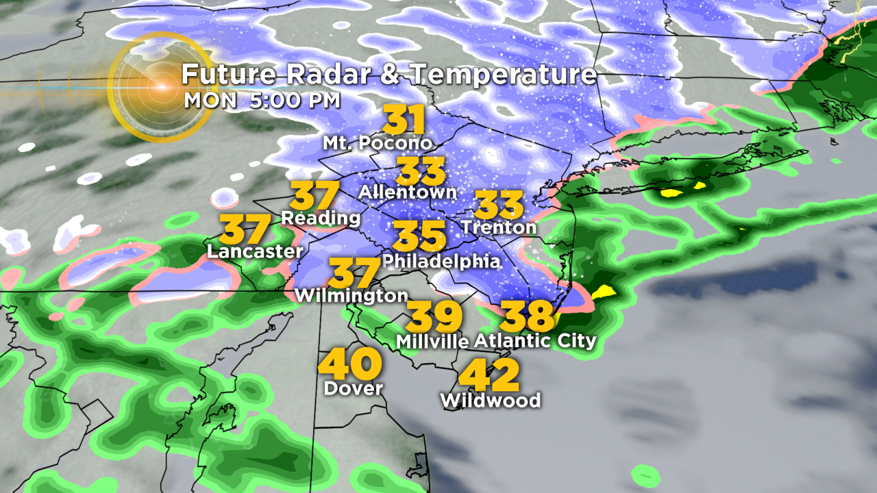
Accumulating snow will be possible across most of the Delaware Valley, including the city of Philadelphia.
Here is our latest snow forecast:
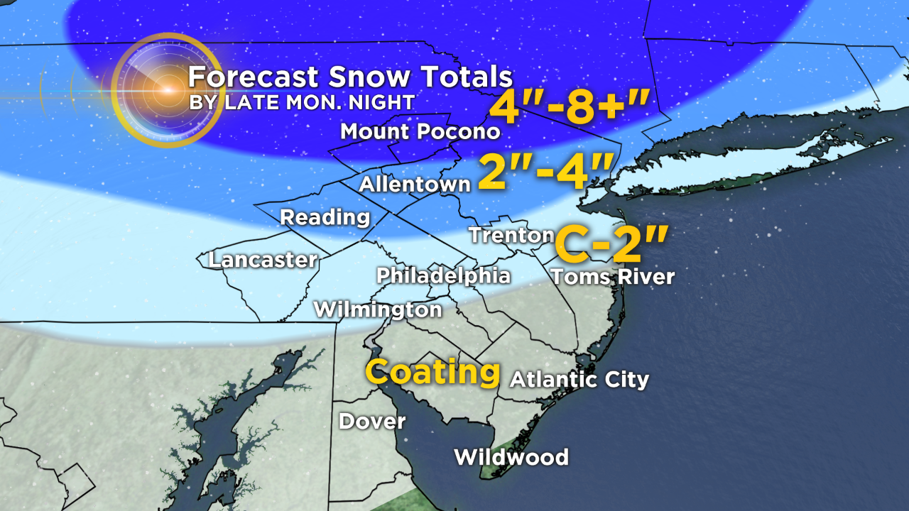
Keep in mind that a heavy snow band will likely develop somewhere across Northeast Pennsylvania and Northern New Jersey tomorrow. It is extremely tough to forecast where this band will set up and location is key because snowfall rates will increase along with snow totals.
Overall, the highest snow totals with this storm look to be across the Poconos and parts of New England.
Stay with the Eyewitness Weather Team for updates throughout the day.