Philadelphia Weather: Chance Of Snow For Parts Of New Jersey, Pennsylvania On Thursday Night
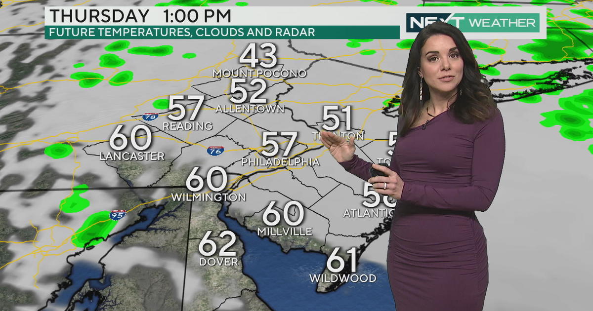
PHILADELPHIA (CBS) -- November has just started and winter doesn't officially begin for about another month-and-a-half, but get ready for an early taste of December cold as early as the end of the week. Some of us could even see our first flakes of the season on Thursday night.
Over the past 24 hours since this system signature first started to appear on the models, we have started to see some greater agreement or confidence in the eventual outcome for the end of the week. Right now, it still looks as though most of Thursday should actually remain dry with clouds that will increase through the day and temperatures that will be generally seasonable, if only below normal by a degree or two at most.
Thanks to temperatures that are well above freezing at the onset of the storm system, we should see rain across the whole region starting in the afternoon in the Poconos and areas north, while the rain likely waits until the evening hours for Philadelphia and across South Jersey.
Once the overnight hours arrive, that is when we start to see the forecast become more difficult to nail down. Starting overnight Thursday, cold air will start to spill into the region on the backside of the center of the area of low pressure. How fast this cold air moves in will dictate the chance for the rain to change over to a mix of rain and snow or potentially all snow in parts of the area.
What makes this difficult is trying to determine if the cold air and precipitation will be in the same areas at the same time and long enough that the cold air can freeze the liquid rain from early in the night.
In the latest model runs the system has sped up, meaning the precipitation is likely looking to out run the cold air. This type of set up likely does not allow for the rain to change over to a mix or snow in many areas outside of the Poconos. This does not mean that we still cannot see a few wet flakes mixing in with the rain in the Lehigh Valley or as far south as the far northwest suburbs, until even as late as 4 a.m. Friday. But in much of the area, the precipitation will stay as rain and end before the cold air is able to overtake the region and allow for the change over to snow.
Skies will then clear out throughout the day Friday since the rain or rain/snow mix should be wrapped up by 7 a.m. or 8 a.m. Friday at the latest.
At this time, accumulations are too uncertain. However, the best chance to see accumulating snow will be in the high elevations of the Poconos and it would likely be a light accumulation at best.
After the skies clear out, a dose of early winter cold will slam the region. Temperatures on Friday morning will start out in the 30s in many places before only warming into the lower 40s in the afternoon. Expect temperatures to get even colder on Friday night into Saturday as we could see lows in the 20s, even in the city, and once again afternoon highs only in the lower to middle 40s.
On Friday, our high is forecast to be 43 degrees. This is only one degree off from a record cold high temperature for the day of 42 degrees set in 1976. Another potentially record-breaking cold high is forecast on Saturday too when we only get to 44 degrees. The record for Saturday is 40 degrees set in 1976 as well.
All eyes will then turn to next week as another strong system could bring potential for wintry precipitation as well as another string of very cold days to start the week.


