Philadelphia Weather: What To Expect When Hurricane Dorian Reaches Delaware Valley Late This Week
PHILADELPHIA (CBS) -- Hurricane Dorian, once a ferocious Category 5 storm, thankfully has weakened to a Category 2 as of Tuesday night. It's track, once predicted to take the storm directly into the Florida coastline, has shifted as well.
The storm is now expected to follow the curvature of the southeast coastline, possibly making landfall Thursday along the coast of South Carolina, or further north along the Outer Banks.
This change in track and intensity is especially good news for south and central Florida, where the impacts will be much less than a direct landfall.
However, the storm has slowed down and it's sluggish movement means that rain and wind will batter the southern Atlantic coastline for days. In addition, storm surge inundation is expected in the low-lying areas of the coastline as water will continually be driven towards the shoreline.
You may be wondering whether we will feel the effects of Dorian here at home. The answer is yes, but only indirectly. And the effects will be most noticeable closer to the coast.
Delaware County Police, First Responders Collecting Donations For Hurricane Dorian Relief Efforts
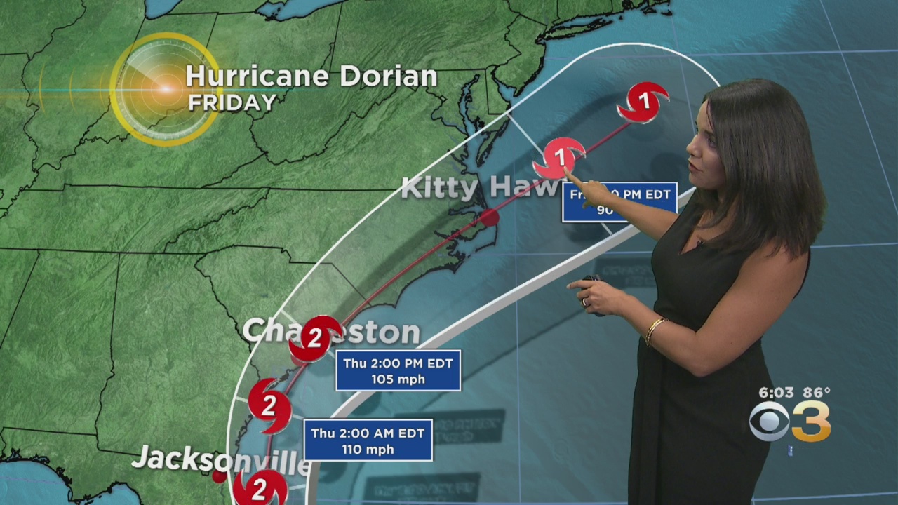
We can expect to begin seeing the impact of Dorian late Thursday when clouds will begin to increase from south to north. The storm will make it's closest pass to our coastline by midday Friday, likely as a weakening Category 1 hurricane.
Nearly 200 Cats & Dogs Evacuated From Hurricane Dorian's Path, Taken To Brandywine Valley SPCA
Although the center of the storm will stay well offshore, we can expect to at least be brushed by the outer rain bands. The greatest chance for steady rain will be along the coast, while inland we'll likely just see some showers.
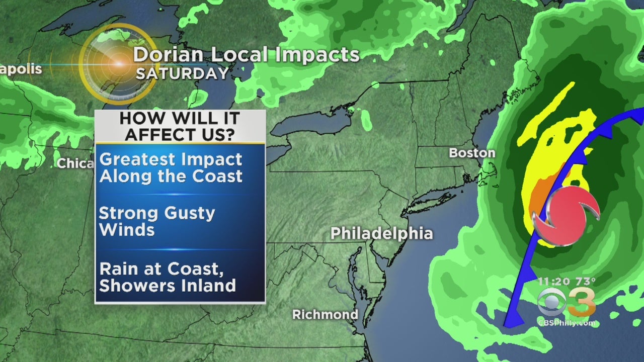
A potent east wind will be in place all day, keeping our area cool, raw and cloudy. Along the coast, winds could gust to 40 or 50 miles per hour.
The shore points will also have to deal with very rough surf and a high rip current risk starting Thursday and through much of the day Friday. Beach erosion is also a concern with a storm offshore.
Dorian will begin to speed up as we get into Friday, though, meaning it's impacts won't linger for days and days. In fact, by the weekend the sunshine will return and we can expect a stretch of very nice weather.