Philadelphia Weather: Winter Storm Leaves Behind Significant Snow For Parts Of Region
Follow CBSPHILLY Facebook | Twitter
PHILADELPHIA (CBS) -- Sunday's winter weather has come and gone, but not without leaving behind significant snow for areas north and west of the I-95 corridor. Many areas received over a half-foot of snow and our Eyewitness Weather snowfall forecast map verified nicely!
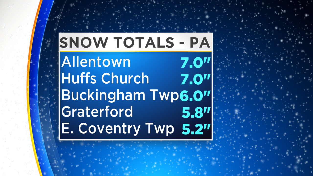
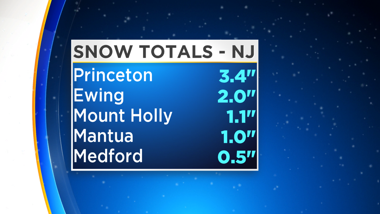
Areas south and east of I-95 saw anything from a coating to 3 or 4 inches before transitioning back to rain, which ended up melting a lot of what fell. Here are some of the updated snowfall totals across our area:
The CBS3 Mobile Weather Watcher was out and about this morning surveying roads. While roads closer to the city were just wet, there were some slick side roads, especially for some of our north and western suburbs.
There were even power outages reported due to the heavy, wet snowfall weighing down tree branches.
Sunshine will return today, and with temperatures above freezing, we should get a solid amount of melting to take place. Look for plenty of sunshine this afternoon and a high of 39 degrees in Philadelphia.
Temperatures will drop overnight into the teens, so the potential is there for some re-freezing to take place. This is something we will have to keep an eye on for tonight.