Temperatures To Drastically Plummet After Second Winter Storm This Weekend
Follow CBSPHILLY Facebook | Twitter
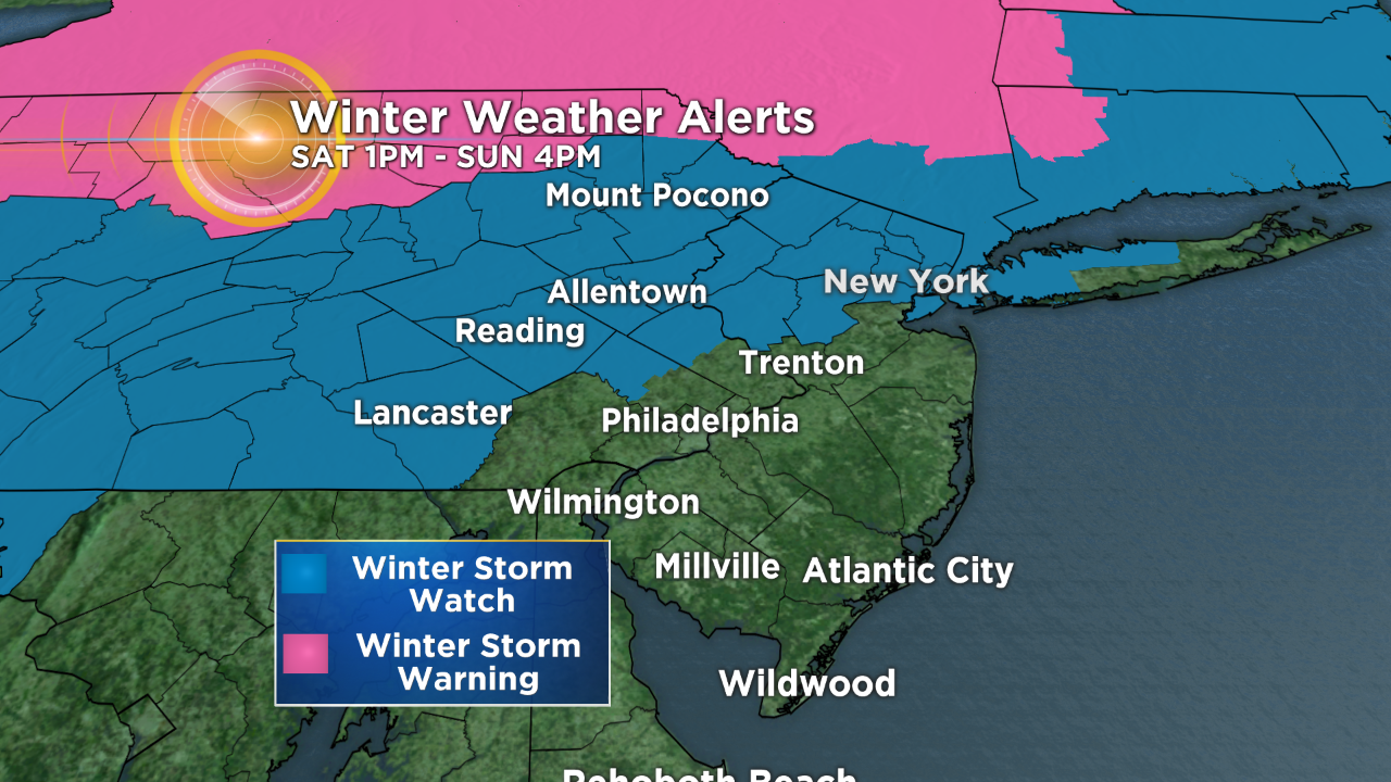
PHILADELPHIA (CBS) -- With one of two storms now come and gone, the focus shifts to the next, stronger storm this weekend. Our region stays generally problem free through at least midday Saturday. But late in the day, snow or a wintry mix arrives for the northwest half of the region, and a winter storm watch will be in effect. The storm arrives primarily as rain southeast of I-95 later that night but there will be no watches for this region.
Crews, Residents Prepare For 2nd Round Of Snow As First Winter Blast Wraps Up
PRECIPITATION BY REGION:
PHILADELPHIA, I-95 AND ADJACENT COUNTIES JUST NORTHWEST:
The storm may leave an initial 1 to 3 inches at the onset Saturday, but an eventual change to heavy takes place overnight into Sunday. The system will likely wrap up with a quick burst of snow or a wintry mix.
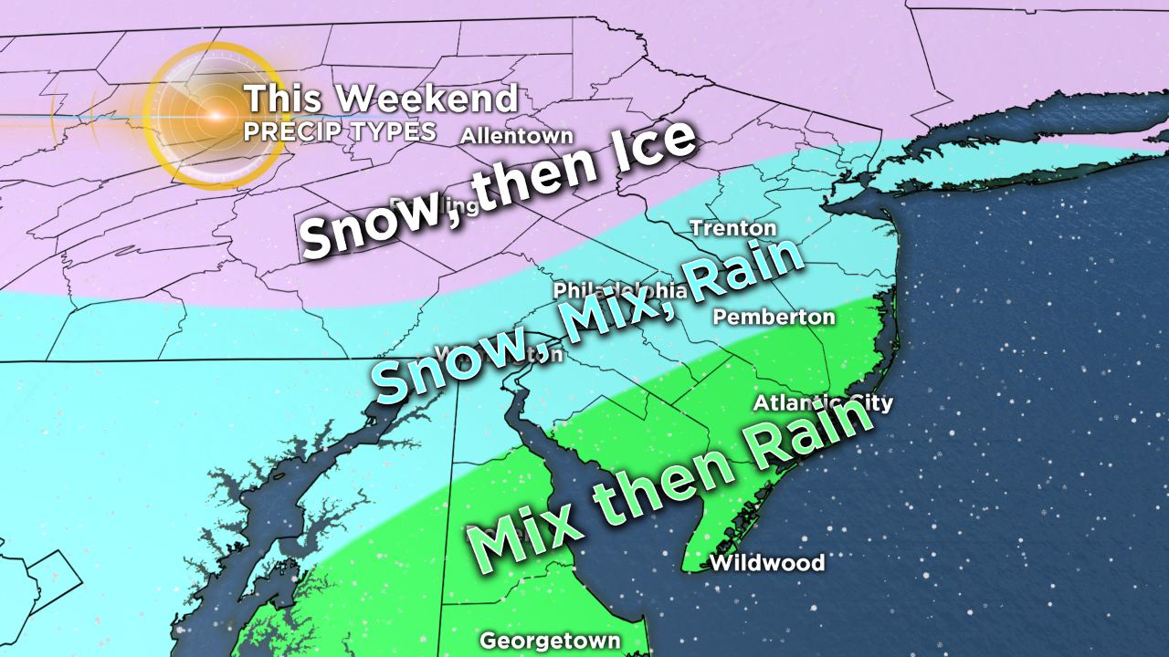
LEHIGH VALLEY, BERKS COUNTY AND POCONOS:
The Poconos may score big with 6 to 12 inches of snow as colder air will be in place longer before any changeover. Three to 6 inches of snow may fall during the first part of the storm through the Lehigh Valley and Berks County, followed by a period of ice or freezing rain Saturday night, before finishing with a little more snow as the system exits Sunday.
SOUTHEAST OF I-95:
The storm could start with a brief wintry mix, but the main precipitation type is rain and lots of it through this zone. A quick wintry mix may fall as the storm departs and cold air is rushing in.
One remarkable feature of this storm setup is the drastic plummet the temperatures take Sunday. Sunday's official high is pegged at 50 degrees. We'll hit that just before sunrise, and from that point forward the mercury drops, and quickly! By 7 p.m., we'll be hovering in the teens. So anything that's wet, regardless of precipitation type, will freeze over, i.e. sidewalks, railings, your car doors, etc.
Not to be forgotten: the wind. A storm this strong will easily produce gusts between 35 to 45 mph, perhaps a few 50 mph gusts. Power outages then become a concern, especially for the northwest most counties where an ice accumulation is possible.
Stay safe this weekend!