Washout To End The Week, Arctic Blast This Weekend
Follow CBSPHILLY Facebook | Twitter
PHILADELPHIA (CBS) - A brief break from the wet weather to start the week has been welcomed over the last couple of days but just as we are getting settled into the dry pattern, a new system will look to work across the region starting Friday afternoon with heavy rain likely at times on Friday evening and into the early hours of Friday night.
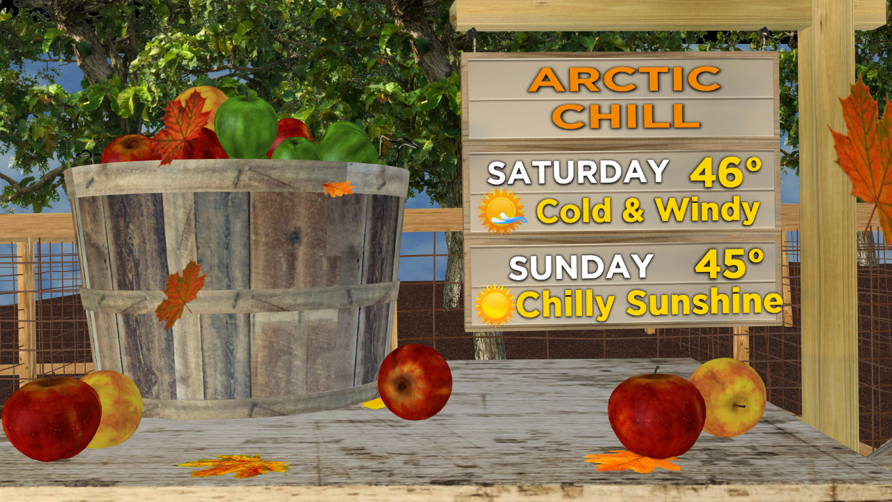
There is some good news though and that is that the wet weather will end in time for a vast bulk of the weekend, but the drier weather Saturday and Sunday is likely to be accompanied by a blast of arctic chill both afternoons.
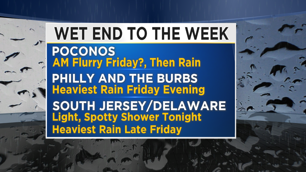
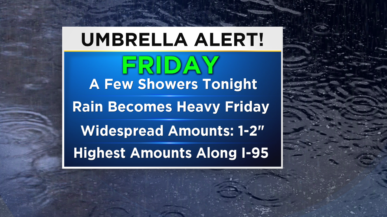
Showers could start as early as tonight, especially in places across Delaware and South Jersey. They should remain light but it would not be surprising to wake up to some wet cars and roads tomorrow morning in these areas. Friday morning's showers should remain pretty light and sparse throughout most of the region as we wait for the bulk to rain to move in, in the second half of the afternoon and evening hours. While it will not be a foregone conclusion it would also not be surprising to see a few snow flurries flying around in areas around the Poconos in the higher elevations on Friday morning as well.
These extremely limited chances for flurries will quickly give way to rain showers as temperatures warm up. The heaviest rain is likely to fall along the I-95 corridor and it should fall between about 7pm Friday - 2am Saturday. Overall rain amounts will stay generally light since the system will be on the quicker side so widespread amounts will be in the 1-2" range, again with a bulk of that rain falling late Friday into the extreme early Saturday.
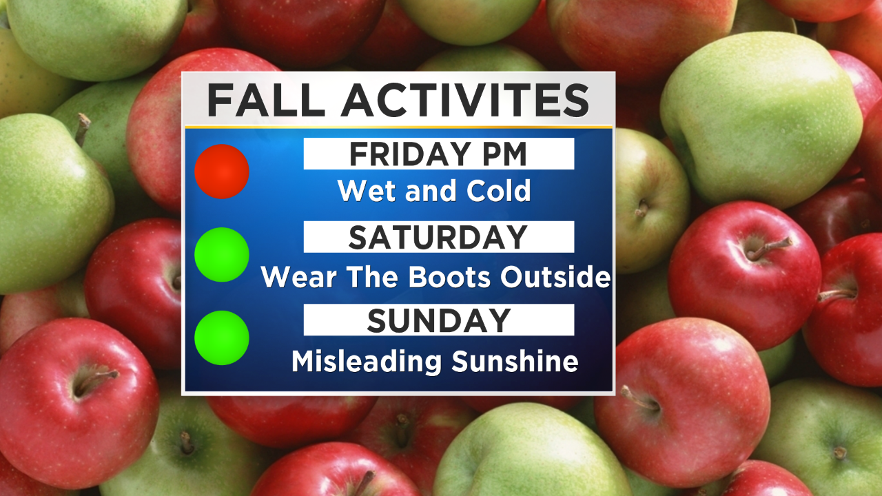
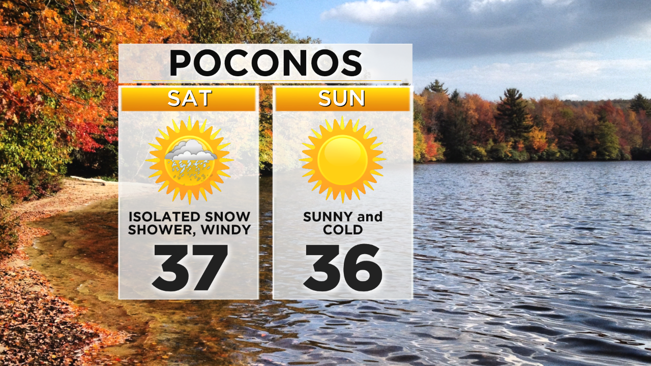
Once the low exits the area, get ready for a blast of arctic air to engulf the region and winds should pick up too. Saturday is going to be generally sunny in the afternoon but if you are going to be outside make sure to bundle up. High temperatures on Saturday will likely not escape the 40s and with winds that could gust up to 30-40mph, wind chills on Saturday could stay in the 20s and 30s all afternoon long.
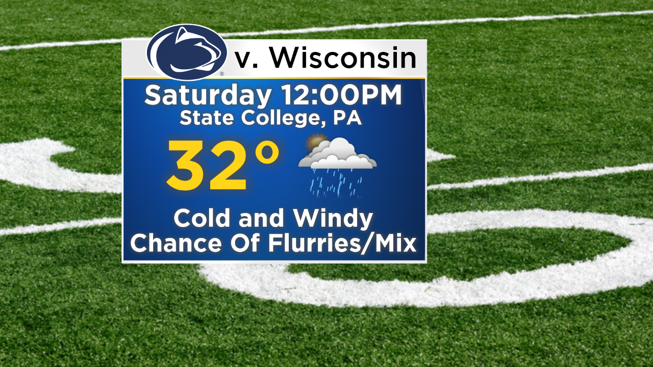
If you are planning on Heading up to State College on Saturday for the Penn State/Wisconsin football game make sure you are packing the Winter clothes to say the least. It should be even colder in Central PA than here in Philly. Temperatures at game time on Saturday will only be around 32° and it wouldn't be shocking to be dealing with some flurries or some wintry mix in the morning or even during the game.
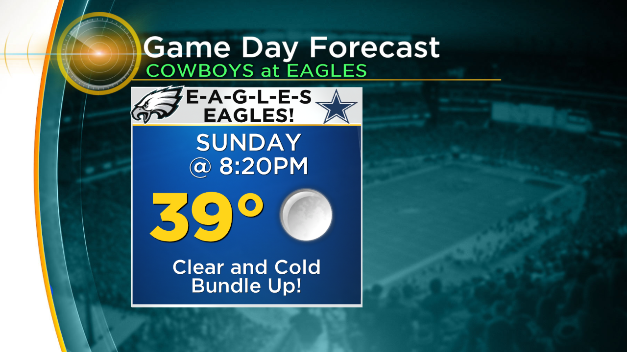
By Sunday the winds should calm and the sunshine should stick around as well, but so will the cold temperatures. Highs on Sunday should once again only stay in the 40s. Of course it is a big football day on Sunday in Philly as well, as the Dallas Cowboys come to town for Sunday Night Football. If you are planning on tailgating and then attending the game on Sunday make sure you are dressing with the Winter clothes and prepping for a game that is more likely to be seen in December than early November. While it should stay quiet for the game, skies will be clear and temperatures at kickoff will hover in the upper 30s and drop throughout the game.
A new chance for showers will return to the forecast in the first half of next week as temperatures look to remain cooler than normal.
Stay dry tomorrow and warm over the weekend everyone!


