Messy Start To Week, Massive Cooldown This Weekend
Follow CBSPHILLY Facebook Twitter
PHILADELPHIA (CBS) — The end of the weekend was wonderful with an extremely fall-like Sunday with plenty of sunshine and nice cool temperatures for those that prefer cooler weather.
However, a massive change in the pattern will be taking place Monday and throughout most of Tuesday before a big time cooldown arrives just in time for the weekend.
Severe Storm Dumps Record Rainfall In Allentown
The first of two systems will roll through the region on Monday with showers and pockets of heavy rain likely throughout the morning and afternoon hours.
The low that is going to be riding the coastline could also stir up some gusty winds at times, especially along the shore points Monday afternoon.
Wind gusts on Monday at the shore could push near 40 mph at times with temperatures staying cool as well. The forecast will likely range from the upper 40s in the Poconos to the lower 60s at the shore.
A quick break in the action Monday night will bring generally drier and warmer-than-average conditions across the region but Tuesday will pick up right where the prior day left off.
The second system Tuesday will hold a stronger punch than the showers Monday. Thunderstorms could fire up along the cold front Tuesday afternoon throughout the region.
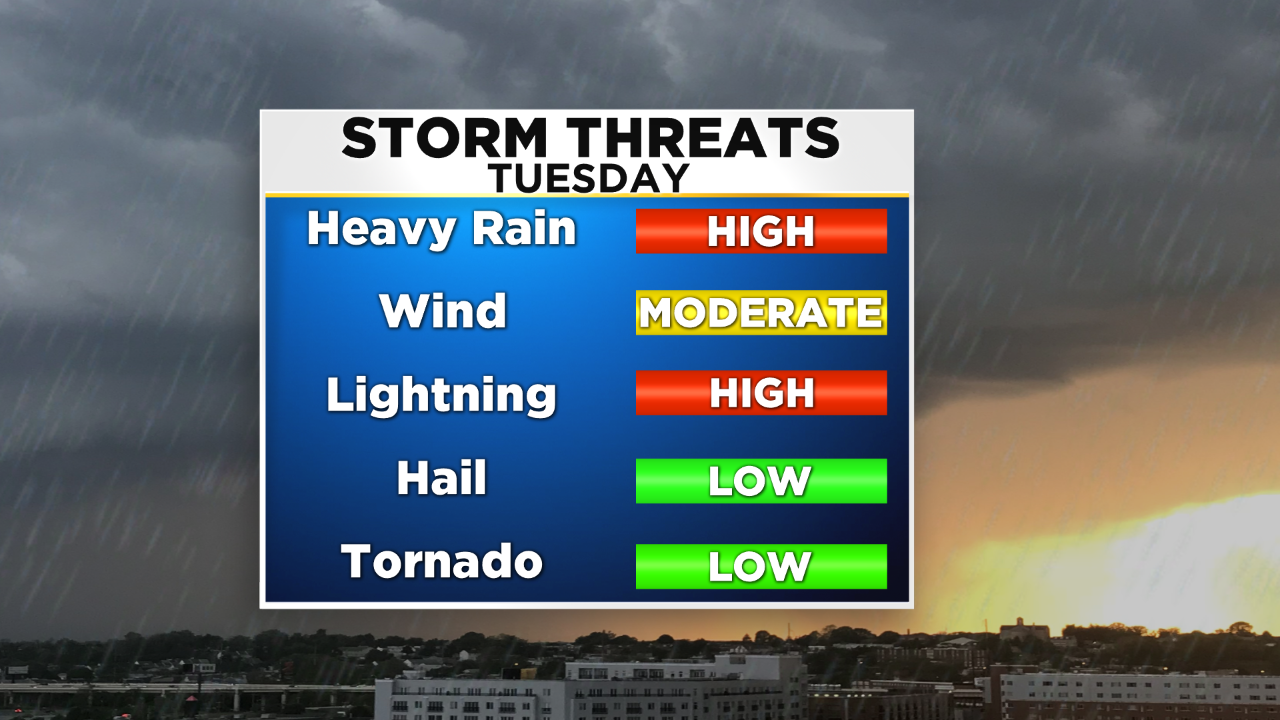
Conditions will be ripe enough for a threat of severe weather Tuesday.
South Jersey and Delaware are the areas most likely to be affected. At this point, the biggest threats with the stronger storms will be heavy rain, lightning, and strong winds. However, there is still an isolated chance for a tornado to spin up.
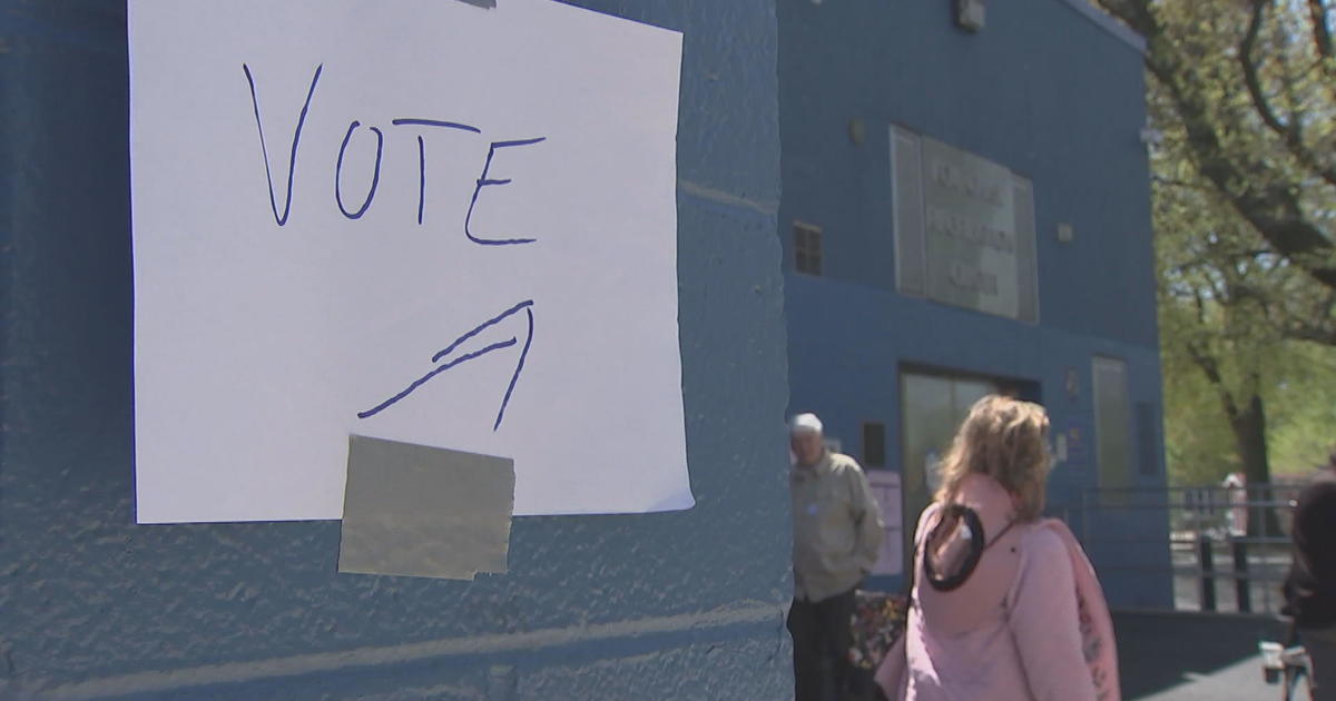
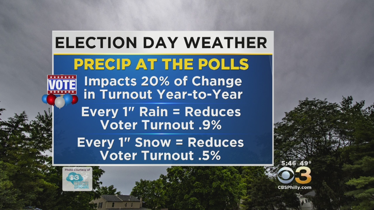
Tuesday's storms will likely strike between 11 a.m. to 3 p.m so be sure to take the umbrella and rain gear with you to the polling places. Highs on Tuesday should jump into the upper 60s.
The middle through the end of the week should be much quieter than the start of the week with high pressure in control Wednesday and Thursday. This means sunshine and more seasonable temperatures will return.
Heavy Rain, Strong Winds Cause Storm Damage Around Region
A chance of showers arrive Friday with a new area of low pressure that will try to work its way across the region before a massive pattern change for the weekend.
A strong push of cold arctic air will slide in and temperatures over the weekend should only hover in the upper 40s to low 50s. Morning lows, especially on Sunday morning, could be into the 20s or 30s in certain areas.
The Eyewitness Weather Team will continue to keep you posted on the latest weather alerts and updates.


THIS AFTERNOON -- Breezy with Rain, Some Heavy. High 57
TONIGHT -- Mild with Showers Ending. Low 53
TOMORROW (ELECTION DAY) -- Warm and Windy with Rain and a Locally Strong T-Storm. High 68
WEDNESDAY -- Mostly Sunny and Breezy. High 62
THURSDAY -- Sunny and Cooler. High 55
FRIDAY -- Cool With Rain Likely. High 54
---------------------------------
JERSEY SHORE:
THIS AFTERNOON -- Overcast and Windy with Rain. High 62
TONIGHT -- Cloudy Skies. Low 54
TOMORROW (ELECTION DAY) -- Rain Likely, Thunderstorm Possible. High 70
OCEAN TEMP: 56-59°
------------------------------------
POCONOS:
THIS AFTERNOON -- Breezy and Chilly with Showers. High 47
TONIGHT -- Cloudy and Cool. Low 42
TOMORROW (ELECTION DAY) -- Mostly Cloudy with Rain and Isolated Thunderstorms. High 57