Coastal System Looks To Make It A Messy Weekend
Follow CBSPHILLY Facebook | Twitter
PHILADELPHIA (CBS) - Most of this week has been focused around the colder than normal temperatures, but as we approach the weekend, our eyes will turn to a coastal system that will bring, the potential for heavy rain and strong winds to parts of the region, and yes even the chance for a few wet snowflakes to mix in, in some of the higher elevations.
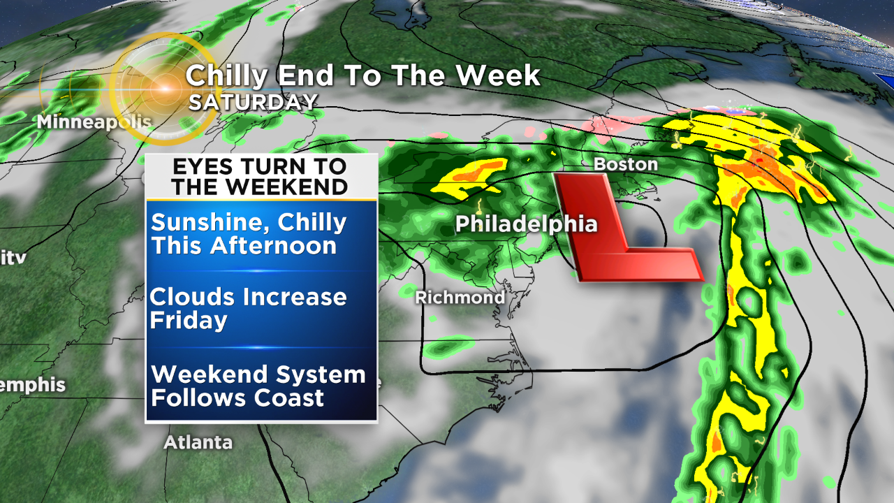
The coastal low that is the player this weekend is a mixture of the remnants of Hurricane Willa and an upper level system in the southeast US. The brunt of the system will be felt across mainly the southern and eastern regions of the area, but everyone should be ready to feel the effects in some capacity from this storm system.
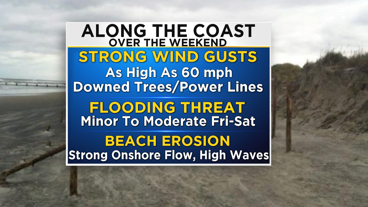
Rain showers should start to move into southern sections of the area as early as Friday evening. The rain will become heavier and more widespread as we move through the overnight hours on Friday into Saturday morning before tapering a bit at times on Saturday afternoon. As the center of the Low moves almost directly over the region on Saturday morning, we should see winds really peak with gusts along the coast, possibly in the 40-60mph range at times. When you couple the strong onshore flow with heavy rains, minor to even at times moderate coastal flooding is possible, with the highest threat being during high tide on Saturday morning. Beach erosion will be another factor along the shore this weekend due to the strong winds and high waves.
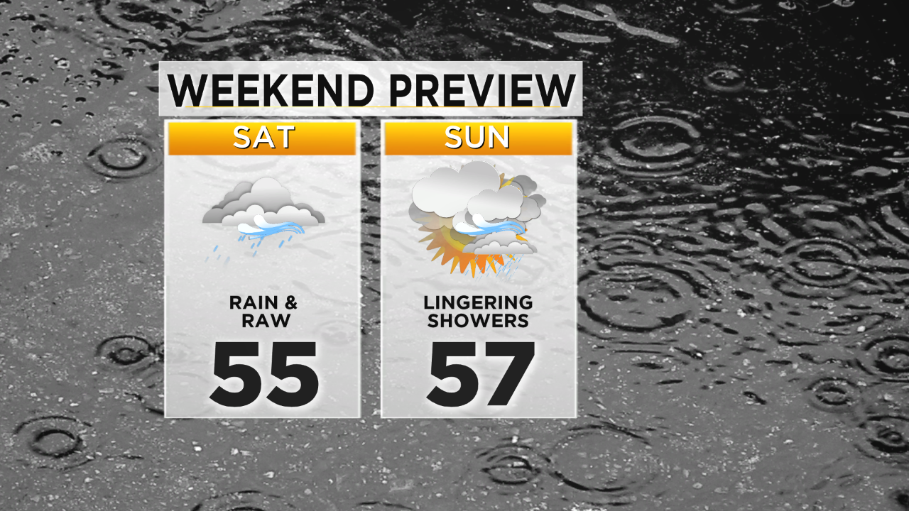
Closer to the Philly area, we should expect strong winds with gusts possibly as high as 30-40mph at times and also drenching rain. Much like the shore points though the heaviest rain on Saturday will be in the first half of the day with then showers throughout the afternoon. During the time of heaviest rain on Friday night and Saturday morning, is when we could potentially see a few wet snow flakes mix in, specifically in the higher elevations of the Poconos. In general though this should remain a liquid precipitation event for the entire area. Rain amounts over the weekend will be widespread in the 1-2" range with some areas, mainly along the coast possibly getting up to 3" locally in spots.
By Sunday while it will not be a dry day, we should see at least some sunshine peek through the clouds with a few showers once again possible in the afternoon. The breeze will stick around for the end of the weekend but it shouldn't be nearly as strong as Saturday.
Another system could slide through the region then early next week, so make sure to stay with the Eyewitness Weather Team as the next storm system looks to roll through. Have a great weekend.