Coastal Storm Potential Threat This Weekend
Follow CBSPHILLY Facebook | Twitter
PHILADELPHIA (CBS) - There is the chance for a strong storm system to develop and move up the coast and into the Mid-Atlantic this weekend.
The system would be the remnants of Hurricane Willa, currently a Category 4 storm in the Eastern Pacific and forecast to make landfall in western Mexico as early as tonight. The leftover pieces of that system after it makes landfall will likely travel into the Gulf of Mexico and combine with an upper level trough allowing for some re-intensification as it tracks to northeast and up the Eastern Seaboard.
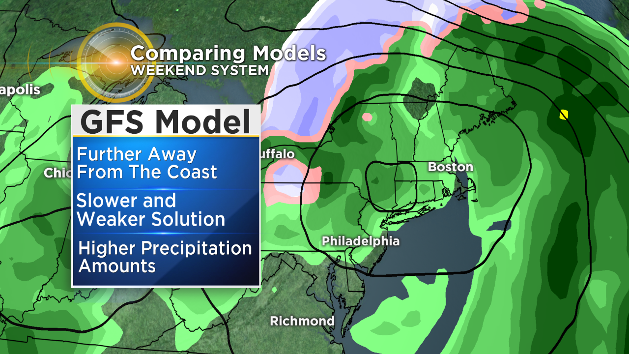
As of Tuesday morning, there is still a decent amount of uncertainty that is coming with this potential storm. The first issue is the speed of the system. When will it actually show up in the region. One forecast model, the GFS or American model is relatively slow but also weaker when it comes to the overall system strength. However, the slower progression will allow for the chance of heavier rain to fall over the region.
The other main forecast model, the European or Euro, is faster with its northern progression but also stronger in overall intensity. This solution allows for stronger winds, especially along the coast but also less precipitation to fall over the area. The timing is also crucial because with early season storms like this one, the type of precipitation that could fall is very much unknown.
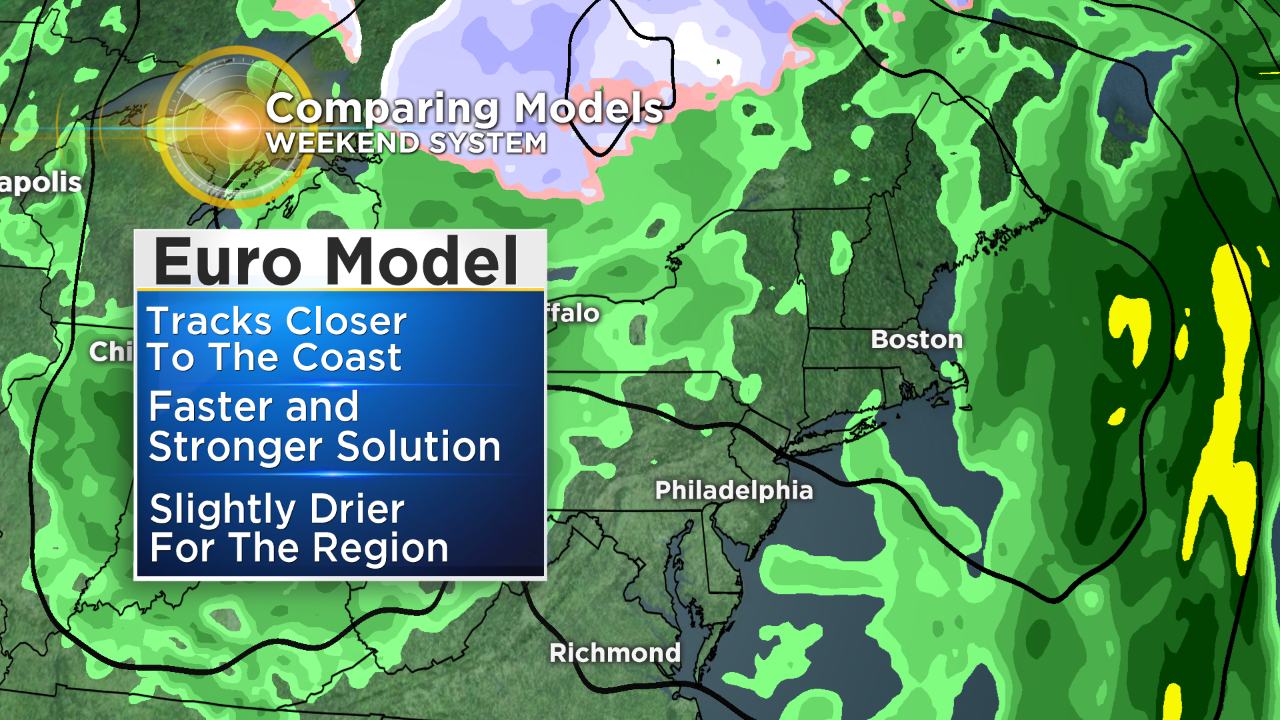
If the slower GFS solution were to come to pass the chance for frozen precipitation is much lower over the elevated areas, since the majority of the precipitation would fall during a time where the temperatures are not cold enough for snow to form. However, with the faster Euro solution we could be looking at a slightly better chance for snow formation in areas of higher terrain since most of the precipitation would be falling in a nighttime time frame when temperatures in areas like the Poconos could be cold enough for some light snow. Whether we get snow or not in areas of the region remains to be seen.
The other factor that we will be watching closer is the position of the center of the low as it makes it passes through the region. At this point the GFS will bring the center of the low farther from the coast. This would allow for a slightly colder and more wet solution to take hold over the region. The Euro on the other hand currently tracks the system closer to the New Jersey coastline which would make for drier weather in the immediate Philly area with higher amount inland into central Pennsylvania, it would also allow for a slightly warmer solution to develop.
Lastly the biggest threat beyond the potential for heavier rain or some frozen precipitation in the higher elevations, will be strong winds that are likely to develop. The strong gusts are forecast to be along the coast of New Jersey in the Mid-Atlantic, and some models are suggesting wind gusts as high as 60mph at times. This would lead to likely beach erosion and potential flooding as well, especially along the immediate shoreline. The chance for the strong winds will be a factor to monitor and one that is likely to be a problem no matter how the system plays.
No matter whether the GFS or Euro solution turns out to be right, we will be looking at a wet, windy and generally miserable Saturday and potentially Sunday as well. There are still many moving parts as the system continuities to come together so make sure to stay with the Eyewitness Weather Team for all your updates at we get closer to the weekend.