Hurricane Michael Rains Expected To Sweep Through Region
Follow CBSPHILLY Facebook | Twitter
PHILADELPHIA (CBS) - After making landfall as one of the most powerful hurricanes in weather history, according to central pressure, what is now Tropical Storm Michael continues to track up the East Coast of the United States and while here across our region we are not likely to see any kind of direct hit from Michael, a glancing blow could still cause some issues, especially along the New Jersey and Delaware beaches.
Michael is currently getting absorbed into a cold front that is sweeping across the U.S. and will likely push through the region tonight before exiting early in the day on Friday.
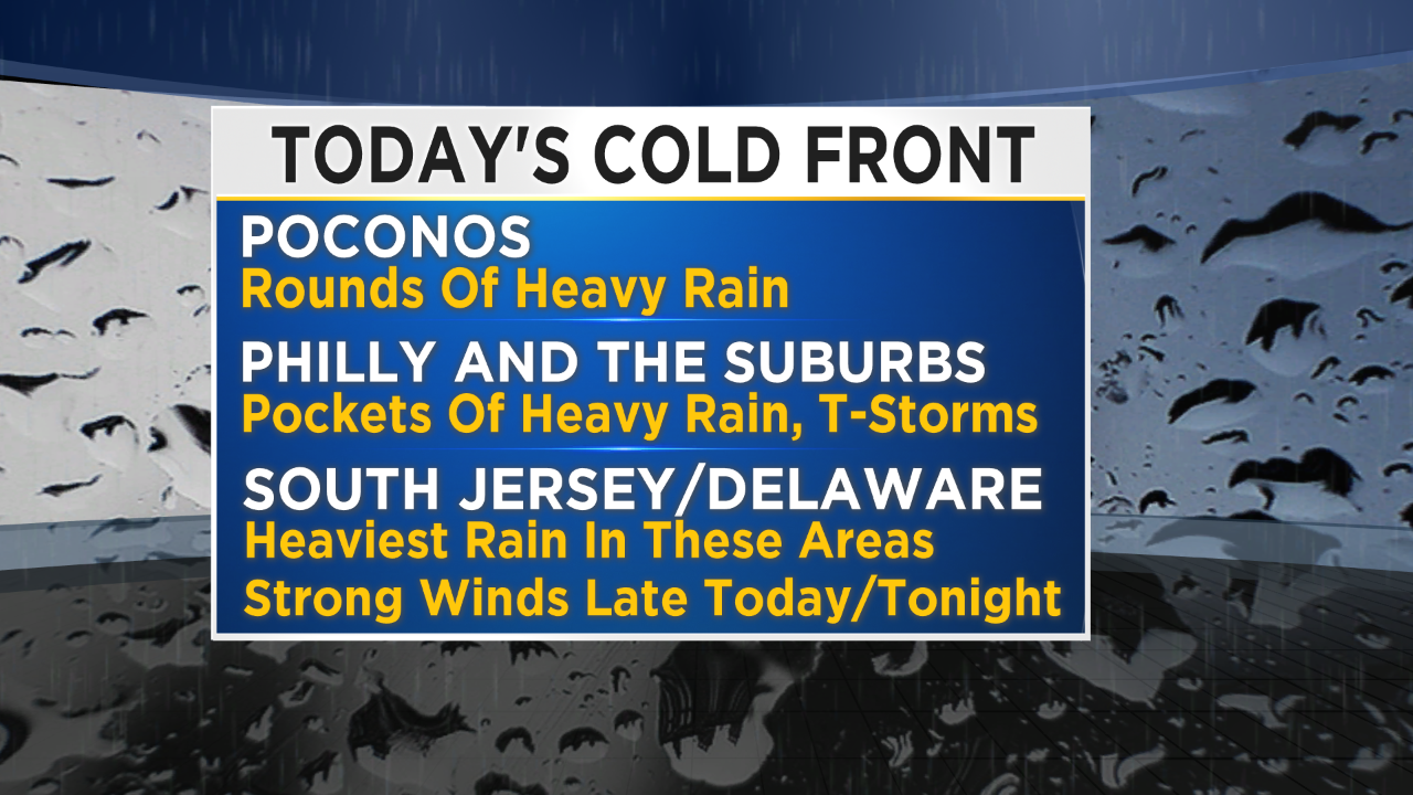
As the front scoops up the tropical storm, it will speed up its northern as well as eastern movement, thus keeping it away from the immediate Philly area. The worst of the effects will be felt at the shore, generally in the later parts of Thursday and through Thursday night.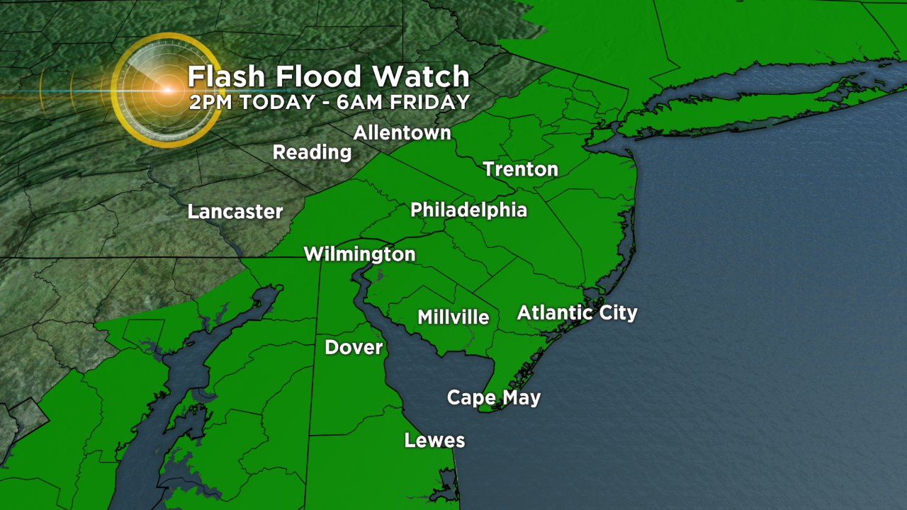
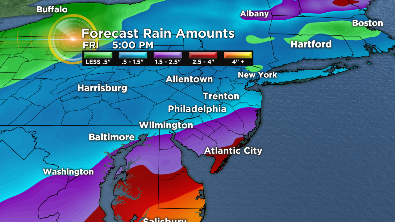
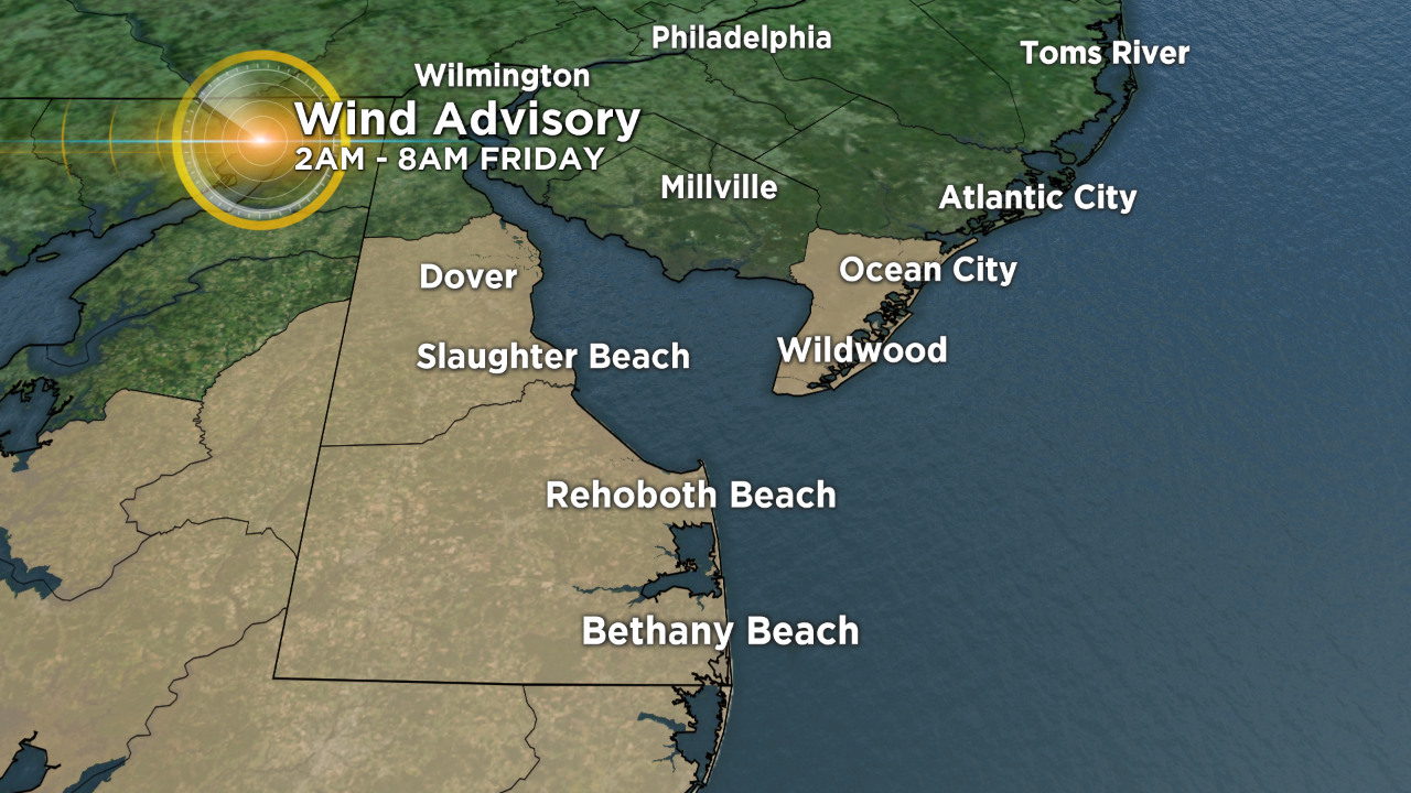
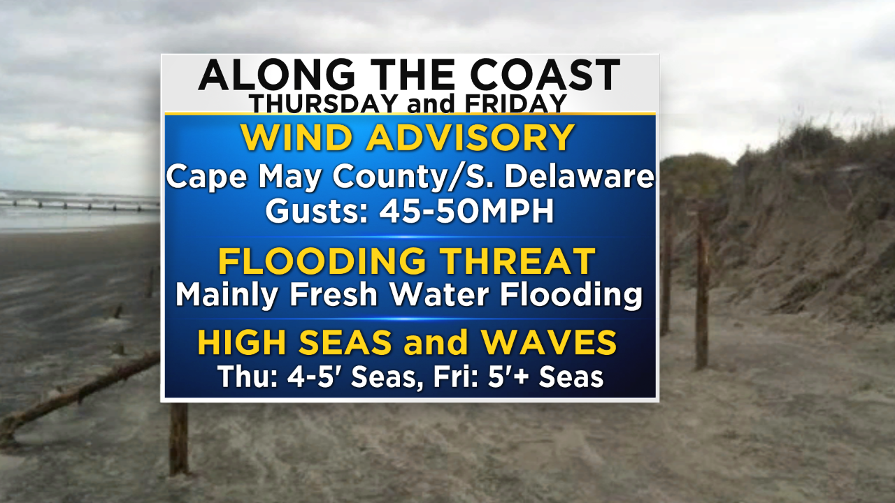
A flash flood watch will go into effect at 2 p.m. today and a wind advisory will go into effect at 2 a.m. Friday morning. With the flash flood watch we will need to be on the lookout for flood-prone areas to see rapidly rising water. When it comes to the wind advisory, gusts tonight as Michael makes its brush past us could be as high as 45 to 50 mph at times. Rain amounts across the region will be widespread.
The lowest amounts are likely to be north and west of the city while the highest amounts are likely across South Jersey and Delaware. At this point it looks as though Philly should hover somewhere around an inch or so of rain but South Jersey could locally see up to 4 inches of rain in spots. The heaviest of the rain will end through the overnight hours tonight but we should remain on the lookout for showers or a few thunderstorms to continue into the morning hours on Friday as well, especially for areas south of Philadelphia. Behind the departing front and tropical system, temperatures will be much cooler and skies will slowly clear out as well. Friday afternoon should be slightly below average with highs only in the middle 60s and a mix of sun and clouds for much of the region.
A quick look into the weekend shows that temperatures will likely remain in the 60s both Saturday and Sunday and we should be prepared for a shower on Saturday morning before a dry afternoon with conditions staying cool but dry again on Sunday.