Heavy Rain Leads To Flooding Concerns Across Region
Follow CBSPHILLY Facebook Twitter
PHILADELPHIA (CBS) - As the Philadelphia and surrounding areas brace for more rain, we are prepping for chances of flooding as we head through the coming weekend. Many areas across the region are already inundated with moisture from thunderstorms earlier in the week and when you add in the steady showers we experienced through parts of Wednesday and now into Thursday, we should be ready for these flooding concerns to overtake almost the entire region.

This stretch of wet weather started on Tuesday of this week when a cold front barreled through the area, kicking off a batch of severe storms that caused damage, killed one person and caused a Meteotsunami to form off the Jersey coast near Atlantic City. After that front pushed through, it stalled to the south thanks to a large block area of high pressure just off the southeast coast of the U.S., that kept the front from making its way all the way out of the region and allowing pressure to filter into our neck of the woods. Instead, we have been dealt a hand where the front is hovering to our south with small areas of low pressure constantly riding along the trough, keeping the rain chances in play for the Delaware Valley. Now, Mother Nature is doubling down on us as well, thanks to an area of tropical moisture that is slowly riding off the eastern seaboard and should enhance the front to our south just enough, and allow an influx of moisture into the system that rain chances are likely and heavy rain is possible at times starting this afternoon and lasting until Saturday.
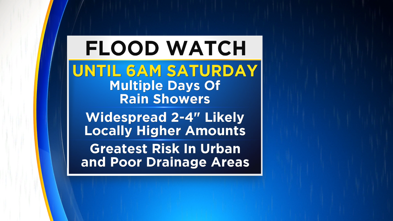
Some areas across the region have already measured over two inches of rain in the past few days. The newest model projections for the region show an additional two to four inches are possible now through Saturday with localized spots within the area getting as much as an additional five inches of rain before we start to slowly dry out. This means that towns and cities across southeast Pennsylvania, South Jersey and the Lehigh Valley and Poconos could have up to five to seven inches of rain before all is said and done.
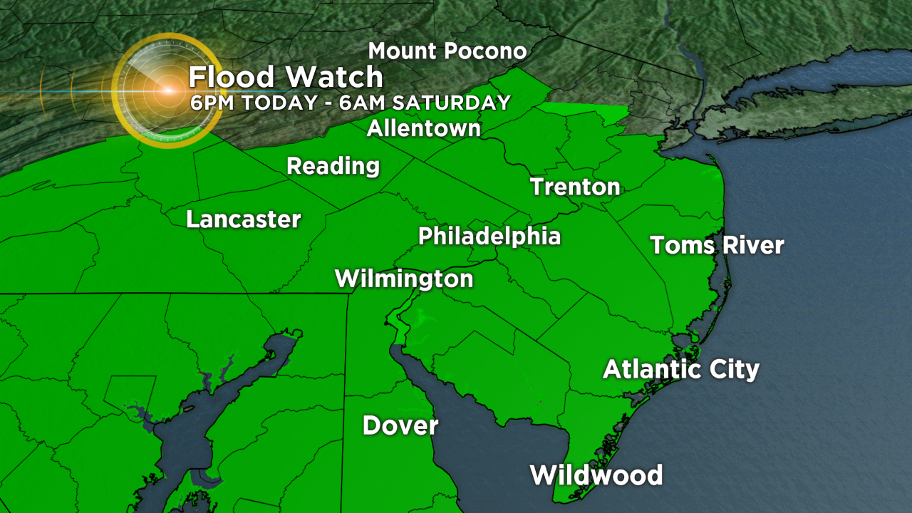
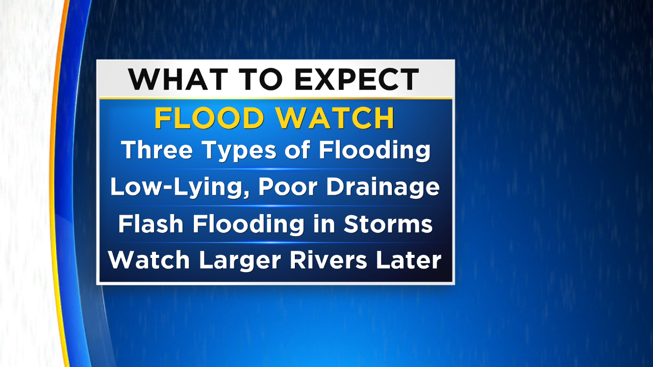
Thanks to the threat for extreme rainfall the National Weather Service has issued a flood watch for almost all of the viewing area. It will go into effect this afternoon at 6 p.m. and last until Saturday at 6 a.m. We are concerned at this time with multiple types of flooding. As per usual the low-lying and poor drainage areas are going to be susceptible to flooding. However, with pockets of heavy rain embedded within the more widespread shower activity, flash flooding is also a concern through the next 72 hours or so. Finally, since there will be no real chance for any drainage, streams and rivers, even large ones like the Delaware and Schuylkill, could fall victim to high water. Due to this fact, the Stotesbury Cup Regatta is moving to the Cooper River, making it the first time in 90 years that it will not be held on the Schuylkill.
As of right now there is not a clear picture as to when we officially start to really dry out. We should hopefully start to see the blocking high breakdown a bit as we get toward the end of the week and into next week. This means that while shower chances are still in the forecast, even moving into the early parts of next week, they will not be as widespread and we are likely to see more drier weather as we climb into the middle of next week.
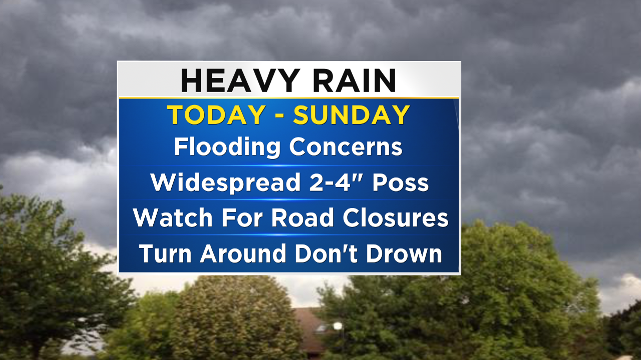

Make sure to stay up to date on the impacts of the high water and flooding concerns by connecting with the CBS Philly Weather Team on-line, on social media, and through our weather App. Stay dry everyone and always remember "Turn Around Don't Drown."


