Severe Weather Potential For Thursday Afternoon
Follow CBSPHILLY Facebook Twitter
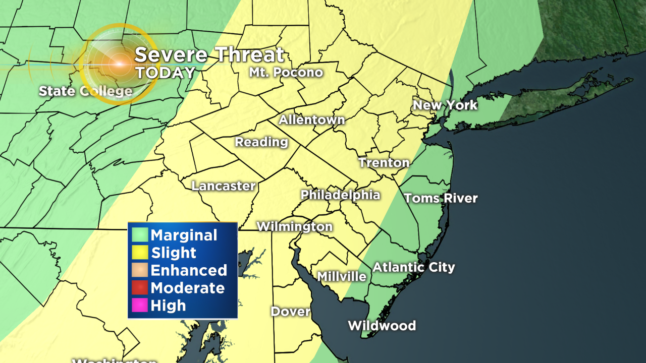
PHILADELPHIA (CBS) - It is officially spring time in the Northeast and that means that the chances for thunderstorms and severe weather is back on everyone's mind. We have our first true chance of severe storms today, as a slight risk of severe weather has been issued for the region.
An upper level system is slowly plotting through the western parts of the Pennsylvania this morning and both the cold front and the associated weaker trough out in front of the main area of low pressure will spark off some showers or thunderstorms both this morning and this afternoon. The initial round of rain will be on the lighter side and likely should just be some plain rain showers, but a few isolated rumbles of thunder are not out of the question in the first of the day either.
The first line of showers is likely to move by late morning and it looks to hang in the region until about the early afternoon, likely finishing up around 2 p.m. We then get a quick break in the action for a an hour or so before the more potent cold front sweeps across the area.
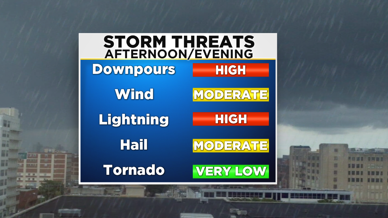
After 3 p.m. we should see localized strong to severe storms fire up along the front, but it is not likely that we see a full formed line segment at this point. What this means is that not everyone will be in the path of the severe storm, or even a thunderstorm in general. If you are caught in one of the stronger storms though, make sure you are prepared for what you could experience.

Right now, due to the fact that the thunderstorms will be sparking up along a cold front and we are not dealing with a ton of other severe ingredients within the atmosphere, we should look for there to be strong wind gusts and possibly hail associated with the strong storms. Also, as with all thunderstorms, dangerous lightning as well as heavy downpours are likely. The cold front will slide through the region during the evening and should exit off the coastline by the time we get into the early overnight hours, or even sooner. Right now, we will hold a chance for a thunderstorm in areas east of Philly until about 10 p.m. but it would not be surprising to see things wrap up prior to that late. The areas of greatest concern for the strong or severe storms today are going to be the Poconos, though the Lehigh Valley, into the Philly Metro and then down into Delaware and some parts of South Jersey. The only area right now where thunderstorm activity is possible but the threat for severe storms is lower, is along the immediate coastline and shore points, as it looks like the front is going to fizzle out before it reaches the Jersey coast and pushes away from the shore.

Stay with the CBS3 Eyewitness Weather team for the latest on the storm.