From White As Snow To Damp And Dreary
PHILADELPHIA (CBS) - It was a wintry Wednesday across much of the region this week with areas in the Poconos receiving as much as 5" of snow, but the warmer air is going to take over as we get ready for more precipitation, this time in the form of rain.
However the rain showers that develop heading into Sunday could also bring a threat for some localized flooding, especially in areas in the Northern half of the region where the snow was heaviest earlier in the week.
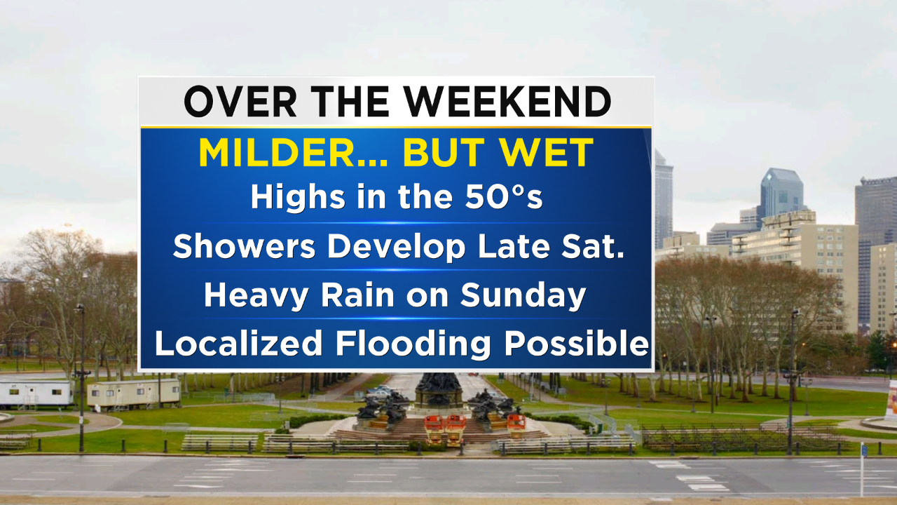
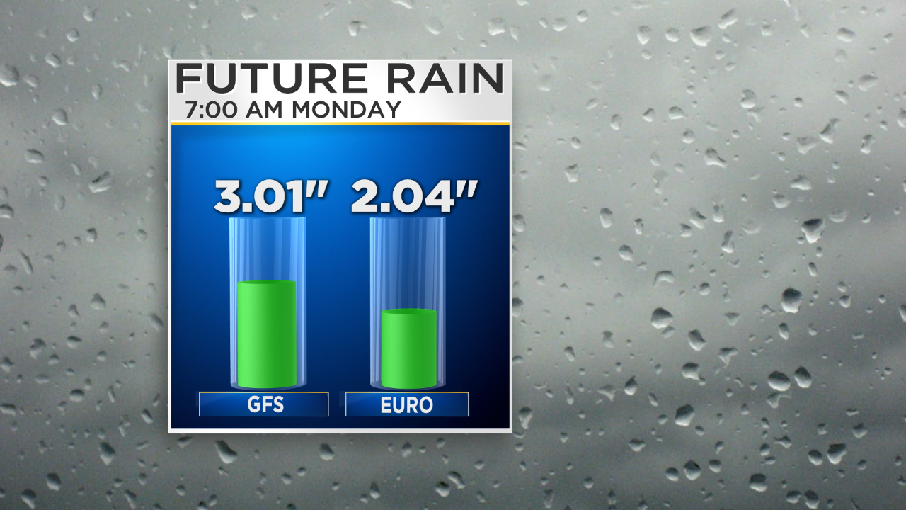
This weekend's rain showers and warm up are going to be a nice break from the wintry weather we had on Wednesday and the cold and windy conditions on Thursday as well, but the flooding concern over the weekend will have to be monitored in areas north of Philly. An area of low pressure will develop on Saturday and eventually move into the area from south to north on Saturday evening and night into Sunday morning. Rain showers could start as early as Saturday evening in some area southwest of Philly. Rain will become more widespread and heavier in the overnight hours with the heaviest rain falling throughout the daytime hours on Sunday. The axis of heaviest rain will likely be in the 95 corridor where amounts could be as high as 2"+ in areas.
Flooding will be a concern in the Lehigh Valley and Poconos over the weekend due to the fact that there is still a small snow pack that will likely be melting, on top of the 1-2" of rain that is possible on Saturday into Sunday as well. The areas most susceptible to the flooding concern will be the smaller streams, creeks and rivers in the area. Make sure you are staying alert if you are near these smaller tributaries this weekend.
Have a fun and safe weekend! Stay dry out there!