January Thaw Gives Way To Winter's Return
PHILADELPHIA (CBS) -- It is great to have a couple days in the dead of winter where temperatures are warm and we are treated to a chance to thaw out, but as the saying goes, "All good thing much come to an end."
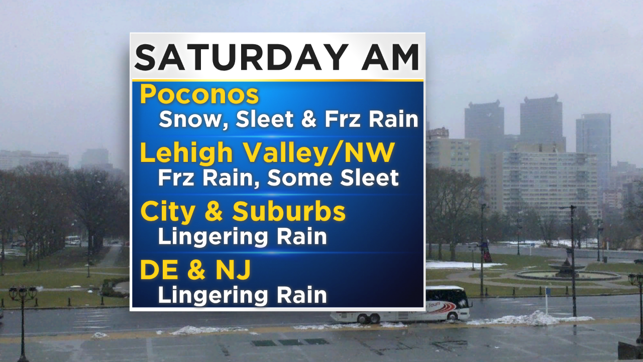
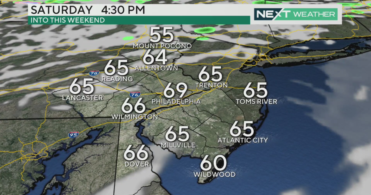
After the highs on Friday afternoon in the middle 60s across Philly and well above normal for the whole region, our attention turns to the cold air that will rush in on the backside of the arctic cold front that sweeps through as we go through the night tonight. Temperatures are likely to fall as much as 20 to 30 or more degrees in only 24 hours across the area. This will lead to a chance for some wintry precipitation to develop mainly tonight north of Philly and potentially last into the morning hours on Saturday.
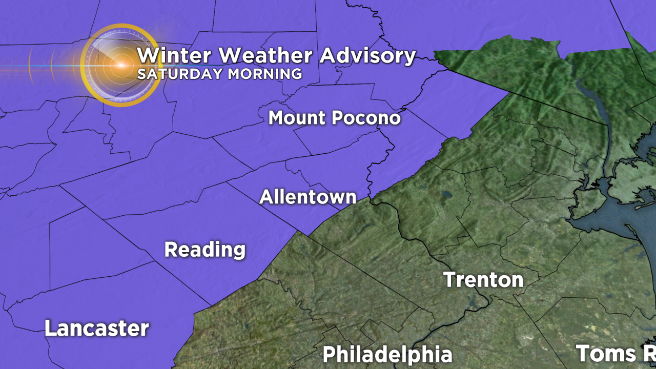
With the threat for icy roads and limited snow and ice accumulations, there is a winter weather advisory that goes into effect for parts of the Lehigh Valley and Poconos starting at 1 a.m. and lasting until 10 a.m. on Saturday morning.
At this time the threat for winter weather in the Philly metro area is very slim as temperatures remain well above the freezing mark on Saturday morning, and will not fall into the very cold range until after the precipitation is finished in the area.
When it comes to the icy conditions north of the city tonight and Saturday morning, the threat for freezing rain and sleet are the biggest concerns, with a small chance for some very wet snow to mix in as well. Ice accumulations in the far northern Poconos is not ruled out either.
We could have up to a couple tenth of an inch of ice accumulation on tree branches and power lines, which could pose issues for power outages and road blockages as well, so make sure you are staying vigilant as the precipitation changes lat tonight and tomorrow in the northern counties.
Temperatures then remain cold to end the weekend and the cold air will settle over the region through most of next week, with highs below normal in the 20s and 30s most likely. The forecast could get white again on Tuesday and into Wednesday of next week as we are tracking another chance for some snow as a quick hitting clipper system rolls through.
Have a great weekend everyone!