Fall Temperatures Rushing Back Into The Delaware Valley
PHILADELPHIA (CBS) -- For the first time in about a week, temperatures are going to be back on the cooler side of things as a more Fall-like pattern sets up over the Delaware Valley.
As of Thursday morning, we are in the transitional period after the physical front goes through and the cooler and less humid air really starts to move. The effects of the front however will definitely be felt as early as this afternoon, especially when it comes to lower dew points as well as slightly cooler temperatures, especially related to recent afternoon highs.
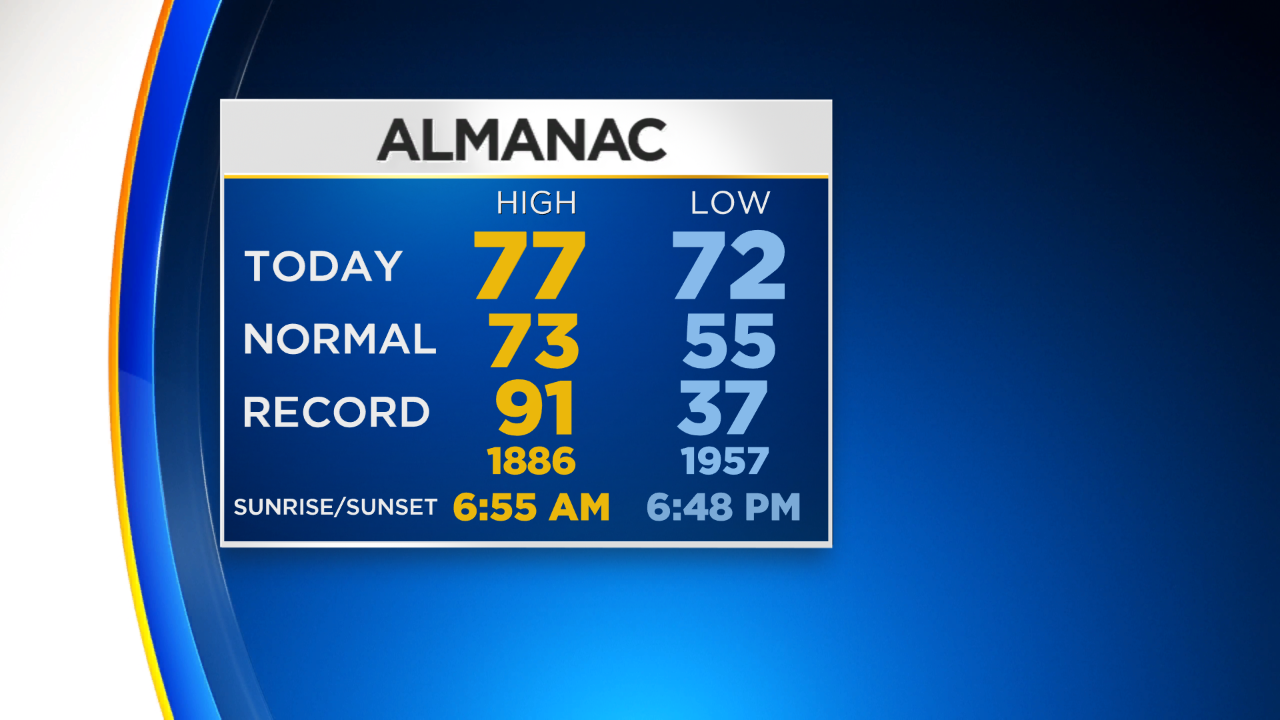
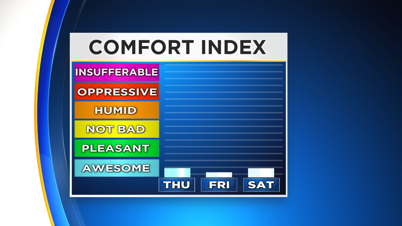
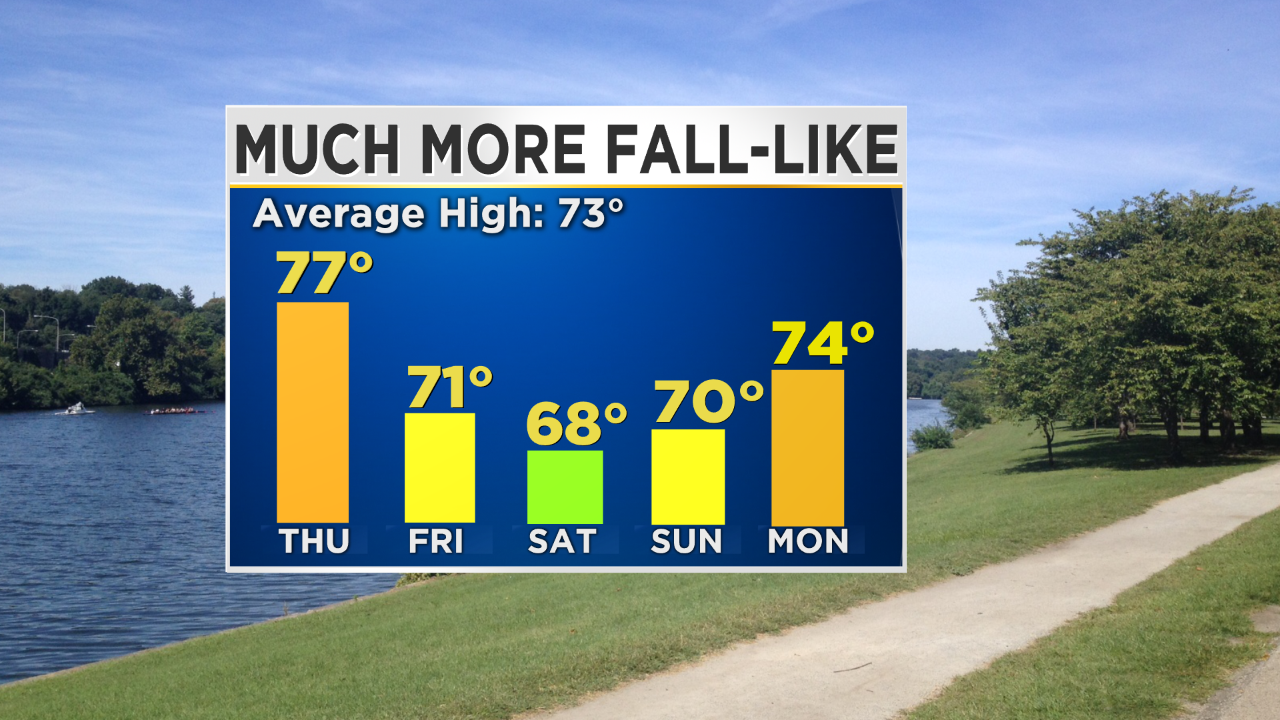
When we look at today's high of 77° it ends up still being slightly above normal but only by about 4° rather than the close to 10°-15° we had been experiencing. Dew points over the next few days, including the weekend are going to be in the "Awesome" range or more specifically sitting in the 50s or maybe 40s.
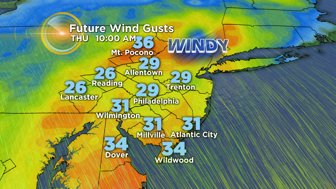
Besides just the cooler and drier air moving in throughout the day today, it will be windy. This is due to the drastic change in the pressure as the front moves in and then slide out of the area. Expect winds gusts this afternoon to be as high as 20-25 mph at times, so hold on to your hats!
Finally, we are likely to remain in the nice Fall-like pattern into the start of the next work week it looks like before we could see another slight warm up as we get toward the middle of the first week of October.
Have a great Thursday!