WEATHER BLOG: Nor'easter Still On Track
PHILADELPHIA (CBS) -- A storm system currently over the central U.S. will continue to track into the Ohio Valley and help develop a coastal storm during the day on Monday. The coastal low will track up the East Coast and with cold air in place, a widespread late season snowfall is expected.

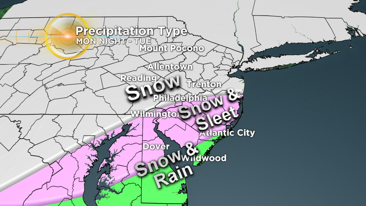
The snow will be heavy at times on Tuesday morning and will accumulate on roads. There is still some uncertainty on the track and where sleet could mix in, which would cut down snow amounts. A winter storm warning will go into effect late Monday night for most the region.
A high wind watch for parts of the region and a coastal flood watch for coastal NJ & DE will also go into effect on Tuesday .
TIMING: Snow will arrive from southwest to northeast late Monday evening and continue into Tuesday afternoon. The heaviest snow will fall Tuesday morning before tapering off by mid afternoon. A changeover to sleet and rain is possible, especially south & east during the morning on Tuesday.
AMOUNTS: Snow amounts of 6-12" are possible around Philly and surrounding suburbs, with highest amounts north of Philly and lesser amounts to the south & east. These amounts can change due to the uncertainty of the track, location of heaviest snow, and sleet/rain zone.
IMPACTS: This will be a heavy wet snow with scattered power outages, hazardous travel with snow covered roads and low visibility. Snowfall rates on 1-2" per hour are possible. Strong wind gusts of 40-60 mph near the coast will cause minor to moderate coastal flooding at times of high tide on Tuesday.