Weather: Sluggish System
By Geoff Bansen
PHILADELPHIA (CBS) --- Wednesday morning is thankfully nothing like what we saw yesterday. In fact, it's mainly been on the quiet side. But as the departing nor'easter tries to, well, depart, it's going to take it's sweet time in doing so.
Clouds plus rain and snow showers are rotating around the large area of low pressure that brought the heavy rain, high winds and significant flooding yesterday.
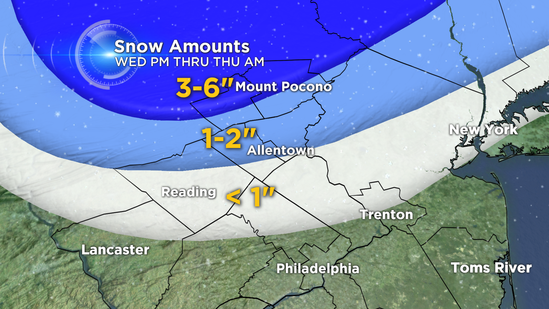
All is calm in the Delaware Valley right now, but some mild action will return this afternoon. Conditions will remain chilly, and once again breezy. As these showers drop down this afternoon into tonight, accumulation is mainly expected up towards the Poconos region.
A Winter Weather Advisory is in effect for Carbon and Monroe Counties until 4AM Thursday. A few inches are possible there, with perhaps a dusting to an inch dropping further south than that. No accumulation is expected from the city on south.
Heading into Thursday, a few more snow and rain showers may spin down during the morning and early afternoon hours, but we can expect it to be the last day for the threat of any precipitation.
As Friday rolls around, the sun does its best to make a return appearance, fighting through what leftover clouds remain. The quantity of sunshine should increase each day heading into the weekend, as should temperatures too.
Weather info is available any time at CBSPhilly.com/weather.