A Mixed Midweek
By Geoff Bansen
PHILADELPHIA (CBS) -- Not great, not bad either! That's the story for the next few days.
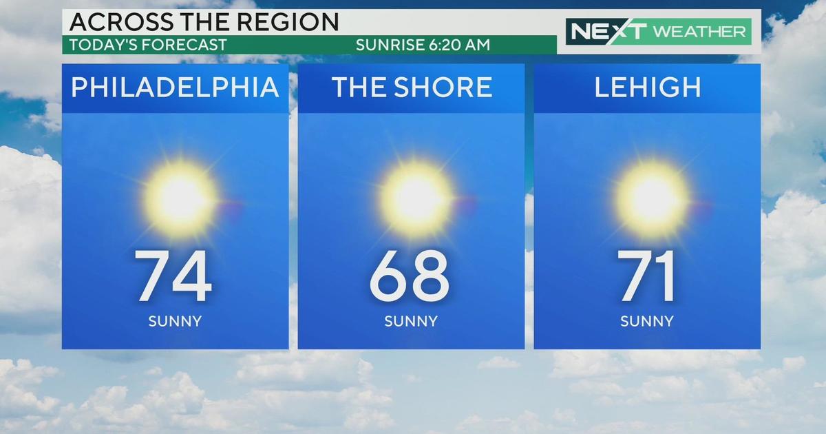
Sunshine will break out on Tuesday once the morning fog lifts and clouds move eastward and it will be an overall decent day. It will remain mild as well with highs in the upper 70s.
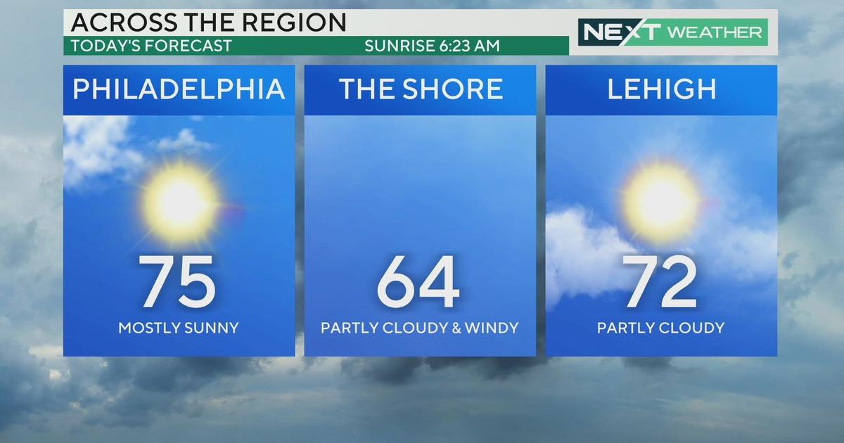
Wednesday will feature a few more clouds with a few showers possible in spots, thanks to a weak frontal boundary; but it too won't be a terrible day. Thursday looks to be the nicest day of the week with mostly sunny skies and highs in the mid 70s.
Friday should start nice before conditions deteriorate later in the day as a more potent front approaches from the west. There is a slight amount of uncertainty with the timing of this front, but it is looking like rain will be likely overnight and into Saturday morning, before skies clear by Saturday afternoon. The big change? Temperatures: expect highs to stay in the 60s, and nighttime lows to fall into the upper 40s!
September in a few words? Warm and dry. We wrap up that month 1.1 degrees above normal, with a daytime max of 93 on the 2nd and a nighttime low of 50 on the 23rd. In the wet weather department, 1.69" of rain fell, nearly two below average.
Today's Highs:
Philly - 79
Shore - 75
Poconos - 70
On this day in weather history...
1884 - The month ended with 0.20" of precipitation, the DRIEST SEP in PHL records.
1924 - tropical storm moved northeast from the Gulf of Mexico traveling on land east of the Appalachians and dissipated at the mouth of the Chesapeake Bay. The remnants continued moving northeast and brought heavy rains to the region. Philadelphia received 0.99" on the 29th and 1.51" on the 30th.
1952 - The average ocean temperature measured off Atlantic City for the 4 recreational summer season months of June, July, August and September was 71.7 degrees, the warmest on record, while in 1988, the average ocean temperature measured off Atlantic City for the same 4 recreational summer season months was 63.6 degrees, the coldest on record. The normal temperature is 68.6 degrees. Records extend back to 1911.
1999 - The month ended with 13.07" of precipitation, the WETTEST September - and the wettest MONTH - ever on official records. (This was mainly due to Hurricane Floyd) *In unofficial records, 15.82" was recorded for Aug. 1867.