Not So Fast Summer!
By Geoff Bansen
PHILADELPHIA (CBS) -- A "backdoor" cold front will move into our area from the northeast during the day on Wednesday May 28th, bringing in much cooler weather. Expect plenty of low clouds and showers, especially in the afternoon.
We term it a backdoor front because as opposed to the usual cold front that will move from the northwest to southeast, this front sort of backs up from northeast to southwest.
This ushers in cool air from off the ocean, which is still quite chilly. The cool air really settles in Thursday, with highs only in the 60's, but at least it will be a dry day.
Temperatures rebound Friday, highs will be in the mid 70's, but a cold front will bring an afternoon shower or thunderstorm.
The weekend will be warm with highs in the upper 70's both days and lots of sunshine, a great way to kick off June!
Don't forget this week is Hurricane Preparedness Week! We'll have some explainers and tips to keep you safe each morning this week.
Today In Weather History:
1990 -- Two to five inches of rain that fell over southeastern Ohio on the 28th & 29th triggered widespread flooding, and capped an exceptionally wet month of May. The flooding claimed three lives, and caused millions of dollars of damage.
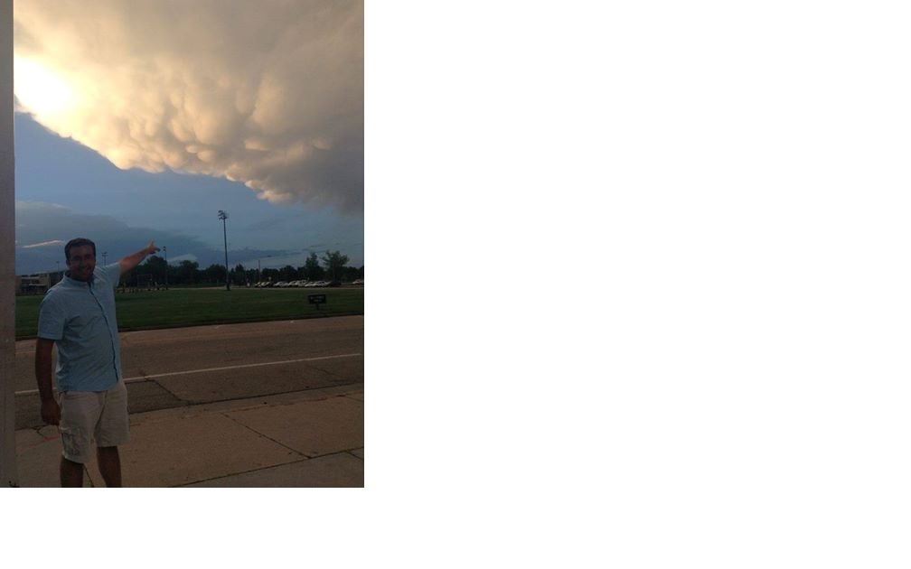
Viewer Photo of the Day:
https://assets1.cbsnewsstatic.com/i/cbslocal/wp-content/uploads/sites/15116066/2014/05/wx.jpg
This image comes from Michael Colbert, who is out in Fort Collins, Colorado taking part in some meteorology research. The storm in this photo caused lots of hail and several rainbows, which may remind you of what we experienced here in the Delaware Valley just this past Thursday. You can see the mammatus clouds in this picture. They are formed at the bottom of thunderstorms by intense updrafts and are composed primarily of ice. Despite popular misconception, they are not a sign that a tornado is about to form and many times are a sign that storms are weakening. However, they can still be indicative of a very strong storm. They sometimes form on the upwind, or backside, of severe thunderstorms that at the same time are dropping large hail and packing 60-70 mph bursts of wind. This was recently the case, as these types of clouds were spotted in our area right before last week's storms.
Remember to send us your weather photos! You can upload them HERE or tweet them to us @cbs3_wx.
Geoff Bansen
WX Producer


