Weather Blog: Thawing Out
By Steve Strouss
PHILADELPHIA (CBS) -- After two days of bone chilling cold, record low temperatures, and bitter wind chills, some of the Delaware Valley will finally climb above the freezing point on Thursday as the Polar Vortex retreats to the north.
As a result of the recent frigid air mass, many of the streams and rivers in the region have frozen or developed large chunks of ice. Shifting ice is collecting near bends and bridges and this has prompted the National Weather Service to post Flood Warnings in susceptible locations where water and ice is piling up. Ice jams along the Delaware River have already closed roads in parts of Morrisville, PA and Trenton, NJ. A Flood Watch has also been posted downstream of these locations because the backed up water may flow quickly once the jam breaks.
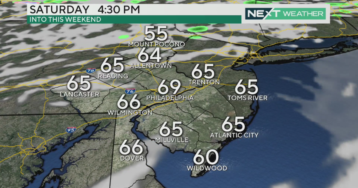
Temperatures will climb into the low 40s Friday afternoon as a warm front lifts through the region. A weak system may bring a period of light snow or rain early on Friday but we are not expecting much. A more potent system is expected Saturday night as a front approaches from the west. We will remain in the warm sector most of the day on Saturday and that will cause temperatures to surge into the 50s before the rain arrives. Behind the front, high pressure moves in and that will dry us out for the rest of the weekend but it will be windy and cooler.